Club Sawtooth

Lost River Valley · Craters of the Moon · Sun Valley side

Explore Arco, Idaho: Hot Springs, Trails and Lost River Valley Adventures

Everything worth doing within a morning's drive of 156 W Grand Ave, in one place: marked walks on black cinder, cold water in the Big Lost River, dark skies past the lava fields and the town's own odd piece of atomic history. Filter by what you came for, search by name, then read the guide before you go.

Meet up at the Club, pick your route, then come back and tell us how it actually went. Map pins are for planning, not a guarantee of access; each one notes whether its position is exact or a research area.

21 guides125 map destinationsJump to destinations

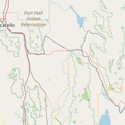
Plan from the map

Destinations near Arco

Markers at a distance are grouped into counts. Tap a marker for its accuracy note, the guide and any official source we could confirm.

Showing 125 of 125 map destinations · 21 of 21 guides

Interactive map
19
20
4
4
3
3
2
4
2
5
4
2
2
4
2
2
Leaflet © OpenStreetMap contributors

Map data © OpenStreetMap contributors. Positions are planning references; several are deliberately approximate so nobody mistakes a dot for legal access.

Results

  • Club Sawtooth

    Club Sawtooth

    Exact location

    Remote Play darts · pool · AMI jukebox

    Site details
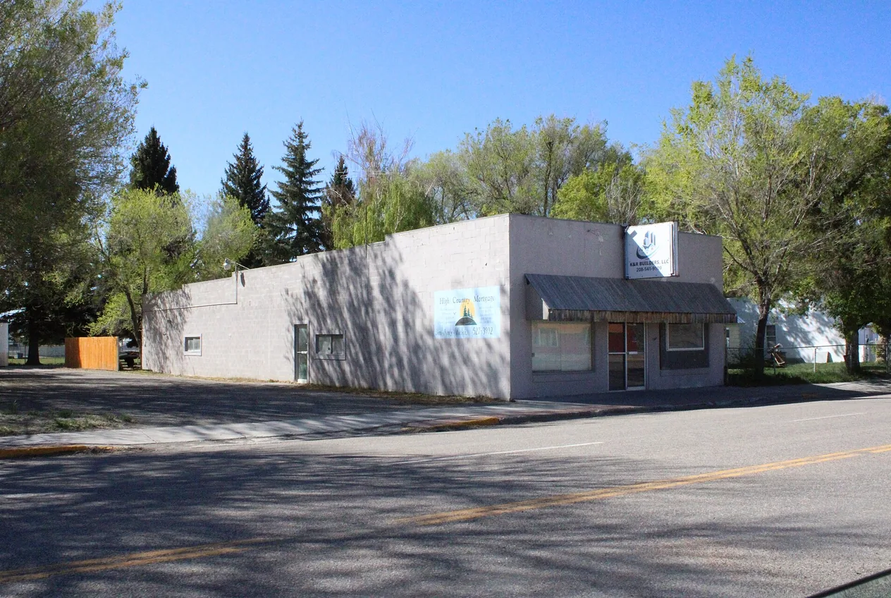
    156 W Grand Ave, Arco, ID 83213
    From the Club:
    You’re at home base
    Region:
    Downtown Arco
    Season:
    Check current conditions
    Managed by:
    Verify land ownership before travel
    Drinking water:
    Not verified at this pin; bring your own
    Restrooms:
    Not verified at this pin; plan ahead
    Road type:
    Not verified; check current access before driving
    Official updates:
    No location-specific official link verified; see the guide
    Ask staff before leaving a vehicle overnight. Arrange a sober ride.
    About the Club
  • Arco landmarks

    Things to do in Arco, Idaho: the honest local list

    Downtown Arco

    Trip planning · Arco, Idaho

    Site details
    Downtown Arco, Butte County; the hub for outings in every direction.
    From the Club:
    Less than one mile · straight line
    Region:
    Butte County, Idaho
    Season:
    Year-round; access varies
    Managed by:
    Mixed: NPS, Forest Service, BLM, IDFG, private
    Drinking water:
    Not verified at this pin; bring your own
    Restrooms:
    Not verified at this pin; plan ahead
    Road type:
    Not verified; check current access before driving
    Official updates:
    No location-specific official link verified; see the guide
    Use a legal public viewpoint or the signed visitor entrance.
    Read guide
  • Craters & lava

    Craters of the Moon from Arco: trails, caves, camping and stargazing

    Official visitor entrance

    Lava landscapes · Arco, Idaho

    Site details
    Robert Limbert Visitor Center, 1266 Craters Loop Road, Arco, ID 83213.
    From the Club:
    About 18 mi · straight line
    Region:
    Southwest of Arco
    Season:
    Year-round; seasonal access
    Managed by:
    National Park Service
    Drinking water:
    Not verified at this pin; bring your own
    Restrooms:
    Not verified at this pin; plan ahead
    Road type:
    Not verified; check current access before driving
    Official updates:
    Official link below
    Check Loop Road and cave access before setting out.
    NPS current conditions and cave closures
    Read guide
  • Arco landmarks

    EBR-I Atomic Museum near Arco: where nuclear electricity became real

    Approximate landmark

    Atomic history · near Arco, Idaho

    Site details
    Approximate EBR-I Atomic Museum complex on US-20/26 southeast of Arco; follow official highway signs and INL directions.
    From the Club:
    About 17 mi · straight line
    Region:
    Southeast of Arco
    Season:
    Memorial Day–Labor Day; verify hours
    Managed by:
    U.S. Department of Energy / Idaho National Laboratory
    Drinking water:
    Not verified at this pin; bring your own
    Restrooms:
    Not verified at this pin; plan ahead
    Road type:
    Not verified; check current access before driving
    Official updates:
    No location-specific official link verified; see the guide
    A museum visit does not authorise access to the rest of Idaho National Laboratory. Stay inside the public complex, obey every sign and barrier, and keep drones off laboratory property.
    Read guide
  • Arco landmarks

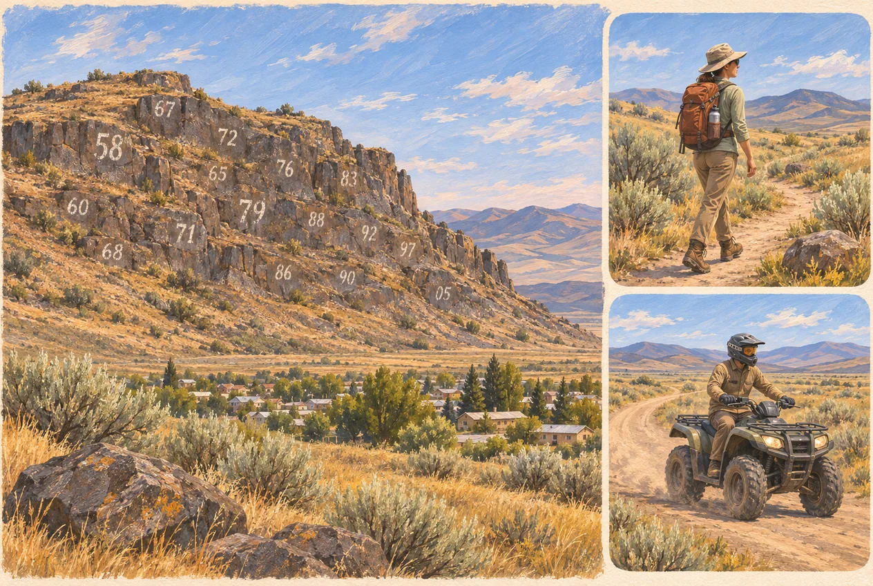
    Number Hill in Arco: the painted graduation years, and how to see them right

    Approximate landmark

    Local landmark · Arco, Idaho

    Site details
    Approximate hillside location above Arco in the Lost River Valley. This marks the landmark only — it is not a trailhead, a public parking area or an ATV staging point.
    From the Club:
    About 1 mi · straight line
    Region:
    Downtown Arco
    Season:
    Year-round; the view depends on light and weather
    Managed by:
    Verify land ownership before travel
    Drinking water:
    Not verified at this pin; bring your own
    Restrooms:
    Not verified at this pin; plan ahead
    Road type:
    Not verified; check current access before driving
    Official updates:
    No location-specific official link verified; see the guide
    No trailhead, maintained trail or designated ATV area on Number Hill has been verified. View the hill from a lawful public place, stay off private land, and leave the painted rock exactly as you found it.
    Read guide
  • Hiking

    King Mountain gliding near Arco: the launch, the airfield, and what visitors should know

    Official launch site

    Hang gliding, paragliding and soaring · Moore, Idaho

    Site details
    Forest Service King Mountain Launch Site near Moore, reached from US-93 at the hang glider signs and up toward Beaverland Pass Road. This pin marks the mountain launch only — it is not the King Mountain Glider Park airfield.
    From the Club:
    About 9 mi · straight line
    Region:
    Moore, Idaho
    Season:
    Late spring through early fall; weather dependent
    Managed by:
    Verify land ownership before travel
    Drinking water:
    Not verified at this pin; bring your own
    Restrooms:
    Not verified at this pin; plan ahead
    Road type:
    Not verified; check current access before driving
    Official updates:
    Official link below
    The Forest Service rates King Mountain an advanced H4/P4 hang gliding and paragliding site. It is not a beginner hill, a tandem booking service or a scheduled airshow. King Mountain Glider Park is a separate private-use gliderport where permission is required before landing.
    US Forest Service — King Mountain Launch Site
    Read guide
  • Hot springs

    Wild Rose Hot Springs near Carey: a careful visitor’s guide

    Research area · Arco planning reference, not an activity location

    Hot springs · Carey, Idaho

    Site details
    Near the US-20/26/93 corridor, approximately 9–10 miles east of Carey, west of Craters of the Moon.
    From the Club:
    Less than one mile · straight line
    Region:
    Carey, Idaho
    Season:
    Any season; access and conditions vary
    Managed by:
    Verify land ownership before travel
    Drinking water:
    Not verified at this pin; bring your own
    Restrooms:
    Not verified at this pin; plan ahead
    Road type:
    Not verified; check current access before driving
    Official updates:
    No location-specific official link verified; see the guide
    This guide covers a region or several sites. This pin marks the Arco planning base, not a destination or legal access point.
    Read guide
  • Hot springs

    Best hot springs in Idaho: natural pools, resorts and road trips

    Research area · Arco planning reference, not an activity location

    Hot springs · Idaho

    Site details
    Springs across Idaho; Wild Rose is the Arco–Carey corridor option, subject to current access conditions.
    From the Club:
    Less than one mile · straight line
    Region:
    Idaho statewide
    Season:
    Year-round where access allows; roads and facilities vary
    Managed by:
    Varies by spring: private operators, Forest Service, BLM and other agencies
    Drinking water:
    Not verified at this pin; bring your own
    Restrooms:
    Not verified at this pin; plan ahead
    Road type:
    Not verified; check current access before driving
    Official updates:
    No location-specific official link verified; see the guide
    This guide covers a region or several sites. This pin marks the Arco planning base, not a destination or legal access point.
    Read guide
  • Hiking

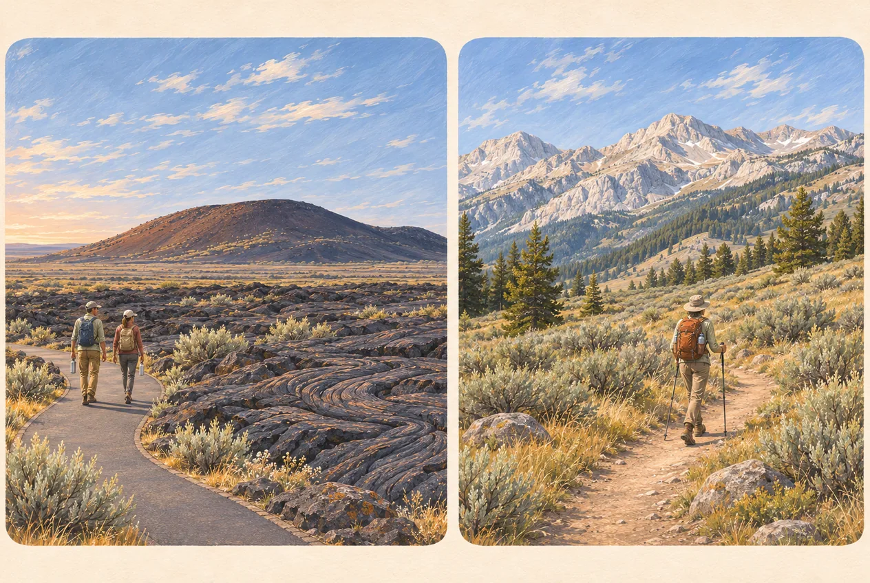
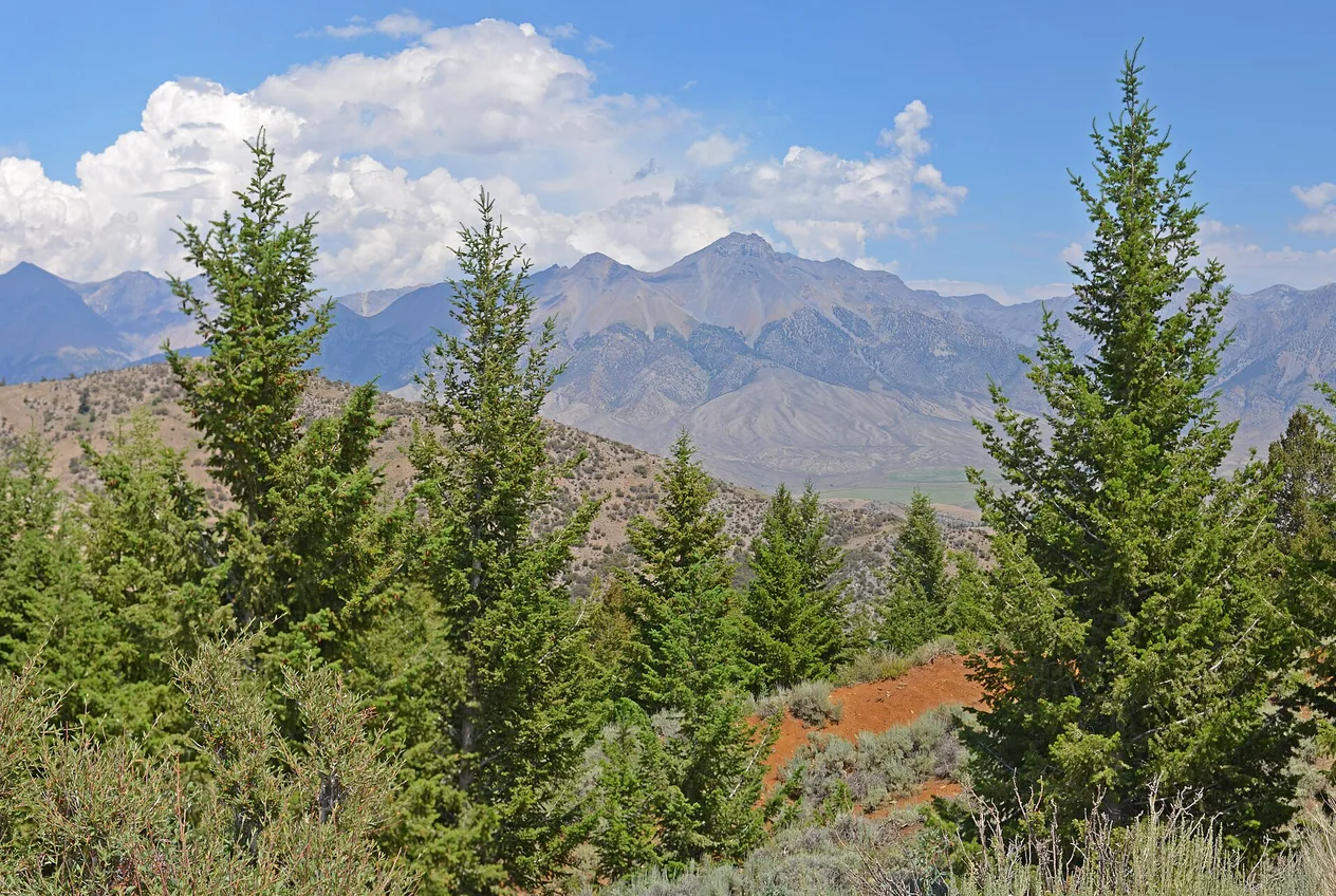
    Hiking near Arco, Idaho: lava walks to Lost River scrambles

    Research area · Arco planning reference, not an activity location

    Hiking · Arco, Idaho

    Site details
    Craters of the Moon southwest of Arco; King Mountain to the west; Lost River Range north and Copper Basin northwest.
    From the Club:
    Less than one mile · straight line
    Region:
    Arco, Idaho
    Season:
    May to October; winter access changes
    Managed by:
    National Park Service, Salmon–Challis National Forest and BLM
    Drinking water:
    Not verified at this pin; bring your own
    Restrooms:
    Not verified at this pin; plan ahead
    Road type:
    Not verified; check current access before driving
    Official updates:
    No location-specific official link verified; see the guide
    This guide covers a region or several sites. This pin marks the Arco planning base, not a destination or legal access point.
    Read guide
  • Hiking

    Mount Borah climbing guide: Idaho’s high point from the southwest ridge

    Research area · Arco planning reference, not an activity location

    Mountaineering · Lost River Range

    Site details
    Mount Borah trailhead in the Lost River Range, reached from US-93 north of Mackay.
    From the Club:
    Less than one mile · straight line
    Region:
    Lost River Range, Idaho
    Season:
    Ordinary season starts in early July
    Managed by:
    Salmon–Challis National Forest
    Drinking water:
    Not verified at this pin; bring your own
    Restrooms:
    Not verified at this pin; plan ahead
    Road type:
    Not verified; check current access before driving
    Official updates:
    No location-specific official link verified; see the guide
    This guide covers a region or several sites. This pin marks the Arco planning base, not a destination or legal access point.
    Read guide
  • Fishing

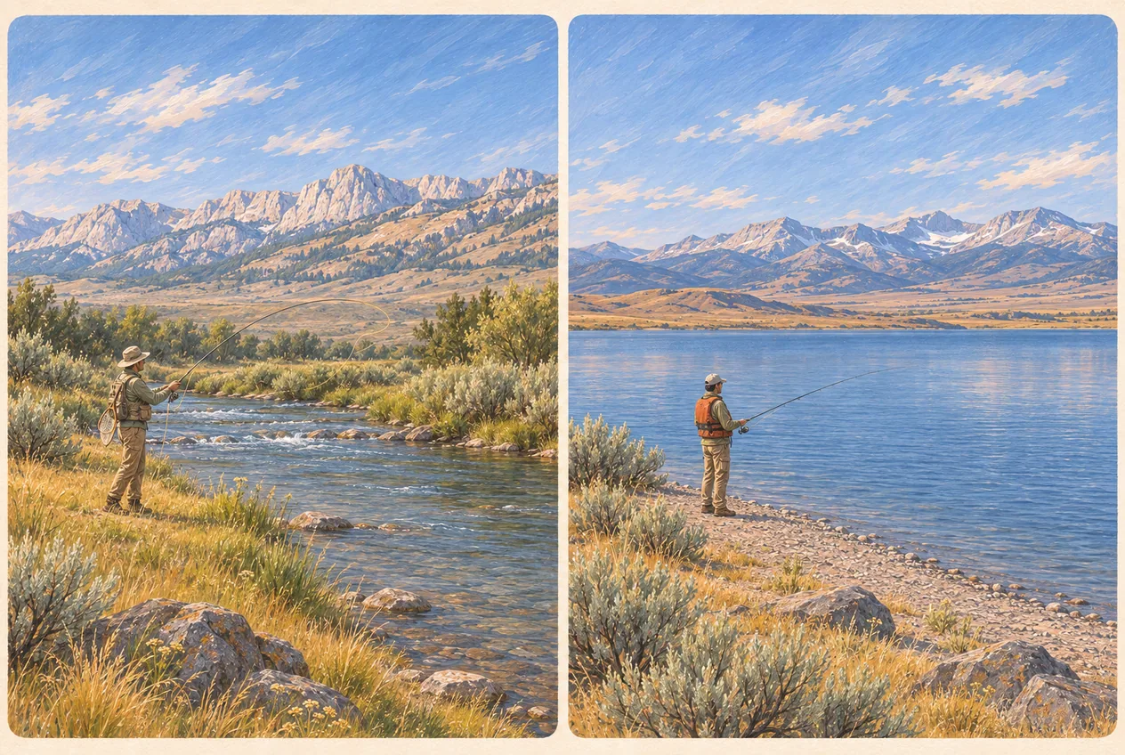
    Fishing near Arco, Idaho: tailwater, reservoir and mountain streams

    Named waters, not a single pin

    Fishing · Lost River Valley

    Site details
    Arco is the base; the nearest waters are the Big Lost River and Mackay Reservoir, 20 to 25 miles north.
    From the Club:
    Less than one mile · straight line
    Region:
    Lost River Valley, Idaho
    Season:
    Fishing seasons and harvest rules vary by water; ice fishing only when conditions are safe
    Managed by:
    Idaho Fish and Game; Forest Service; BLM
    Drinking water:
    Not verified at this pin; bring your own
    Restrooms:
    Not verified at this pin; plan ahead
    Road type:
    Not verified; check current access before driving
    Official updates:
    No location-specific official link verified; see the guide
    Anglers 14 and older need an Idaho fishing license. Special rules apply seasonally to specific waters.
    Read guide
  • Hunting

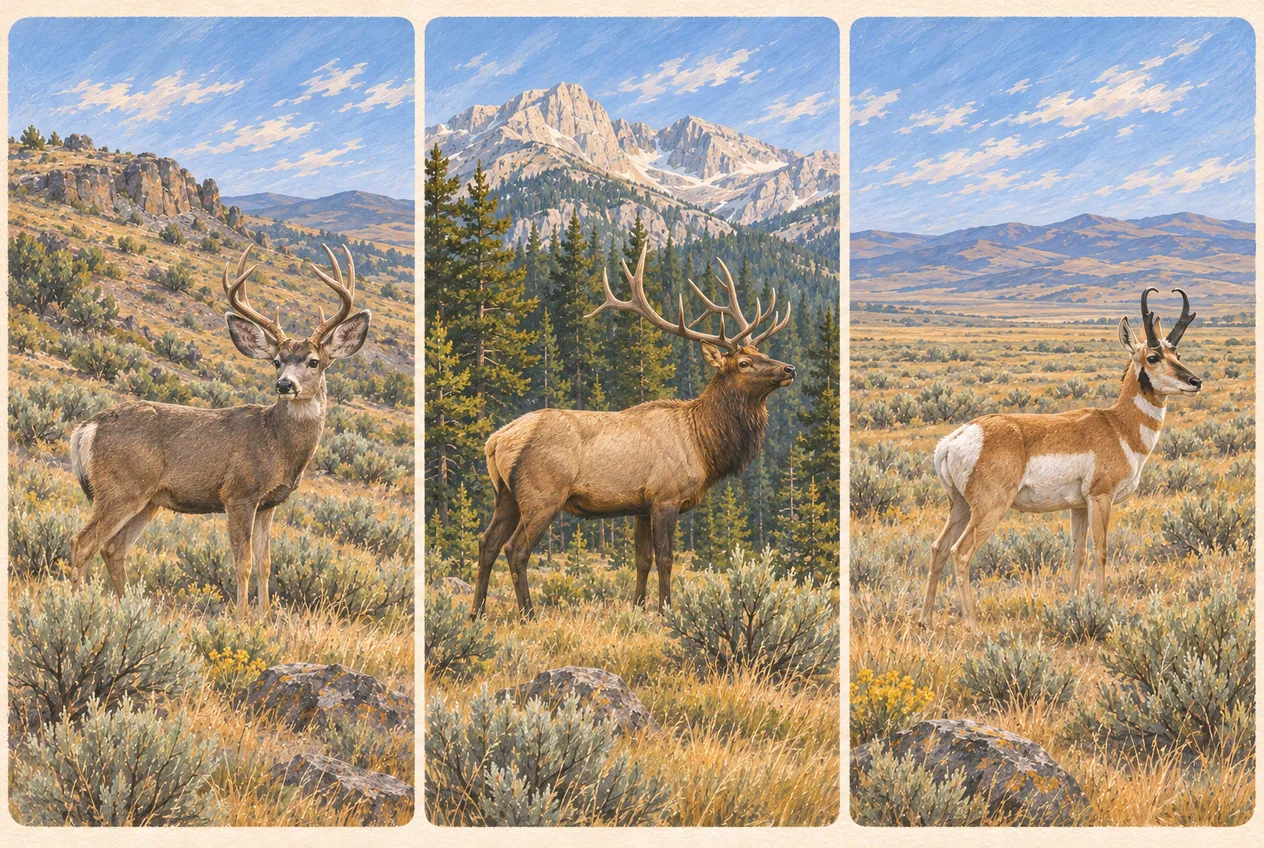
    Hunting near Arco, Idaho: units, tags and the private land problem

    Game unit boundaries, not a single pin

    Hunting · Lost River Valley

    Site details
    Arco, Butte County, as a base for researching regional hunting opportunities in Units 49, 50 and 51 and adjacent areas; confirm the exact destination in the Hunt Planner.
    From the Club:
    Less than one mile · straight line
    Region:
    Butte and Custer Counties, Idaho
    Season:
    Species-specific; set annually by Idaho Fish and Game
    Managed by:
    Idaho Fish and Game; Forest Service; BLM
    Drinking water:
    Not verified at this pin; bring your own
    Restrooms:
    Not verified at this pin; plan ahead
    Road type:
    Not verified; check current access before driving
    Official updates:
    No location-specific official link verified; see the guide
    Get the landowner’s permission before entering private property to hunt or retrieve game. A legal forest road can still enter private ground.
    Read guide
  • ATV & UTV

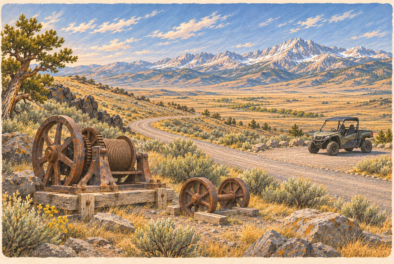
    ATV and UTV trails near Arco and Mackay: what your machine is allowed on

    Route designations, not a single pin

    OHV riding · Lost River Valley

    Site details
    Arco and Mackay, with the primary riding country in the Lost River Range behind them and the Mine Hill district above Mackay.
    From the Club:
    Less than one mile · straight line
    Region:
    Lost River Valley and Salmon-Challis National Forest
    Season:
    Mostly late spring through fall; dependent on snow, mud and fire closures
    Managed by:
    Salmon-Challis National Forest; BLM; Idaho Parks and Recreation
    Drinking water:
    Not verified at this pin; bring your own
    Restrooms:
    Not verified at this pin; plan ahead
    Road type:
    Not verified; check current access before driving
    Official updates:
    No location-specific official link verified; see the guide
    A route absent from the current Motor Vehicle Use Map is closed to public motorized use, whatever a GPS track or set of tire marks suggests.
    Read guide
  • Mining history

    Mackay Mine Hill and the White Knob Mining District: a self-guided tour

    Signed tour route above Mackay

    Mining history · Mackay, Idaho

    Site details
    Mine Hill Road above Mackay, Lost River Valley; the tour area sits on the west flank of the White Knob range.
    From the Club:
    About 26 mi · straight line
    Region:
    White Knob Mining District above Mackay, Idaho
    Season:
    Late spring through late fall, subject to snow, mud, fire and mining closures
    Managed by:
    BLM, with active private mining in parts of the district
    Drinking water:
    Not verified at this pin; bring your own
    Restrooms:
    Not verified at this pin; plan ahead
    Road type:
    Not verified; check current access before driving
    Official updates:
    No location-specific official link verified; see the guide
    Never enter a mine opening. Continuing mining operations have closed some routes and interpretive sites, and further temporary closures can occur.
    Read guide
  • Arco landmarks

    The 1983 Borah Peak earthquake and the Lost River fault scarp

    Approximate landmark

    Natural hazards · North of Mackay, Idaho

    Site details
    Earthquake Interpretive Site, off Doublespring Pass Road, about 22 miles north of Mackay on US-93.
    From the Club:
    About 46 mi · straight line
    Region:
    Lost River Valley, Doublespring Pass north of Mackay
    Season:
    Listed May 1 through September 30, decided by road conditions
    Managed by:
    US Forest Service, Salmon-Challis National Forest
    Drinking water:
    Not verified at this pin; bring your own
    Restrooms:
    Not verified at this pin; plan ahead
    Road type:
    Not verified; check current access before driving
    Official updates:
    No location-specific official link verified; see the guide
    The last 2.5 miles are on Doublespring Pass Road: snow, mud and road damage decide whether it is open. There is no potable water at the site and no cell service to count on.
    Read guide
  • Stargazing

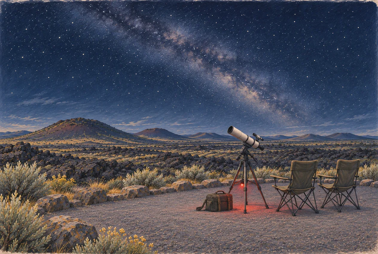
    Stargazing near Arco: Craters of the Moon and Idaho dark skies

    Research area · Arco planning reference, not an activity location

    Dark skies · Craters of the Moon, 18 miles southwest of Arco

    Site details
    Craters of the Moon National Monument and Preserve, about 18 miles southwest of Arco on US-20/26/93.
    From the Club:
    Less than one mile · straight line
    Region:
    Craters of the Moon National Monument and Preserve, Butte County
    Season:
    Late spring through fall is easiest; winter skies are excellent but the Loop Road closes to vehicles
    Managed by:
    Verify land ownership before travel
    Drinking water:
    Not verified at this pin; bring your own
    Restrooms:
    Not verified at this pin; plan ahead
    Road type:
    Not verified; check current access before driving
    Official updates:
    No location-specific official link verified; see the guide
    This guide covers a region or several sites. This pin marks the Arco planning base, not a destination or legal access point.
    Read guide
  • Camping

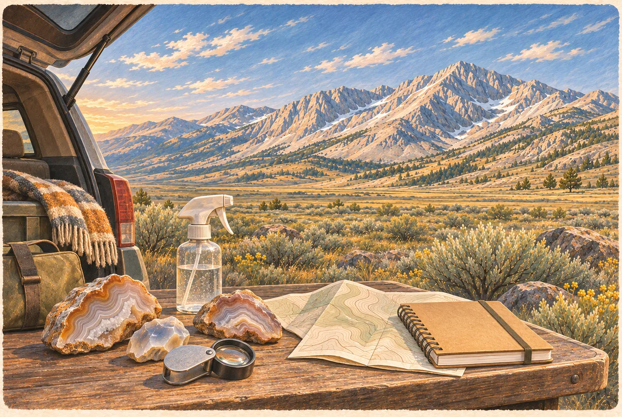
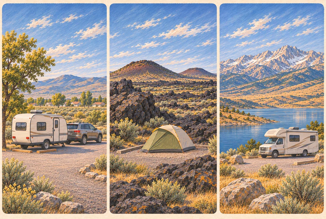
    Camping near Arco: RV parks, lava-field sites and Lost River Valley campgrounds

    Research area · Arco planning reference, not an activity location

    Camping and RV travel · Arco, Craters of the Moon and the Lost River Valley

    Site details
    Arco, Idaho, with campgrounds spread along US-20/26/93, US-93 north to Mackay Reservoir and the Copper Basin Loop Road.
    From the Club:
    Less than one mile · straight line
    Region:
    Arco, Craters of the Moon, Mackay Reservoir and the Copper Basin district of the Salmon-Challis National Forest
    Season:
    Most sites run late May or June through September or early October; Arco RV parks and Joe T. Fallini operate into the colder months
    Managed by:
    Verify land ownership before travel
    Drinking water:
    Not verified at this pin; bring your own
    Restrooms:
    Not verified at this pin; plan ahead
    Road type:
    Not verified; check current access before driving
    Official updates:
    No location-specific official link verified; see the guide
    This guide covers a region or several sites. This pin marks the Arco planning base, not a destination or legal access point.
    Read guide
  • Winter

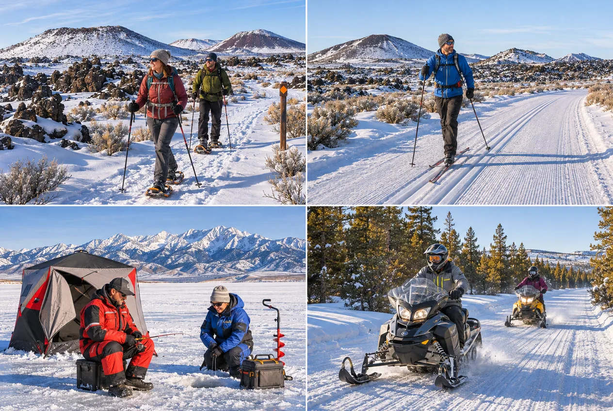
    Winter activities near Arco: snowshoeing, skiing, ice fishing and snowmobiling

    Official visitor entrance

    Winter · Craters of the Moon, Mackay and the Lost River Valley

    Site details
    Robert Limbert Visitor Center at Craters of the Moon, about 18 miles southwest of Arco on US-20/26/93.
    From the Club:
    About 18 mi · straight line
    Region:
    Craters of the Moon, Mackay Reservoir and the Lost River Region
    Season:
    December through March, decided by snow, ice and road conditions rather than by calendar
    Managed by:
    National Park Service and Salmon–Challis National Forest
    Drinking water:
    Not verified at this pin; bring your own
    Restrooms:
    Not verified at this pin; plan ahead
    Road type:
    Not verified; check current access before driving
    Official updates:
    No location-specific official link verified; see the guide
    Winter access changes daily. Snow depth, grooming, ice thickness, avalanche danger, road closures and visibility are not settled by a past trip report or by another group’s tracks.
    Read guide
  • Geocaching

    Geocaching and letterboxing near Arco: EarthCaches, the Arco Desert and one local letterbox

    Research area · Arco planning reference, not an activity location

    Geocaching · Arco, Craters of the Moon and the Lost River Valley

    Site details
    Searches start from Arco: downtown and the Arco Hills, Craters of the Moon about 18 miles southwest on US-20/26/93, Arco Desert roads, and Mackay about 21 miles north on US-93.
    From the Club:
    Less than one mile · straight line
    Region:
    Arco, Craters of the Moon, the Arco Desert and the Lost River Valley
    Season:
    April through October is the practical window; desert routes depend on dry roads and Craters EarthCaches depend on the Loop Road
    Managed by:
    Verify land ownership before travel
    Drinking water:
    Not verified at this pin; bring your own
    Restrooms:
    Not verified at this pin; plan ahead
    Road type:
    Not verified; check current access before driving
    Official updates:
    No location-specific official link verified; see the guide
    This guide covers a region or several sites. This pin marks the Arco planning base, not a destination or legal access point.
    Read guide
  • Rockhounding

    Rockhounding near Arco: the Arco Hills, Big Lost River gravels and Mackay mining minerals

    Research area · Arco planning reference, not an activity location

    Rockhounding · Butte and Custer counties

    Site details
    Searching starts from Arco: the Arco Hills and Horsethief Canyon country to the west and northwest, high desert to the north, the Big Lost River corridor and Mackay about 21 miles north on US-93, and Challis about 60 miles north.
    From the Club:
    Less than one mile · straight line
    Region:
    Arco and the Arco Hills, the Arco Desert, the Big Lost River corridor, Mackay and the White Knob Mining District, and the Challis country to the north
    Season:
    April through early November; spring and fall are the practical windows, summer brings heat and fire risk, winter is a season for sorting and research
    Managed by:
    Verify land ownership before travel
    Drinking water:
    Not verified at this pin; bring your own
    Restrooms:
    Not verified at this pin; plan ahead
    Road type:
    Not verified; check current access before driving
    Official updates:
    No location-specific official link verified; see the guide
    This guide covers a region or several sites. This pin marks the Arco planning base, not a destination or legal access point.
    Read guide
  • Scenic drives

    Peaks to Craters Scenic Byway: Idaho road trip through Arco, Mackay and Challis

    Research area · Arco planning reference, not an activity location

    Scenic drives · Central Idaho, US-93 corridor

    Site details
    The southern end is the junction of Idaho 75 and US 20 near Carey; the northern end is the junction of US 93 and Idaho 75 near Challis. Arco sits roughly in the middle, about 18 miles northeast of the Craters of the Moon visitor entrance and about 21 miles south of Mackay.
    From the Club:
    Less than one mile · straight line
    Region:
    Carey, Craters of the Moon, Arco, Moore, Mackay, Willow Creek Summit, Grand View Canyon and Challis, on US-20/26/93 and US-93
    Season:
    The route itself is a year-round designation; Willow Creek Summit is weather-dependent and most side roads, campgrounds, caves and museums are seasonal
    Managed by:
    Verify land ownership before travel
    Drinking water:
    Not verified at this pin; bring your own
    Restrooms:
    Not verified at this pin; plan ahead
    Road type:
    Not verified; check current access before driving
    Official updates:
    No location-specific official link verified; see the guide
    This guide covers a region or several sites. This pin marks the Arco planning base, not a destination or legal access point.
    Read guide
  • Local events

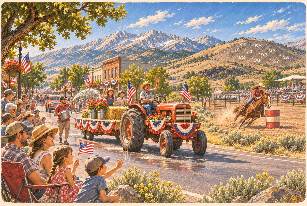
    Atomic Days in Arco, Idaho: the festival, the wet parade and the rodeo

    Town-wide event, pinned to downtown Arco

    Events · Arco, Butte County

    Site details
    Downtown Arco on the West Grand Avenue civic block, parade activities on the route announced for the current year, festivities around Bottolfsen Park and the rodeo at the Butte County Rodeo Grounds. Check current event locations before travelling.
    From the Club:
    Less than one mile · straight line
    Region:
    Arco, Idaho: downtown festivities, Bottolfsen Park and the Butte County Rodeo Grounds
    Season:
    Traditionally the third full weekend in July; the schedule, performers and fireworks are set fresh each year
    Managed by:
    Verify land ownership before travel
    Drinking water:
    Not verified at this pin; bring your own
    Restrooms:
    Not verified at this pin; plan ahead
    Road type:
    Not verified; check current access before driving
    Official updates:
    No location-specific official link verified; see the guide
    Nothing about this weekend is permanent. Parade times, rodeo performances, park activities, performers, vendors, fireworks and evening events are announced each year, and one year’s schedule is not next year’s. Street closures, wet pavement, livestock trailers and heavy foot traffic all move through town at once, so plan the drive around the closures and decide who is driving before anyone drinks.
    Read guide
  • Hot springs

    Wild Rose (Carey / Milford Sweat) Hot Springs

    Approximate regional location · access unverified

    Variable

    Site details
    Approximate regional location for primitive creekside pools near Carey. Access has historically been permission-dependent and is not guaranteed; confirm current access and obey all signs, gates and property-owner requests. No developed facilities: test the water before entering and carry out your trash.
    From the Club:
    About 31 mi · straight line
    Estimated drive:
    33 min
    Region:
    Check the full guide
    Season:
    Check current conditions
    Managed by:
    Verify land ownership before travel
    Drinking water:
    Not verified at this pin; bring your own
    Restrooms:
    Not verified at this pin; plan ahead
    Road type:
    Not verified; check current access before driving
    Official updates:
    No location-specific official link verified; see the guide
    Approximate marker, not a public access point. Visitors have historically used the spring without a formal check-in, but access is not guaranteed; obey signs, gates and property-owner requests.
    Read guide
  • Hot springs

    Kirkham Hot Springs

    Approximate pool area

    105°F

    Site details
    Cliffside steamy waterfalls into the Payette.
    From the Club:
    About 116 mi · straight line
    Estimated drive:
    2 hrs
    Region:
    Check the full guide
    Season:
    Check current conditions
    Managed by:
    Verify land ownership before travel
    Drinking water:
    Not verified at this pin; bring your own
    Restrooms:
    Not verified at this pin; plan ahead
    Road type:
    Not verified; check current access before driving
    Official updates:
    No location-specific official link verified; see the guide
    Primitive soaks vary in access and facilities. Check conditions and test the water before entering.
    Read guide
  • Hot springs

    Goldbug Hot Springs

    Approximate pool area

    104°F

    Site details
    Legendary mountain views, heart-pumping hike.
    From the Club:
    About 92 mi · straight line
    Estimated drive:
    3 hrs
    Region:
    Check the full guide
    Season:
    Check current conditions
    Managed by:
    Verify land ownership before travel
    Drinking water:
    Not verified at this pin; bring your own
    Restrooms:
    Not verified at this pin; plan ahead
    Road type:
    Not verified; check current access before driving
    Official updates:
    No location-specific official link verified; see the guide
    Primitive soaks vary in access and facilities. Check conditions and test the water before entering.
    Read guide
  • Hot springs

    Sunbeam Hot Springs

    Approximate pool area

    100°F

    Site details
    Accessible roadside soak on the Salmon River.
    From the Club:
    About 84 mi · straight line
    Estimated drive:
    1.5 hrs
    Region:
    Check the full guide
    Season:
    Check current conditions
    Managed by:
    Verify land ownership before travel
    Drinking water:
    Not verified at this pin; bring your own
    Restrooms:
    Not verified at this pin; plan ahead
    Road type:
    Not verified; check current access before driving
    Official updates:
    No location-specific official link verified; see the guide
    Primitive soaks vary in access and facilities. Check conditions and test the water before entering.
    Read guide
  • Hot springs

    Worswick Hot Springs

    Approximate pool area

    104°F

    Site details
    Dozens of small natural pools near Fairfield.
    From the Club:
    About 79 mi · straight line
    Estimated drive:
    1.4 hrs
    Region:
    Check the full guide
    Season:
    Check current conditions
    Managed by:
    Verify land ownership before travel
    Drinking water:
    Not verified at this pin; bring your own
    Restrooms:
    Not verified at this pin; plan ahead
    Road type:
    Not verified; check current access before driving
    Official updates:
    No location-specific official link verified; see the guide
    Primitive soaks vary in access and facilities. Check conditions and test the water before entering.
    Read guide
  • Hot springs

    Lava Hot Springs

    Approximate pool area

    Natural Pools

    Site details
    Developed soaking pools and river tubing town.
    From the Club:
    About 96 mi · straight line
    Estimated drive:
    2.5 hrs
    Region:
    Check the full guide
    Season:
    Check current conditions
    Managed by:
    Verify land ownership before travel
    Drinking water:
    Not verified at this pin; bring your own
    Restrooms:
    Not verified at this pin; plan ahead
    Road type:
    Not verified; check current access before driving
    Official updates:
    No location-specific official link verified; see the guide
    Primitive soaks vary in access and facilities. Check conditions and test the water before entering.
    Read guide
  • Hot springs

    Ninemeyer Hot Springs

    Approximate pool area

    River Soak

    Site details
    Remote river pools, primitive access.
    From the Club:
    About 114 mi · straight line
    Estimated drive:
    3 hrs
    Region:
    Check the full guide
    Season:
    Check current conditions
    Managed by:
    Verify land ownership before travel
    Drinking water:
    Not verified at this pin; bring your own
    Restrooms:
    Not verified at this pin; plan ahead
    Road type:
    Not verified; check current access before driving
    Official updates:
    No location-specific official link verified; see the guide
    Primitive soaks vary in access and facilities. Check conditions and test the water before entering.
    Read guide
  • Hot springs

    Bonneville Hot Springs

    Approximate pool area

    102°F

    Site details
    Backcountry pools near Deadwood Reservoir.
    From the Club:
    About 128 mi · straight line
    Estimated drive:
    2.8 hrs
    Region:
    Check the full guide
    Season:
    Check current conditions
    Managed by:
    Verify land ownership before travel
    Drinking water:
    Not verified at this pin; bring your own
    Restrooms:
    Not verified at this pin; plan ahead
    Road type:
    Not verified; check current access before driving
    Official updates:
    No location-specific official link verified; see the guide
    Primitive soaks vary in access and facilities. Check conditions and test the water before entering.
    Read guide
  • Hot springs

    Trail Creek Hot Springs

    Approximate pool area

    103°F

    Site details
    Natural soaking tubs near Sun Valley.
    From the Club:
    About 89 mi · straight line
    Estimated drive:
    2 hrs
    Region:
    Check the full guide
    Season:
    Check current conditions
    Managed by:
    Verify land ownership before travel
    Drinking water:
    Not verified at this pin; bring your own
    Restrooms:
    Not verified at this pin; plan ahead
    Road type:
    Not verified; check current access before driving
    Official updates:
    No location-specific official link verified; see the guide
    Primitive soaks vary in access and facilities. Check conditions and test the water before entering.
    Read guide
  • Hot springs

    Jerry Johnson Hot Springs

    Approximate pool area

    105°F

    Site details
    Iconic Clearwater River soaking pools - 355 mi up the Salmon River canyon, an overnight trip, not a night out from the bar.
    From the Club:
    About 221 mi · straight line
    Estimated drive:
    10 hrs
    Region:
    Check the full guide
    Season:
    Check current conditions
    Managed by:
    Verify land ownership before travel
    Drinking water:
    Not verified at this pin; bring your own
    Restrooms:
    Not verified at this pin; plan ahead
    Road type:
    Not verified; check current access before driving
    Official updates:
    No location-specific official link verified; see the guide
    Primitive soaks vary in access and facilities. Check conditions and test the water before entering.
    Read guide
  • Hot springs

    Weir Creek Hot Springs

    Approximate pool area

    104°F

    Site details
    Easily accessible river pools on the South Fork of the Clearwater, 355 mi away - plan to overnight.
    From the Club:
    About 218 mi · straight line
    Estimated drive:
    10 hrs
    Region:
    Check the full guide
    Season:
    Check current conditions
    Managed by:
    Verify land ownership before travel
    Drinking water:
    Not verified at this pin; bring your own
    Restrooms:
    Not verified at this pin; plan ahead
    Road type:
    Not verified; check current access before driving
    Official updates:
    No location-specific official link verified; see the guide
    Primitive soaks vary in access and facilities. Check conditions and test the water before entering.
    Read guide
  • Hot springs

    Sacajawea Hot Springs

    Approximate pool area

    101°F

    Site details
    Historic soak on the Middle Fork of the Salmon, 203 mi and about 5 h 30 min out of Arco.
    From the Club:
    About 137 mi · straight line
    Estimated drive:
    5.5 hrs
    Region:
    Check the full guide
    Season:
    Check current conditions
    Managed by:
    Verify land ownership before travel
    Drinking water:
    Not verified at this pin; bring your own
    Restrooms:
    Not verified at this pin; plan ahead
    Road type:
    Not verified; check current access before driving
    Official updates:
    No location-specific official link verified; see the guide
    Primitive soaks vary in access and facilities. Check conditions and test the water before entering.
    Read guide
  • Hot springs

    Mountain Village Resort Springs

    Approximate pool area

    98-104°F

    Site details
    Resort with multiple pools near Stanley.
    From the Club:
    About 116 mi · straight line
    Estimated drive:
    3 hrs
    Region:
    Check the full guide
    Season:
    Check current conditions
    Managed by:
    Verify land ownership before travel
    Drinking water:
    Not verified at this pin; bring your own
    Restrooms:
    Not verified at this pin; plan ahead
    Road type:
    Not verified; check current access before driving
    Official updates:
    No location-specific official link verified; see the guide
    Primitive soaks vary in access and facilities. Check conditions and test the water before entering.
    Read guide
  • Hot springs

    Elkhorn Hot Springs

    Approximate pool area

    103°F

    Site details
    Historic resort in the Salmon-Challis NF.
    From the Club:
    About 92 mi · straight line
    Estimated drive:
    3.5 hrs
    Region:
    Check the full guide
    Season:
    Check current conditions
    Managed by:
    Verify land ownership before travel
    Drinking water:
    Not verified at this pin; bring your own
    Restrooms:
    Not verified at this pin; plan ahead
    Road type:
    Not verified; check current access before driving
    Official updates:
    No location-specific official link verified; see the guide
    Primitive soaks vary in access and facilities. Check conditions and test the water before entering.
    Read guide
  • Hot springs

    Skinny Dipper Hot Springs

    Approximate pool area

    104°F

    Site details
    Remote cliffside pools near Kirkham.
    From the Club:
    About 118 mi · straight line
    Estimated drive:
    2.2 hrs
    Region:
    Check the full guide
    Season:
    Check current conditions
    Managed by:
    Verify land ownership before travel
    Drinking water:
    Not verified at this pin; bring your own
    Restrooms:
    Not verified at this pin; plan ahead
    Road type:
    Not verified; check current access before driving
    Official updates:
    No location-specific official link verified; see the guide
    Primitive soaks vary in access and facilities. Check conditions and test the water before entering.
    Read guide
  • Hot springs

    Frenchman's Bend Hot Springs

    Approximate pool area

    101°F

    Site details
    Family-friendly pools along the river.
    From the Club:
    About 116 mi · straight line
    Estimated drive:
    2.1 hrs
    Region:
    Check the full guide
    Season:
    Check current conditions
    Managed by:
    Verify land ownership before travel
    Drinking water:
    Not verified at this pin; bring your own
    Restrooms:
    Not verified at this pin; plan ahead
    Road type:
    Not verified; check current access before driving
    Official updates:
    No location-specific official link verified; see the guide
    Primitive soaks vary in access and facilities. Check conditions and test the water before entering.
    Read guide
  • Hot springs

    Pine Flats Hot Springs

    Approximate pool area

    102°F

    Site details
    Multiple riverfront pools with camping.
    From the Club:
    About 117 mi · straight line
    Estimated drive:
    2.1 hrs
    Region:
    Check the full guide
    Season:
    Check current conditions
    Managed by:
    Verify land ownership before travel
    Drinking water:
    Not verified at this pin; bring your own
    Restrooms:
    Not verified at this pin; plan ahead
    Road type:
    Not verified; check current access before driving
    Official updates:
    No location-specific official link verified; see the guide
    Primitive soaks vary in access and facilities. Check conditions and test the water before entering.
    Read guide
  • Hot springs

    Challis Hot Springs

    Approximate pool area

    105°F

    Site details
    Commercial pools with RV park access.
    From the Club:
    About 74 mi · straight line
    Estimated drive:
    2.5 hrs
    Region:
    Check the full guide
    Season:
    Check current conditions
    Managed by:
    Verify land ownership before travel
    Drinking water:
    Not verified at this pin; bring your own
    Restrooms:
    Not verified at this pin; plan ahead
    Road type:
    Not verified; check current access before driving
    Official updates:
    No location-specific official link verified; see the guide
    Primitive soaks vary in access and facilities. Check conditions and test the water before entering.
    Read guide
  • Hot springs

    Vulcan Hot Springs

    Approximate pool area

    106°F

    Site details
    Primitive pools in the Wood River Valley.
    From the Club:
    About 68 mi · straight line
    Estimated drive:
    1.8 hrs
    Region:
    Check the full guide
    Season:
    Check current conditions
    Managed by:
    Verify land ownership before travel
    Drinking water:
    Not verified at this pin; bring your own
    Restrooms:
    Not verified at this pin; plan ahead
    Road type:
    Not verified; check current access before driving
    Official updates:
    No location-specific official link verified; see the guide
    Primitive soaks vary in access and facilities. Check conditions and test the water before entering.
    Read guide
  • Hot springs

    Zims Hot Springs

    Approximate pool area

    103°F

    Site details
    Family-owned resort in the Weiser headwaters, 294 mi and about 6 h from the bar.
    From the Club:
    About 163 mi · straight line
    Estimated drive:
    6 hrs
    Region:
    Check the full guide
    Season:
    Check current conditions
    Managed by:
    Verify land ownership before travel
    Drinking water:
    Not verified at this pin; bring your own
    Restrooms:
    Not verified at this pin; plan ahead
    Road type:
    Not verified; check current access before driving
    Official updates:
    No location-specific official link verified; see the guide
    Primitive soaks vary in access and facilities. Check conditions and test the water before entering.
    Read guide
  • Hot springs

    Miracle Hot Springs

    Approximate pool area

    Natural Pools

    Site details
    Resort with private soaking tubs.
    From the Club:
    About 79 mi · straight line
    Estimated drive:
    2.3 hrs
    Region:
    Check the full guide
    Season:
    Check current conditions
    Managed by:
    Verify land ownership before travel
    Drinking water:
    Not verified at this pin; bring your own
    Restrooms:
    Not verified at this pin; plan ahead
    Road type:
    Not verified; check current access before driving
    Official updates:
    No location-specific official link verified; see the guide
    Primitive soaks vary in access and facilities. Check conditions and test the water before entering.
    Read guide
  • Hot springs

    Boat Box Hot Springs

    Approximate pool area

    107°F

    Site details
    One galvanised tub on the Salmon River beside Highway 75, 3 miles north of Stanley — a pipe does the filling, river water cools it.
    From the Club:
    About 89 mi · straight line
    Estimated drive:
    2 hrs
    Region:
    Check the full guide
    Season:
    Check current conditions
    Managed by:
    Verify land ownership before travel
    Drinking water:
    Not verified at this pin; bring your own
    Restrooms:
    Not verified at this pin; plan ahead
    Road type:
    Not verified; check current access before driving
    Official updates:
    No location-specific official link verified; see the guide
    Primitive soaks vary in access and facilities. Check conditions and test the water before entering.
    Read guide
  • Fishing

    Big Lost River

    Approximate water location

    Blue Ribbon Fly Fishing · Rainbow, Brook & Brown Trout

    Site details
    Technical tailwater right outside Arco, 3 mi down the road. Check flows!
    From the Club:
    About 3 mi · straight line
    Estimated drive:
    8 min
    Region:
    Check the full guide
    Season:
    Check current conditions
    Managed by:
    Verify land ownership before travel
    Drinking water:
    Not verified at this pin; bring your own
    Restrooms:
    Not verified at this pin; plan ahead
    Road type:
    Not verified; check current access before driving
    Official updates:
    No location-specific official link verified; see the guide
    Not an access point. Check current Idaho Fish and Game rules, flows and legal access.
    Read guide
  • Fishing

    Little Lost River

    Approximate water location

    Remote Stream · Bull Trout (Catch/Release Only)

    Site details
    Native bull trout stronghold, 49 mi north up the Lost River Valley.
    From the Club:
    About 33 mi · straight line
    Estimated drive:
    1.5 hrs
    Region:
    Check the full guide
    Season:
    Check current conditions
    Managed by:
    Verify land ownership before travel
    Drinking water:
    Not verified at this pin; bring your own
    Restrooms:
    Not verified at this pin; plan ahead
    Road type:
    Not verified; check current access before driving
    Official updates:
    No location-specific official link verified; see the guide
    Not an access point. Check current Idaho Fish and Game rules, flows and legal access.
    Read guide
  • Fishing

    Redfish Lake

    Approximate water location

    Deep Lake Trolling · Kokanee, Mackinaw

    Site details
    Iconic Sawtooth alpine lake, 140 mi over Stanley.
    From the Club:
    About 88 mi · straight line
    Estimated drive:
    3 hrs
    Region:
    Check the full guide
    Season:
    Check current conditions
    Managed by:
    Verify land ownership before travel
    Drinking water:
    Not verified at this pin; bring your own
    Restrooms:
    Not verified at this pin; plan ahead
    Road type:
    Not verified; check current access before driving
    Official updates:
    No location-specific official link verified; see the guide
    Not an access point. Check current Idaho Fish and Game rules, flows and legal access.
    Read guide
  • Fishing

    Silver Creek Preserve

    Approximate water location

    Spring Creek Fly Fishing · Large Brown Trout

    Site details
    World-famous technical spring creek, 57 mi south near Hagerman.
    From the Club:
    About 48 mi · straight line
    Estimated drive:
    1 hr 15 min
    Region:
    Check the full guide
    Season:
    Check current conditions
    Managed by:
    Verify land ownership before travel
    Drinking water:
    Not verified at this pin; bring your own
    Restrooms:
    Not verified at this pin; plan ahead
    Road type:
    Not verified; check current access before driving
    Official updates:
    No location-specific official link verified; see the guide
    Not an access point. Check current Idaho Fish and Game rules, flows and legal access.
    Read guide
  • Fishing

    Salmon River

    Approximate water location

    Big River · Steelhead, Chinook, Trout

    Site details
    Legendary river with multiple access points, 119 mi toward Stanley.
    From the Club:
    About 83 mi · straight line
    Estimated drive:
    2.5 hrs
    Region:
    Check the full guide
    Season:
    Check current conditions
    Managed by:
    Verify land ownership before travel
    Drinking water:
    Not verified at this pin; bring your own
    Restrooms:
    Not verified at this pin; plan ahead
    Road type:
    Not verified; check current access before driving
    Official updates:
    No location-specific official link verified; see the guide
    Not an access point. Check current Idaho Fish and Game rules, flows and legal access.
    Read guide
  • Fishing

    Mackay Reservoir

    Approximate water location

    Reservoir · Perch, Trout

    Site details
    27 mi up the valley. Windy afternoons, great ice fishing.
    From the Club:
    About 25 mi · straight line
    Estimated drive:
    35 min
    Region:
    Check the full guide
    Season:
    Check current conditions
    Managed by:
    Verify land ownership before travel
    Drinking water:
    Not verified at this pin; bring your own
    Restrooms:
    Not verified at this pin; plan ahead
    Road type:
    Not verified; check current access before driving
    Official updates:
    No location-specific official link verified; see the guide
    Not an access point. Check current Idaho Fish and Game rules, flows and legal access.
    Read guide
  • Fishing

    Birch Creek

    Approximate water location

    Spring Creek · Native Trout

    Site details
    24 mi to the east. Cold clear water with selective hatches.
    From the Club:
    About 18 mi · straight line
    Estimated drive:
    35 min
    Region:
    Check the full guide
    Season:
    Check current conditions
    Managed by:
    Verify land ownership before travel
    Drinking water:
    Not verified at this pin; bring your own
    Restrooms:
    Not verified at this pin; plan ahead
    Road type:
    Not verified; check current access before driving
    Official updates:
    No location-specific official link verified; see the guide
    Not an access point. Check current Idaho Fish and Game rules, flows and legal access.
    Read guide
  • Fishing

    Little Wood River

    Approximate water location

    Freestone · Rainbow & Brown Trout

    Site details
    56 mi south through Carey and Hill City.
    From the Club:
    About 42 mi · straight line
    Estimated drive:
    1 hr 20 min
    Region:
    Check the full guide
    Season:
    Check current conditions
    Managed by:
    Verify land ownership before travel
    Drinking water:
    Not verified at this pin; bring your own
    Restrooms:
    Not verified at this pin; plan ahead
    Road type:
    Not verified; check current access before driving
    Official updates:
    No location-specific official link verified; see the guide
    Not an access point. Check current Idaho Fish and Game rules, flows and legal access.
    Read guide
  • Fishing

    Warm Springs Creek

    Approximate water location

    Mountain Stream · Cutthroat Trout

    Site details
    Remote high-elevation water, 136 mi over the Sawtooths.
    From the Club:
    About 83 mi · straight line
    Estimated drive:
    3 hrs
    Region:
    Check the full guide
    Season:
    Check current conditions
    Managed by:
    Verify land ownership before travel
    Drinking water:
    Not verified at this pin; bring your own
    Restrooms:
    Not verified at this pin; plan ahead
    Road type:
    Not verified; check current access before driving
    Official updates:
    No location-specific official link verified; see the guide
    Not an access point. Check current Idaho Fish and Game rules, flows and legal access.
    Read guide
  • Fishing

    Henrys Fork

    Approximate water location

    World-Class Fly Fishing · Rainbow Trout

    Site details
    158 mi east through Idaho Falls. Famous for large trout and hatches.
    From the Club:
    About 116 mi · straight line
    Estimated drive:
    3 hrs
    Region:
    Check the full guide
    Season:
    Check current conditions
    Managed by:
    Verify land ownership before travel
    Drinking water:
    Not verified at this pin; bring your own
    Restrooms:
    Not verified at this pin; plan ahead
    Road type:
    Not verified; check current access before driving
    Official updates:
    No location-specific official link verified; see the guide
    Not an access point. Check current Idaho Fish and Game rules, flows and legal access.
    Read guide
  • Fishing

    South Fork Boise River

    Approximate water location

    Tailwater Fishery · Rainbow & Brown Trout

    Site details
    Below Anderson Ranch Dam, 156 mi west - excellent dry fly fishing, but an overnight.
    From the Club:
    About 101 mi · straight line
    Estimated drive:
    4.5 hrs
    Region:
    Check the full guide
    Season:
    Check current conditions
    Managed by:
    Verify land ownership before travel
    Drinking water:
    Not verified at this pin; bring your own
    Restrooms:
    Not verified at this pin; plan ahead
    Road type:
    Not verified; check current access before driving
    Official updates:
    No location-specific official link verified; see the guide
    Not an access point. Check current Idaho Fish and Game rules, flows and legal access.
    Read guide
  • Fishing

    Henry's Lake

    Approximate water location

    Stillwater Trophy Lake · Hybrid Trout

    Site details
    159 mi east over Teton Pass. Large hybrid trout, big views.
    From the Club:
    About 117 mi · straight line
    Estimated drive:
    3 hrs
    Region:
    Check the full guide
    Season:
    Check current conditions
    Managed by:
    Verify land ownership before travel
    Drinking water:
    Not verified at this pin; bring your own
    Restrooms:
    Not verified at this pin; plan ahead
    Road type:
    Not verified; check current access before driving
    Official updates:
    No location-specific official link verified; see the guide
    Not an access point. Check current Idaho Fish and Game rules, flows and legal access.
    Read guide
  • Fishing

    Priest Lake

    Approximate water location

    Deep Lake · Lake Trout, Kokanee

    Site details
    Far northern Idaho, 527 mi and about 11 hours - a vacation, not a day trip from the bar.
    From the Club:
    About 383 mi · straight line
    Estimated drive:
    11 hrs
    Region:
    Check the full guide
    Season:
    Check current conditions
    Managed by:
    Verify land ownership before travel
    Drinking water:
    Not verified at this pin; bring your own
    Restrooms:
    Not verified at this pin; plan ahead
    Road type:
    Not verified; check current access before driving
    Official updates:
    No location-specific official link verified; see the guide
    Not an access point. Check current Idaho Fish and Game rules, flows and legal access.
    Read guide
  • Fishing

    Snake River (Hells Canyon)

    Approximate water location

    Big River · Smallmouth Bass, Sturgeon

    Site details
    Deepest river canyon in North America, 409 mi and roughly 10 h 40 min up the Clearwater.
    From the Club:
    About 204 mi · straight line
    Estimated drive:
    11 hrs
    Region:
    Check the full guide
    Season:
    Check current conditions
    Managed by:
    Verify land ownership before travel
    Drinking water:
    Not verified at this pin; bring your own
    Restrooms:
    Not verified at this pin; plan ahead
    Road type:
    Not verified; check current access before driving
    Official updates:
    No location-specific official link verified; see the guide
    Not an access point. Check current Idaho Fish and Game rules, flows and legal access.
    Read guide
  • Fishing

    Anderson Ranch Reservoir

    Approximate water location

    Reservoir · Kokanee, Trout

    Site details
    142 mi west below the dam. Popular for trolling and scenic camping.
    From the Club:
    About 107 mi · straight line
    Estimated drive:
    3 hrs 45 min
    Region:
    Check the full guide
    Season:
    Check current conditions
    Managed by:
    Verify land ownership before travel
    Drinking water:
    Not verified at this pin; bring your own
    Restrooms:
    Not verified at this pin; plan ahead
    Road type:
    Not verified; check current access before driving
    Official updates:
    No location-specific official link verified; see the guide
    Not an access point. Check current Idaho Fish and Game rules, flows and legal access.
    Read guide
  • Fishing

    Crane Creek

    Approximate water location

    Spring Creek · Rainbow Trout

    Site details
    Small Weiser River tributary in Washington County, 271 mi west; pin at the creek mouth near Weiser.
    From the Club:
    About 179 mi · straight line
    Estimated drive:
    5.5 hrs
    Region:
    Check the full guide
    Season:
    Check current conditions
    Managed by:
    Verify land ownership before travel
    Drinking water:
    Not verified at this pin; bring your own
    Restrooms:
    Not verified at this pin; plan ahead
    Road type:
    Not verified; check current access before driving
    Official updates:
    No location-specific official link verified; see the guide
    Not an access point. Check current Idaho Fish and Game rules, flows and legal access.
    Read guide
  • Fishing

    Lochsa River

    Approximate water location

    Wild River · Steelhead, Cutthroat

    Site details
    Bitterroot steelhead water, 378 mi and about 8 h 20 min to the Selway–Lochsa confluence at Lowell.
    From the Club:
    About 206 mi · straight line
    Estimated drive:
    8.5 hrs
    Region:
    Check the full guide
    Season:
    Check current conditions
    Managed by:
    Verify land ownership before travel
    Drinking water:
    Not verified at this pin; bring your own
    Restrooms:
    Not verified at this pin; plan ahead
    Road type:
    Not verified; check current access before driving
    Official updates:
    No location-specific official link verified; see the guide
    Not an access point. Check current Idaho Fish and Game rules, flows and legal access.
    Read guide
  • Fishing

    Magic Reservoir

    Approximate water location

    Reservoir · Rainbow Trout, Perch

    Site details
    96 mi south out of the Big Lost country. Good shoreline access.
    From the Club:
    About 68 mi · straight line
    Estimated drive:
    2 hrs 40 min
    Region:
    Check the full guide
    Season:
    Check current conditions
    Managed by:
    Verify land ownership before travel
    Drinking water:
    Not verified at this pin; bring your own
    Restrooms:
    Not verified at this pin; plan ahead
    Road type:
    Not verified; check current access before driving
    Official updates:
    No location-specific official link verified; see the guide
    Not an access point. Check current Idaho Fish and Game rules, flows and legal access.
    Read guide
  • Fishing

    St. Joe River

    Approximate water location

    Wild & Scenic River · Cutthroat Trout

    Site details
    454 mi and about 9 h 20 min to the Panhandle - one of the highest navigable rivers in the world, and a trip of its own.
    From the Club:
    About 299 mi · straight line
    Estimated drive:
    9 hrs
    Region:
    Check the full guide
    Season:
    Check current conditions
    Managed by:
    Verify land ownership before travel
    Drinking water:
    Not verified at this pin; bring your own
    Restrooms:
    Not verified at this pin; plan ahead
    Road type:
    Not verified; check current access before driving
    Official updates:
    No location-specific official link verified; see the guide
    Not an access point. Check current Idaho Fish and Game rules, flows and legal access.
    Read guide
  • Hiking

    Grand Loop

    Approximate route reference

    72mi · 14k ft gain · Hard

    Site details
    From the Club:
    About 84 mi · straight line
    Region:
    Check the full guide
    Season:
    Check current conditions
    Managed by:
    Verify land ownership before travel
    Drinking water:
    Not verified at this pin; bring your own
    Restrooms:
    Not verified at this pin; plan ahead
    Road type:
    Not verified; check current access before driving
    Official updates:
    No location-specific official link verified; see the guide
    Not a verified trailhead. Check your route, weather and land-manager conditions before hiking.
    Read guide
  • Hiking / Craters & lava

    Inferno Cone

    Approximate route reference

    0.4mi · 164ft gain · Moderate

    Site details
    From the Club:
    About 18 mi · straight line
    Region:
    Check the full guide
    Season:
    Check current conditions
    Managed by:
    Verify land ownership before travel
    Drinking water:
    Not verified at this pin; bring your own
    Restrooms:
    Not verified at this pin; plan ahead
    Road type:
    Not verified; check current access before driving
    Official updates:
    No location-specific official link verified; see the guide
    Not a verified trailhead. Check your route, weather and land-manager conditions before hiking.
    Read guide
  • Hiking

    Sawtooth Lake

    Approximate route reference

    10mi · 1.7k ft gain · Hard

    Site details
    From the Club:
    About 95 mi · straight line
    Region:
    Check the full guide
    Season:
    Check current conditions
    Managed by:
    Verify land ownership before travel
    Drinking water:
    Not verified at this pin; bring your own
    Restrooms:
    Not verified at this pin; plan ahead
    Road type:
    Not verified; check current access before driving
    Official updates:
    No location-specific official link verified; see the guide
    Not a verified trailhead. Check your route, weather and land-manager conditions before hiking.
    Read guide
  • Hiking

    Big Southern Butte

    Approximate route reference

    2.5mi · 2k ft gain · Hard

    Site details
    From the Club:
    About 20 mi · straight line
    Region:
    Check the full guide
    Season:
    Check current conditions
    Managed by:
    Verify land ownership before travel
    Drinking water:
    Not verified at this pin; bring your own
    Restrooms:
    Not verified at this pin; plan ahead
    Road type:
    Not verified; check current access before driving
    Official updates:
    No location-specific official link verified; see the guide
    Not a verified trailhead. Check your route, weather and land-manager conditions before hiking.
    Read guide
  • Hiking

    Fish Creek Rim

    Approximate route reference

    6mi · 900ft gain · Moderate

    Site details
    From the Club:
    About 81 mi · straight line
    Region:
    Check the full guide
    Season:
    Check current conditions
    Managed by:
    Verify land ownership before travel
    Drinking water:
    Not verified at this pin; bring your own
    Restrooms:
    Not verified at this pin; plan ahead
    Road type:
    Not verified; check current access before driving
    Official updates:
    No location-specific official link verified; see the guide
    Not a verified trailhead. Check your route, weather and land-manager conditions before hiking.
    Read guide
  • Hiking

    Borah Peak Route

    Approximate route reference

    7.5mi · 5.3k ft gain · Extreme

    Site details
    From the Club:
    About 42 mi · straight line
    Region:
    Check the full guide
    Season:
    Check current conditions
    Managed by:
    Verify land ownership before travel
    Drinking water:
    Not verified at this pin; bring your own
    Restrooms:
    Not verified at this pin; plan ahead
    Road type:
    Not verified; check current access before driving
    Official updates:
    No location-specific official link verified; see the guide
    A strenuous climb with exposed scrambling. Check conditions and match the route to your experience.
    Read guide
  • Hiking

    Mammoth Cave Trail

    Approximate route reference

    0.6mi · Minimal gain · Easy

    Site details
    From the Club:
    About 18 mi · straight line
    Region:
    Check the full guide
    Season:
    Check current conditions
    Managed by:
    Verify land ownership before travel
    Drinking water:
    Not verified at this pin; bring your own
    Restrooms:
    Not verified at this pin; plan ahead
    Road type:
    Not verified; check current access before driving
    Official updates:
    No location-specific official link verified; see the guide
    Not a verified trailhead. Check your route, weather and land-manager conditions before hiking.
    Read guide
  • Hiking

    Carey Canyon Walk

    Approximate route reference

    3mi · 400ft gain · Easy

    Site details
    From the Club:
    About 39 mi · straight line
    Region:
    Check the full guide
    Season:
    Check current conditions
    Managed by:
    Verify land ownership before travel
    Drinking water:
    Not verified at this pin; bring your own
    Restrooms:
    Not verified at this pin; plan ahead
    Road type:
    Not verified; check current access before driving
    Official updates:
    No location-specific official link verified; see the guide
    Not a verified trailhead. Check your route, weather and land-manager conditions before hiking.
    Read guide
  • Hiking / Craters & lava

    Devils Orchard Loop

    Approximate route reference

    0.7mi · 50ft gain · Easy

    Site details
    Interpretive trail through lava formations.
    From the Club:
    About 18 mi · straight line
    Region:
    Check the full guide
    Season:
    Check current conditions
    Managed by:
    Verify land ownership before travel
    Drinking water:
    Not verified at this pin; bring your own
    Restrooms:
    Not verified at this pin; plan ahead
    Road type:
    Not verified; check current access before driving
    Official updates:
    No location-specific official link verified; see the guide
    Not a verified trailhead. Check your route, weather and land-manager conditions before hiking.
    Read guide
  • Hiking / Craters & lava

    North Crater Flow Trail

    Approximate route reference

    1.8mi · 100ft gain · Easy

    Site details
    Walk across youngest lava flow in the monument.
    From the Club:
    About 17 mi · straight line
    Region:
    Check the full guide
    Season:
    Check current conditions
    Managed by:
    Verify land ownership before travel
    Drinking water:
    Not verified at this pin; bring your own
    Restrooms:
    Not verified at this pin; plan ahead
    Road type:
    Not verified; check current access before driving
    Official updates:
    No location-specific official link verified; see the guide
    Not a verified trailhead. Check your route, weather and land-manager conditions before hiking.
    Read guide
  • Hiking / Craters & lava

    Broken Top Loop

    Approximate route reference

    2.2mi · 250ft gain · Moderate

    Site details
    Circle a cinder cone with panoramic views.
    From the Club:
    About 18 mi · straight line
    Region:
    Check the full guide
    Season:
    Check current conditions
    Managed by:
    Verify land ownership before travel
    Drinking water:
    Not verified at this pin; bring your own
    Restrooms:
    Not verified at this pin; plan ahead
    Road type:
    Not verified; check current access before driving
    Official updates:
    No location-specific official link verified; see the guide
    Not a verified trailhead. Check your route, weather and land-manager conditions before hiking.
    Read guide
  • Hiking / Craters & lava

    Tree Molds Trail

    Approximate route reference

    2.0mi · 150ft gain · Moderate

    Site details
    See where lava encased ancient trees.
    From the Club:
    About 18 mi · straight line
    Region:
    Check the full guide
    Season:
    Check current conditions
    Managed by:
    Verify land ownership before travel
    Drinking water:
    Not verified at this pin; bring your own
    Restrooms:
    Not verified at this pin; plan ahead
    Road type:
    Not verified; check current access before driving
    Official updates:
    No location-specific official link verified; see the guide
    Not a verified trailhead. Check your route, weather and land-manager conditions before hiking.
    Read guide
  • Hiking / Craters & lava

    Wilderness Trail

    Approximate route reference

    3.5mi · 400ft gain · Moderate

    Site details
    Access to backcountry wilderness area.
    From the Club:
    About 18 mi · straight line
    Region:
    Check the full guide
    Season:
    Check current conditions
    Managed by:
    Verify land ownership before travel
    Drinking water:
    Not verified at this pin; bring your own
    Restrooms:
    Not verified at this pin; plan ahead
    Road type:
    Not verified; check current access before driving
    Official updates:
    No location-specific official link verified; see the guide
    Not a verified trailhead. Check your route, weather and land-manager conditions before hiking.
    Read guide
  • Hiking / Craters & lava

    Echo Crater Route

    Approximate route reference

    5.5mi · 800ft gain · Hard

    Site details
    Backcountry permit required, remote crater exploration.
    From the Club:
    About 18 mi · straight line
    Region:
    Check the full guide
    Season:
    Check current conditions
    Managed by:
    Verify land ownership before travel
    Drinking water:
    Not verified at this pin; bring your own
    Restrooms:
    Not verified at this pin; plan ahead
    Road type:
    Not verified; check current access before driving
    Official updates:
    No location-specific official link verified; see the guide
    Not a verified trailhead. Check your route, weather and land-manager conditions before hiking.
    Read guide
  • Hiking

    Buffalo Caves Trail

    Approximate route reference

    1.5mi · 300ft gain · Moderate

    Site details
    Explore limestone caves near Lost River.
    From the Club:
    About 14 mi · straight line
    Region:
    Check the full guide
    Season:
    Check current conditions
    Managed by:
    Verify land ownership before travel
    Drinking water:
    Not verified at this pin; bring your own
    Restrooms:
    Not verified at this pin; plan ahead
    Road type:
    Not verified; check current access before driving
    Official updates:
    No location-specific official link verified; see the guide
    Not a verified trailhead. Check your route, weather and land-manager conditions before hiking.
    Read guide
  • Hiking

    White Knob Summit

    Approximate route reference

    6.0mi · 2.5k ft gain · Hard

    Site details
    Challenging climb to White Knob peak.
    From the Club:
    About 20 mi · straight line
    Region:
    Check the full guide
    Season:
    Check current conditions
    Managed by:
    Verify land ownership before travel
    Drinking water:
    Not verified at this pin; bring your own
    Restrooms:
    Not verified at this pin; plan ahead
    Road type:
    Not verified; check current access before driving
    Official updates:
    No location-specific official link verified; see the guide
    Not a verified trailhead. Check your route, weather and land-manager conditions before hiking.
    Read guide
  • Hiking

    Cinder Cone Scramble

    Approximate route reference

    1.2mi · 500ft gain · Moderate

    Site details
    Off-trail scramble up a volcanic cone.
    From the Club:
    About 18 mi · straight line
    Region:
    Check the full guide
    Season:
    Check current conditions
    Managed by:
    Verify land ownership before travel
    Drinking water:
    Not verified at this pin; bring your own
    Restrooms:
    Not verified at this pin; plan ahead
    Road type:
    Not verified; check current access before driving
    Official updates:
    No location-specific official link verified; see the guide
    Not a verified trailhead. Check your route, weather and land-manager conditions before hiking.
    Read guide
  • Hiking

    Lava Tube Connection

    Approximate route reference

    4.0mi · 600ft gain · Moderate

    Site details
    Connect multiple lava tube caves.
    From the Club:
    About 17 mi · straight line
    Region:
    Check the full guide
    Season:
    Check current conditions
    Managed by:
    Verify land ownership before travel
    Drinking water:
    Not verified at this pin; bring your own
    Restrooms:
    Not verified at this pin; plan ahead
    Road type:
    Not verified; check current access before driving
    Official updates:
    No location-specific official link verified; see the guide
    Not a verified trailhead. Check your route, weather and land-manager conditions before hiking.
    Read guide
  • ATV & UTV

    Lost River Loop #1

    Approximate first waypoint

    Hard · 4 reference waypoints

    Site details
    From the Club:
    About 6 mi · straight line
    Region:
    Check the full guide
    Season:
    Check current conditions
    Managed by:
    Verify land ownership before travel
    Drinking water:
    Not verified at this pin; bring your own
    Restrooms:
    Not verified at this pin; plan ahead
    Road type:
    Not verified; check current access before driving
    Official updates:
    No location-specific official link verified; see the guide
    Not an approved trail or a trailhead. Check official travel maps, designated routes and closures.
    Read guide
  • ATV & UTV

    Smiley Creek Pass

    Approximate first waypoint

    Moderate · 3 reference waypoints

    Site details
    From the Club:
    About 76 mi · straight line
    Region:
    Check the full guide
    Season:
    Check current conditions
    Managed by:
    Verify land ownership before travel
    Drinking water:
    Not verified at this pin; bring your own
    Restrooms:
    Not verified at this pin; plan ahead
    Road type:
    Not verified; check current access before driving
    Official updates:
    No location-specific official link verified; see the guide
    Not an approved trail or a trailhead. Check official travel maps, designated routes and closures.
    Read guide
  • ATV & UTV

    Arco Desert Plains

    Approximate first waypoint

    Easy · 3 reference waypoints

    Site details
    From the Club:
    About 11 mi · straight line
    Region:
    Check the full guide
    Season:
    Check current conditions
    Managed by:
    Verify land ownership before travel
    Drinking water:
    Not verified at this pin; bring your own
    Restrooms:
    Not verified at this pin; plan ahead
    Road type:
    Not verified; check current access before driving
    Official updates:
    No location-specific official link verified; see the guide
    Not an approved trail or a trailhead. Check official travel maps, designated routes and closures.
    Read guide
  • ATV & UTV

    Pioneer Mountain Traverse

    Approximate first waypoint

    Hard · 3 reference waypoints

    Site details
    From the Club:
    About 50 mi · straight line
    Region:
    Check the full guide
    Season:
    Check current conditions
    Managed by:
    Verify land ownership before travel
    Drinking water:
    Not verified at this pin; bring your own
    Restrooms:
    Not verified at this pin; plan ahead
    Road type:
    Not verified; check current access before driving
    Official updates:
    No location-specific official link verified; see the guide
    Not an approved trail or a trailhead. Check official travel maps, designated routes and closures.
    Read guide
  • ATV & UTV / Mining history

    Mackay Mine Roads

    Approximate first waypoint

    Moderate · 2 reference waypoints

    Site details
    From the Club:
    About 25 mi · straight line
    Region:
    Check the full guide
    Season:
    Check current conditions
    Managed by:
    Verify land ownership before travel
    Drinking water:
    Not verified at this pin; bring your own
    Restrooms:
    Not verified at this pin; plan ahead
    Road type:
    Not verified; check current access before driving
    Official updates:
    No location-specific official link verified; see the guide
    Not an approved trail or a trailhead. Check official travel maps, designated routes and closures.
    Read guide
  • ATV & UTV

    Carey Lava Loop

    Approximate first waypoint

    Easy · 2 reference waypoints

    Site details
    From the Club:
    About 40 mi · straight line
    Region:
    Check the full guide
    Season:
    Check current conditions
    Managed by:
    Verify land ownership before travel
    Drinking water:
    Not verified at this pin; bring your own
    Restrooms:
    Not verified at this pin; plan ahead
    Road type:
    Not verified; check current access before driving
    Official updates:
    No location-specific official link verified; see the guide
    Not an approved trail or a trailhead. Check official travel maps, designated routes and closures.
    Read guide
  • ATV & UTV

    Borah Peak Base Loop

    Approximate first waypoint

    Hard · 3 reference waypoints

    Site details
    From the Club:
    About 42 mi · straight line
    Region:
    Check the full guide
    Season:
    Check current conditions
    Managed by:
    Verify land ownership before travel
    Drinking water:
    Not verified at this pin; bring your own
    Restrooms:
    Not verified at this pin; plan ahead
    Road type:
    Not verified; check current access before driving
    Official updates:
    No location-specific official link verified; see the guide
    Not an approved trail or a trailhead. Check official travel maps, designated routes and closures.
    Read guide
  • ATV & UTV

    Big Butte Challenge

    Approximate first waypoint

    Extreme · 3 reference waypoints

    Site details
    From the Club:
    About 20 mi · straight line
    Region:
    Check the full guide
    Season:
    Check current conditions
    Managed by:
    Verify land ownership before travel
    Drinking water:
    Not verified at this pin; bring your own
    Restrooms:
    Not verified at this pin; plan ahead
    Road type:
    Not verified; check current access before driving
    Official updates:
    No location-specific official link verified; see the guide
    Not an approved trail or a trailhead. Check official travel maps, designated routes and closures.
    Read guide
  • ATV & UTV

    Craters Backcountry Route

    Approximate first waypoint

    Moderate · 3 reference waypoints

    Site details
    From the Club:
    About 18 mi · straight line
    Region:
    Check the full guide
    Season:
    Check current conditions
    Managed by:
    Verify land ownership before travel
    Drinking water:
    Not verified at this pin; bring your own
    Restrooms:
    Not verified at this pin; plan ahead
    Road type:
    Not verified; check current access before driving
    Official updates:
    No location-specific official link verified; see the guide
    Not an approved trail or a trailhead. Check official travel maps, designated routes and closures.
    Read guide
  • ATV & UTV

    White Knob Mountain Trail

    Approximate first waypoint

    Hard · 3 reference waypoints

    Site details
    From the Club:
    About 20 mi · straight line
    Region:
    Check the full guide
    Season:
    Check current conditions
    Managed by:
    Verify land ownership before travel
    Drinking water:
    Not verified at this pin; bring your own
    Restrooms:
    Not verified at this pin; plan ahead
    Road type:
    Not verified; check current access before driving
    Official updates:
    No location-specific official link verified; see the guide
    Not an approved trail or a trailhead. Check official travel maps, designated routes and closures.
    Read guide
  • ATV & UTV

    Little Lost River Valley Run

    Approximate first waypoint

    Easy · 3 reference waypoints

    Site details
    From the Club:
    About 32 mi · straight line
    Region:
    Check the full guide
    Season:
    Check current conditions
    Managed by:
    Verify land ownership before travel
    Drinking water:
    Not verified at this pin; bring your own
    Restrooms:
    Not verified at this pin; plan ahead
    Road type:
    Not verified; check current access before driving
    Official updates:
    No location-specific official link verified; see the guide
    Not an approved trail or a trailhead. Check official travel maps, designated routes and closures.
    Read guide
  • ATV & UTV

    Lehman Creek Canyon Crawl

    Approximate first waypoint

    Moderate · 3 reference waypoints

    Site details
    From the Club:
    About 17 mi · straight line
    Region:
    Check the full guide
    Season:
    Check current conditions
    Managed by:
    Verify land ownership before travel
    Drinking water:
    Not verified at this pin; bring your own
    Restrooms:
    Not verified at this pin; plan ahead
    Road type:
    Not verified; check current access before driving
    Official updates:
    No location-specific official link verified; see the guide
    Not an approved trail or a trailhead. Check official travel maps, designated routes and closures.
    Read guide
  • ATV & UTV

    Mackay Reservoir Shoreline

    Approximate first waypoint

    Easy · 3 reference waypoints

    Site details
    From the Club:
    About 25 mi · straight line
    Region:
    Check the full guide
    Season:
    Check current conditions
    Managed by:
    Verify land ownership before travel
    Drinking water:
    Not verified at this pin; bring your own
    Restrooms:
    Not verified at this pin; plan ahead
    Road type:
    Not verified; check current access before driving
    Official updates:
    No location-specific official link verified; see the guide
    Not an approved trail or a trailhead. Check official travel maps, designated routes and closures.
    Read guide
  • ATV & UTV

    Antelope Valley Traverse

    Approximate first waypoint

    Moderate · 3 reference waypoints

    Site details
    From the Club:
    About 6 mi · straight line
    Region:
    Check the full guide
    Season:
    Check current conditions
    Managed by:
    Verify land ownership before travel
    Drinking water:
    Not verified at this pin; bring your own
    Restrooms:
    Not verified at this pin; plan ahead
    Road type:
    Not verified; check current access before driving
    Official updates:
    No location-specific official link verified; see the guide
    Not an approved trail or a trailhead. Check official travel maps, designated routes and closures.
    Read guide
  • ATV & UTV

    Cinder Butte Circuit

    Approximate first waypoint

    Easy · 3 reference waypoints

    Site details
    From the Club:
    About 17 mi · straight line
    Region:
    Check the full guide
    Season:
    Check current conditions
    Managed by:
    Verify land ownership before travel
    Drinking water:
    Not verified at this pin; bring your own
    Restrooms:
    Not verified at this pin; plan ahead
    Road type:
    Not verified; check current access before driving
    Official updates:
    No location-specific official link verified; see the guide
    Not an approved trail or a trailhead. Check official travel maps, designated routes and closures.
    Read guide
  • ATV & UTV

    Pahsimeroi High Route

    Approximate first waypoint

    Extreme · 3 reference waypoints

    Site details
    From the Club:
    About 48 mi · straight line
    Region:
    Check the full guide
    Season:
    Check current conditions
    Managed by:
    Verify land ownership before travel
    Drinking water:
    Not verified at this pin; bring your own
    Restrooms:
    Not verified at this pin; plan ahead
    Road type:
    Not verified; check current access before driving
    Official updates:
    No location-specific official link verified; see the guide
    Not an approved trail or a trailhead. Check official travel maps, designated routes and closures.
    Read guide
  • Hunting

    Unit 36

    Regional unit reference

    Sawtooth Wilderness – Elk, Deer, Goat

    Site details
    From the Club:
    About 82 mi · straight line
    Region:
    Check the full guide
    Season:
    Check current conditions
    Managed by:
    Verify land ownership before travel
    Drinking water:
    Not verified at this pin; bring your own
    Restrooms:
    Not verified at this pin; plan ahead
    Road type:
    Not verified; check current access before driving
    Official updates:
    No location-specific official link verified; see the guide
    Not a boundary or public access point. Verify the official unit map, season and permissions.
    Read guide
  • Hunting

    Unit 50

    Regional unit reference

    Lost River Range – Antelope, Sheep

    Site details
    From the Club:
    About 8 mi · straight line
    Region:
    Check the full guide
    Season:
    Check current conditions
    Managed by:
    Verify land ownership before travel
    Drinking water:
    Not verified at this pin; bring your own
    Restrooms:
    Not verified at this pin; plan ahead
    Road type:
    Not verified; check current access before driving
    Official updates:
    No location-specific official link verified; see the guide
    Not a boundary or public access point. Verify the official unit map, season and permissions.
    Read guide
  • Hunting

    Unit 49

    Regional unit reference

    Pioneer Mountains – Elk & Mule Deer

    Site details
    From the Club:
    About 47 mi · straight line
    Region:
    Check the full guide
    Season:
    Check current conditions
    Managed by:
    Verify land ownership before travel
    Drinking water:
    Not verified at this pin; bring your own
    Restrooms:
    Not verified at this pin; plan ahead
    Road type:
    Not verified; check current access before driving
    Official updates:
    No location-specific official link verified; see the guide
    Not a boundary or public access point. Verify the official unit map, season and permissions.
    Read guide
  • Hunting

    Unit 20A

    Regional unit reference

    Boise Front – Mule Deer

    Site details
    From the Club:
    About 122 mi · straight line
    Region:
    Check the full guide
    Season:
    Check current conditions
    Managed by:
    Verify land ownership before travel
    Drinking water:
    Not verified at this pin; bring your own
    Restrooms:
    Not verified at this pin; plan ahead
    Road type:
    Not verified; check current access before driving
    Official updates:
    No location-specific official link verified; see the guide
    Not a boundary or public access point. Verify the official unit map, season and permissions.
    Read guide
  • Hunting

    Unit 28

    Regional unit reference

    Salmon Zone – Elk, Bear

    Site details
    From the Club:
    About 53 mi · straight line
    Region:
    Check the full guide
    Season:
    Check current conditions
    Managed by:
    Verify land ownership before travel
    Drinking water:
    Not verified at this pin; bring your own
    Restrooms:
    Not verified at this pin; plan ahead
    Road type:
    Not verified; check current access before driving
    Official updates:
    No location-specific official link verified; see the guide
    Not a boundary or public access point. Verify the official unit map, season and permissions.
    Read guide
  • Hunting

    Unit 51

    Regional unit reference

    Snake River Plains – Antelope

    Site details
    From the Club:
    About 29 mi · straight line
    Region:
    Check the full guide
    Season:
    Check current conditions
    Managed by:
    Verify land ownership before travel
    Drinking water:
    Not verified at this pin; bring your own
    Restrooms:
    Not verified at this pin; plan ahead
    Road type:
    Not verified; check current access before driving
    Official updates:
    No location-specific official link verified; see the guide
    Not a boundary or public access point. Verify the official unit map, season and permissions.
    Read guide
  • Hunting

    Unit 33

    Regional unit reference

    Frank Church Wilderness – Elk, Mountain Lion

    Site details
    From the Club:
    About 105 mi · straight line
    Region:
    Check the full guide
    Season:
    Check current conditions
    Managed by:
    Verify land ownership before travel
    Drinking water:
    Not verified at this pin; bring your own
    Restrooms:
    Not verified at this pin; plan ahead
    Road type:
    Not verified; check current access before driving
    Official updates:
    No location-specific official link verified; see the guide
    Not a boundary or public access point. Verify the official unit map, season and permissions.
    Read guide
  • Hunting

    Unit 39

    Regional unit reference

    Middle Fork Zone – Deer, Wolf

    Site details
    From the Club:
    About 106 mi · straight line
    Region:
    Check the full guide
    Season:
    Check current conditions
    Managed by:
    Verify land ownership before travel
    Drinking water:
    Not verified at this pin; bring your own
    Restrooms:
    Not verified at this pin; plan ahead
    Road type:
    Not verified; check current access before driving
    Official updates:
    No location-specific official link verified; see the guide
    Not a boundary or public access point. Verify the official unit map, season and permissions.
    Read guide
  • Hunting

    Unit 45

    Regional unit reference

    Pahsimeroi Valley – Elk, Antelope

    Site details
    From the Club:
    About 64 mi · straight line
    Region:
    Check the full guide
    Season:
    Check current conditions
    Managed by:
    Verify land ownership before travel
    Drinking water:
    Not verified at this pin; bring your own
    Restrooms:
    Not verified at this pin; plan ahead
    Road type:
    Not verified; check current access before driving
    Official updates:
    No location-specific official link verified; see the guide
    Not a boundary or public access point. Verify the official unit map, season and permissions.
    Read guide
  • Hunting

    Unit 52

    Regional unit reference

    Camas Prairie – Waterfowl, Pheasant

    Site details
    From the Club:
    About 74 mi · straight line
    Region:
    Check the full guide
    Season:
    Check current conditions
    Managed by:
    Verify land ownership before travel
    Drinking water:
    Not verified at this pin; bring your own
    Restrooms:
    Not verified at this pin; plan ahead
    Road type:
    Not verified; check current access before driving
    Official updates:
    No location-specific official link verified; see the guide
    Not a boundary or public access point. Verify the official unit map, season and permissions.
    Read guide
  • Hunting

    Unit 30

    Regional unit reference

    Salmon River Breaks – Bear, Cougar

    Site details
    From the Club:
    About 127 mi · straight line
    Region:
    Check the full guide
    Season:
    Check current conditions
    Managed by:
    Verify land ownership before travel
    Drinking water:
    Not verified at this pin; bring your own
    Restrooms:
    Not verified at this pin; plan ahead
    Road type:
    Not verified; check current access before driving
    Official updates:
    No location-specific official link verified; see the guide
    Not a boundary or public access point. Verify the official unit map, season and permissions.
    Read guide
  • Hunting

    Unit 10

    Regional unit reference

    Panhandle Zone – Moose, Grouse

    Site details
    From the Club:
    About 380 mi · straight line
    Region:
    Check the full guide
    Season:
    Check current conditions
    Managed by:
    Verify land ownership before travel
    Drinking water:
    Not verified at this pin; bring your own
    Restrooms:
    Not verified at this pin; plan ahead
    Road type:
    Not verified; check current access before driving
    Official updates:
    No location-specific official link verified; see the guide
    Not a boundary or public access point. Verify the official unit map, season and permissions.
    Read guide
  • Hunting

    Unit 16

    Regional unit reference

    Clearwater Region – Elk, Turkey

    Site details
    From the Club:
    About 204 mi · straight line
    Region:
    Check the full guide
    Season:
    Check current conditions
    Managed by:
    Verify land ownership before travel
    Drinking water:
    Not verified at this pin; bring your own
    Restrooms:
    Not verified at this pin; plan ahead
    Road type:
    Not verified; check current access before driving
    Official updates:
    No location-specific official link verified; see the guide
    Not a boundary or public access point. Verify the official unit map, season and permissions.
    Read guide
  • Hunting

    Unit 21

    Regional unit reference

    Weiser River Zone – Deer, Bear

    Site details
    From the Club:
    About 178 mi · straight line
    Region:
    Check the full guide
    Season:
    Check current conditions
    Managed by:
    Verify land ownership before travel
    Drinking water:
    Not verified at this pin; bring your own
    Restrooms:
    Not verified at this pin; plan ahead
    Road type:
    Not verified; check current access before driving
    Official updates:
    No location-specific official link verified; see the guide
    Not a boundary or public access point. Verify the official unit map, season and permissions.
    Read guide
  • Hunting

    Unit 54

    Regional unit reference

    Southeast Desert – Pronghorn, Coyote

    Site details
    From the Club:
    About 67 mi · straight line
    Region:
    Check the full guide
    Season:
    Check current conditions
    Managed by:
    Verify land ownership before travel
    Drinking water:
    Not verified at this pin; bring your own
    Restrooms:
    Not verified at this pin; plan ahead
    Road type:
    Not verified; check current access before driving
    Official updates:
    No location-specific official link verified; see the guide
    Not a boundary or public access point. Verify the official unit map, season and permissions.
    Read guide
  • Hunting

    Unit 73

    Regional unit reference

    Island Park – Elk, Bison

    Site details
    From the Club:
    About 128 mi · straight line
    Region:
    Check the full guide
    Season:
    Check current conditions
    Managed by:
    Verify land ownership before travel
    Drinking water:
    Not verified at this pin; bring your own
    Restrooms:
    Not verified at this pin; plan ahead
    Road type:
    Not verified; check current access before driving
    Official updates:
    No location-specific official link verified; see the guide
    Not a boundary or public access point. Verify the official unit map, season and permissions.
    Read guide
  • Geocaching

    Inferno Cone Overlook Cache

    Approximate listing area

    Difficulty 2.5 · Terrain 3 · Small

    Site details
    From the Club:
    About 18 mi · straight line
    Region:
    Check the full guide
    Season:
    Check current conditions
    Managed by:
    Verify land ownership before travel
    Drinking water:
    Not verified at this pin; bring your own
    Restrooms:
    Not verified at this pin; plan ahead
    Road type:
    Not verified; check current access before driving
    Official updates:
    No location-specific official link verified; see the guide
    Verify the live listing and site rules. Pins are not final cache coordinates.
    Read guide
  • Geocaching

    Devil's Orchard EarthCache

    Approximate listing area

    Difficulty 1.5 · Terrain 2 · Virtual

    Site details
    From the Club:
    About 18 mi · straight line
    Region:
    Check the full guide
    Season:
    Check current conditions
    Managed by:
    Verify land ownership before travel
    Drinking water:
    Not verified at this pin; bring your own
    Restrooms:
    Not verified at this pin; plan ahead
    Road type:
    Not verified; check current access before driving
    Official updates:
    No location-specific official link verified; see the guide
    Verify the live listing and site rules. Pins are not final cache coordinates.
    Read guide
  • Geocaching

    Big Southern Butte Summit Cache

    Approximate listing area

    Difficulty 3 · Terrain 4 · Regular

    Site details
    From the Club:
    About 20 mi · straight line
    Region:
    Check the full guide
    Season:
    Check current conditions
    Managed by:
    Verify land ownership before travel
    Drinking water:
    Not verified at this pin; bring your own
    Restrooms:
    Not verified at this pin; plan ahead
    Road type:
    Not verified; check current access before driving
    Official updates:
    No location-specific official link verified; see the guide
    Verify the live listing and site rules. Pins are not final cache coordinates.
    Read guide
  • Geocaching

    Arco's Atomic Power Puzzle Cache

    Approximate listing area

    Difficulty 2 · Terrain 1.5 · Micro

    Site details
    From the Club:
    Less than one mile · straight line
    Region:
    Check the full guide
    Season:
    Check current conditions
    Managed by:
    Verify land ownership before travel
    Drinking water:
    Not verified at this pin; bring your own
    Restrooms:
    Not verified at this pin; plan ahead
    Road type:
    Not verified; check current access before driving
    Official updates:
    No location-specific official link verified; see the guide
    Verify the live listing and site rules. Pins are not final cache coordinates.
    Read guide
  • Geocaching

    Mammoth Cave EarthCache

    Approximate listing area

    Difficulty 2 · Terrain 2.5 · Virtual

    Site details
    From the Club:
    About 18 mi · straight line
    Region:
    Check the full guide
    Season:
    Check current conditions
    Managed by:
    Verify land ownership before travel
    Drinking water:
    Not verified at this pin; bring your own
    Restrooms:
    Not verified at this pin; plan ahead
    Road type:
    Not verified; check current access before driving
    Official updates:
    No location-specific official link verified; see the guide
    Verify the live listing and site rules. Pins are not final cache coordinates.
    Read guide
  • Geocaching

    Echo Crater Rim Cache

    Approximate listing area

    Difficulty 3.5 · Terrain 4 · Small

    Site details
    From the Club:
    About 18 mi · straight line
    Region:
    Check the full guide
    Season:
    Check current conditions
    Managed by:
    Verify land ownership before travel
    Drinking water:
    Not verified at this pin; bring your own
    Restrooms:
    Not verified at this pin; plan ahead
    Road type:
    Not verified; check current access before driving
    Official updates:
    No location-specific official link verified; see the guide
    Verify the live listing and site rules. Pins are not final cache coordinates.
    Read guide
  • Geocaching

    Lost River Sinks Cache

    Approximate listing area

    Difficulty 2 · Terrain 2 · Regular

    Site details
    From the Club:
    About 13 mi · straight line
    Region:
    Check the full guide
    Season:
    Check current conditions
    Managed by:
    Verify land ownership before travel
    Drinking water:
    Not verified at this pin; bring your own
    Restrooms:
    Not verified at this pin; plan ahead
    Road type:
    Not verified; check current access before driving
    Official updates:
    No location-specific official link verified; see the guide
    Verify the live listing and site rules. Pins are not final cache coordinates.
    Read guide
  • Geocaching

    Craters Visitor Center Travel Bug Hotel

    Approximate listing area

    Difficulty 1 · Terrain 1 · Large

    Site details
    From the Club:
    About 18 mi · straight line
    Region:
    Check the full guide
    Season:
    Check current conditions
    Managed by:
    Verify land ownership before travel
    Drinking water:
    Not verified at this pin; bring your own
    Restrooms:
    Not verified at this pin; plan ahead
    Road type:
    Not verified; check current access before driving
    Official updates:
    No location-specific official link verified; see the guide
    Verify the live listing and site rules. Pins are not final cache coordinates.
    Read guide
  • Letterboxing

    Craters of the Moon Lunar Letterbox

    Approximate listing area

    Site details
    From the Club:
    About 18 mi · straight line
    Region:
    Check the full guide
    Season:
    Check current conditions
    Managed by:
    Verify land ownership before travel
    Drinking water:
    Not verified at this pin; bring your own
    Restrooms:
    Not verified at this pin; plan ahead
    Road type:
    Not verified; check current access before driving
    Official updates:
    No location-specific official link verified; see the guide
    Check the current listing and land access; a pin is not a confirmed hiding place.
    Read guide
  • Letterboxing

    Arco Atomic Letterbox

    Approximate listing area

    Site details
    From the Club:
    Less than one mile · straight line
    Region:
    Check the full guide
    Season:
    Check current conditions
    Managed by:
    Verify land ownership before travel
    Drinking water:
    Not verified at this pin; bring your own
    Restrooms:
    Not verified at this pin; plan ahead
    Road type:
    Not verified; check current access before driving
    Official updates:
    No location-specific official link verified; see the guide
    Check the current listing and land access; a pin is not a confirmed hiding place.
    Read guide
  • Letterboxing

    Lost River Letterbox

    Approximate listing area

    Site details
    From the Club:
    About 14 mi · straight line
    Region:
    Check the full guide
    Season:
    Check current conditions
    Managed by:
    Verify land ownership before travel
    Drinking water:
    Not verified at this pin; bring your own
    Restrooms:
    Not verified at this pin; plan ahead
    Road type:
    Not verified; check current access before driving
    Official updates:
    No location-specific official link verified; see the guide
    Check the current listing and land access; a pin is not a confirmed hiding place.
    Read guide
  • Letterboxing

    Borah Peak Summit Letterbox

    Approximate listing area

    Site details
    From the Club:
    About 42 mi · straight line
    Region:
    Check the full guide
    Season:
    Check current conditions
    Managed by:
    Verify land ownership before travel
    Drinking water:
    Not verified at this pin; bring your own
    Restrooms:
    Not verified at this pin; plan ahead
    Road type:
    Not verified; check current access before driving
    Official updates:
    No location-specific official link verified; see the guide
    Check the current listing and land access; a pin is not a confirmed hiding place.
    Read guide

Accuracy note: exact means the address or signed entrance is publicly documented. Approximate means a reference area only, chosen so the pin cannot be read as a parking spot or a right of way.

Written for the valley

21 guides, from the lava fields to the high peaks

Each guide is its own page: what the place actually is, how far it sits from Arco, what to check before you go and where to find the authority that runs it. No invented hours, no copied condition reports.

Start here

Grand Avenue in Arco, Idaho, looking along the town’s main street toward the Butte County courthouse
Arco landmarksButte County, Idaho

Things to do in Arco

Read a hillside yearbook, find a submarine sail and make town your base for the lava fields.

Arco is more than a fuel stop on the way to the lava fields. Read the painted years on Number Hill, look for the USS Hawkbill sail, and make time for the seasonal EBR-I museum if the timing works. A short stop in town can turn into a full day once you look north toward the Lost River Valley. The guide helps you decide what fits in one afternoon and what deserves a separate drive.

Year-round; access varies

Grand Avenue, Arco’s main street, with the class numbers of Number Hill rising behind it. · Chris Light · CC BY-SA 4.0
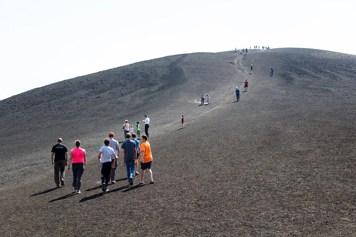
Read the guide
Visitors walking up Inferno Cone at Craters of the Moon National Monument in Idaho
Craters & lavaSouthwest of Arco

Craters of the Moon

Walk black cinder and lava flows from the Robert Limbert Visitor Center.

The lava country southwest of Arco looks like another planet but calls for ordinary good sense: water, sun protection and a plan for the drive back. Start at the Robert Limbert Visitor Center rather than following an improvised shortcut into the preserve. The scenic loop and cave access change with conditions; caves require a permit when open. A few short walks on marked trails can make a fine first visit. Check National Park Service updates before leaving town.

Year-round; seasonal access

Inferno Cone Trail at Craters of the Moon. Image cropped and converted for this guide. · National Park Service · Public domain

Read the guide
Lava fields, an open highway, a mountain reservoir and the Lost River Range, the three landscape changes along the Peaks to Craters Scenic Byway
Scenic drivesCarey, Craters of the Moon, Arco, Moore, Mackay, Willow Creek Summit, Grand View Canyon and Challis, on US-20/26/93 and US-93

Peaks to Craters Scenic Byway

Take the slow road from black lava and sagebrush to the foot of Idaho’s high peaks.

Think of this drive as a string of different landscapes rather than a race between endpoints. North of Arco, the Lost River Valley opens toward high peaks; southwest of town the road passes basalt and cinder at Craters of the Moon. Pick a few stops and leave time for viewpoints instead of trying to do everything at once. Services can be spread out, so take water, check road conditions and fuel up before heading into the valley.

The route itself is a year-round designation; Willow Creek Summit is weather-dependent and most side roads, campgrounds, caves and museums are seasonal

The byway links the volcanic Snake River Plain near Craters of the Moon with Arco, the Lost River Valley, Mackay Reservoir, Mount Borah and Challis.Illustration · not a photograph.

Read the guide

Around Arco

5 guides
Grand Avenue in Arco, Idaho, looking along the town’s main street toward the Butte County courthouse
Arco landmarksButte County, Idaho

Things to do in Arco

Read a hillside yearbook, find a submarine sail and make town your base for the lava fields.

Arco is more than a fuel stop on the way to the lava fields. Read the painted years on Number Hill, look for the USS Hawkbill sail, and make time for the seasonal EBR-I museum if the timing works. A short stop in town can turn into a full day once you look north toward the Lost River Valley. The guide helps you decide what fits in one afternoon and what deserves a separate drive.

Year-round; access varies

Grand Avenue, Arco’s main street, with the class numbers of Number Hill rising behind it. · Chris Light · CC BY-SA 4.0

Read the guide
The EBR-I Atomic Museum reactor building on open high desert in eastern Idaho
Arco landmarksSoutheast of Arco

EBR-I Atomic Museum

See where four lightbulbs made atomic history, then trace Arco’s separate 1955 milestone.

A short history lesson becomes much more tangible inside the experimental reactor building southeast of Arco. EBR-I generated usable electricity from nuclear fission in 1951; the town's later atomic-power milestone is a separate story. The museum has a seasonal visitor schedule, so confirm dates before making the drive. Stay within public museum areas rather than wandering onto the surrounding laboratory property. Pair this stop with Number Hill for two very different chapters of Arco's history.

Memorial Day–Labor Day; verify hours

EBR-I stands along US-20/26 between Arco and Idaho Falls, in the high desert southeast of Arco. This image is an artistic rendering made for this guide.Illustration · not a photograph.

Read the guide
The painted class years on Number Hill in Arco, Idaho
Arco landmarksDowntown Arco

Number Hill

Look up from downtown and the hillside reads like a local yearbook. Arco students have painted graduating years on Number Hill for generations, making the slope one of the easiest landmarks to appreciate without leaving town. Find a lawful public viewpoint rather than climbing toward the numbers or blocking a highway shoulder for a photo. It's a good first stop before a longer outing, or a reason to stretch your legs when you get back to town.

Year-round; the view depends on light and weather

Generations of Butte County High School classes have put their graduation year on the rock above Arco. This image is an artistic rendering made for this guide.Illustration · not a photograph.

Read the guide
A handheld GPS and a small weatherproof cache container beside a carved rubber stamp, ink pad and logbook in high-desert sagebrush
GeocachingArco, Craters of the Moon, the Arco Desert and the Lost River Valley

Geocaching & letterboxing

A small search can make a familiar roadside stop feel new. The map groups geocache and letterbox leads around Arco and the Craters area, but a pin isn't a promise that a container still exists or that access is allowed today. Check the current listing, follow site rules and leave a find as you found it. In protected areas, stay on permitted routes and never disturb natural features. The fun is in looking closely, not crossing a fence to reach a coordinate.

April through October is the practical window; desert routes depend on dry roads and Craters EarthCaches depend on the Loop Road

Two hobbies share one landscape here: coordinates and a container in one hand, a clue and a rubber stamp in the other.Illustration · not a photograph.

Read the guide
An Atomic Days parade scene with a tractor float and barrel racing in Arco, Idaho
Local eventsArco, Idaho: downtown festivities, Bottolfsen Park and the Butte County Rodeo Grounds

Atomic Days

Atomic Days is when Arco's unusual history makes way for a hometown celebration. The parade is the big draw for many visitors, with a wet parade and rodeo among the traditions to look for on the year's program. Don't plan around a date or a headliner from a previous year. Check the current schedule, give yourself time to park and decide whether the rest of the weekend is for lava trails, local history or a slower day in town.

Traditionally the third full weekend in July; the schedule, performers and fireworks are set fresh each year

Illustration of Atomic Days on Grand Avenue. Check the current event schedule and parade-day street closures before you travel.Illustration · not a photograph.

Read the guide

Hiking & mountains

4 guides
Hang gliders riding a ridge above the Lost River Valley near Moore, Idaho
HikingMoore, Idaho

King Mountain gliding & Natural Arch

King Mountain rises above the valley near Moore and attracts experienced hang gliding and paragliding pilots. The mountain launch is distinct from both the gliderport and the Natural Arch trail: pick the right stop before you leave. Spectators should stay clear of flight paths and never assume flying will happen on a particular day. The arch gives walkers a different way to spend the afternoon, provided the approach road and the trail are in good shape.

Late spring through early fall; weather dependent

Hang gliders working lift above the Lost River Valley near Moore. This image is an artistic rendering made for this guide.Illustration · not a photograph.

Read the guide
Editorial illustration of hiking terrain inspired by Idaho’s lava fields and mountain country; not a trail photograph
HikingArco, Idaho

Hiking near Arco

A hike from Arco can mean a short loop over lava or a demanding climb in the Lost River Range. Choose by daylight, elevation and actual trail conditions, not just the length on a screen. Craters of the Moon has marked walks and visitor information; higher mountains call for more preparation. Bring water, know whether the road to your intended start is open and turn around if the day changes. There is plenty to see without forcing a summit.

May to October; winter access changes

Editorial illustration, not a photograph or a navigation reference. Routes around Arco range from paved lava walks to exposed mountain climbs.Illustration · not a photograph.

Read the guide
Editorial illustration of a steep ridge climb in Idaho’s Lost River Range, not a photograph of Mount Borah
HikingLost River Range, Idaho

Mount Borah

Idaho’s high point is a serious climb with exposed scrambling on Chicken Out Ridge.

Idaho's high point is a serious mountain day, not a quick detour from Arco. The standard ascent involves major elevation gain and exposed scrambling at Chicken Out Ridge, where weather and fatigue can turn a manageable plan into a dangerous one. Read a current route guide, check conditions and only go with the preparation and experience the terrain demands. If that isn't your day, the Lost River Range is still spectacular from the valley floor.

Ordinary season starts in early July

The Lost River Range lifts straight out of the valley; Borah is the far end of that wall.Illustration · not a photograph.

Read the guide
A long, low step in sagebrush terrain below the Lost River Range, where the 1983 fault rupture crossed the valley floor
Arco landmarksLost River Valley, Doublespring Pass north of Mackay

Borah Peak earthquake

The Lost River Range tells more than a climbing story. The 1983 Borah Peak earthquake left visible changes in the landscape and a lasting mark on the communities around it. Start with the Earthquake Interpretive Site north of Mackay rather than scrambling cross-country toward a pin. Expect open country, variable roads and limited services away from town. It's a stop that makes sense beside the mountain scenery, whether or not you're planning a hike.

Listed May 1 through September 30, decided by road conditions

The 1983 rupture reads as a step across the ground at the base of the Lost River Range, not as an open chasm.Illustration · not a photograph.

Read the guide

Water & hot springs

3 guides
Steaming high-desert hot spring pool beside a creek in Idaho
Hot springsCarey, Idaho

Wild Rose Hot Springs

Wild Rose is a primitive high-desert soak near Carey. Visitors have historically used the spring, but access is not guaranteed. Obey current signs, gates and property-owner requests; leave it cleaner than you found it. There are no developed facilities to count on: no changing room, no lifeguard and no maintained pathway, and water temperature and footing shift with the season and the creek. Bring drinking water, sturdy footwear and a way to carry every bit of trash back out, and test the water before you get in. It works best as part of a Carey–Craters–Arco drive, not as a quick outing from downtown.

Any season; access and conditions vary

The scene is an artistic rendering of the high-desert setting around the pools near Carey.Illustration · not a photograph.

Read the guide
Editorial illustration of a steaming hot spring in an Idaho-inspired landscape; not a specific spring
Hot springsIdaho statewide

Idaho hot springs

Not every pin on a hot-springs map is an afternoon from Arco. Some pools are far across the state, and the experience ranges from developed resorts to rough creekside water. Choose a trip by drive time, land access and facilities rather than temperature alone. Test natural water before entering, carry supplies and respect any closure or private-property notice. Use the guide to compare options, then verify local conditions and plan a sober drive home.

Year-round where access allows; roads and facilities vary

Editorial illustration, not a photograph or a depiction of a particular spring. Idaho’s soaking areas span distinct road-trip corridors.Illustration · not a photograph.

Read the guide
Editorial illustration of fly fishing on a mountain stream and shore fishing at a reservoir near Arco
FishingLost River Valley, Idaho

Fishing near Arco

From the Big Lost River near town to the water around Mackay Reservoir, fishing here can fill a morning or take the whole day. Flows, access and rules matter more than an old report about where fish were biting. Check current Idaho Fish and Game regulations and site-specific restrictions before casting. The map includes much farther-flung Idaho waters, too. Compare the drives first, and make sure you know how to reach the river without crossing private land.

Fishing seasons and harvest rules vary by water; ice fishing only when conditions are safe

Editorial illustration, not a photograph of a specific access site: the Big Lost River and Mackay Reservoir offer different fishing conditions.Illustration · not a photograph.

Read the guide

Off-road & public land

4 guides
Editorial illustration of mule deer, elk and pronghorn in representative Idaho landscapes
HuntingButte and Custer Counties, Idaho

Hunting near Arco

Hunting plans begin with the right unit, season, license and lawful access, not a dot in the middle of a polygon. The map's unit markers are regional references, never boundary surveys or directions onto private land. Confirm current Idaho Fish and Game maps, tags and rules before traveling, and account for changing weather and road access. Arco makes a practical meeting place for the Lost River country. Secure equipment and game before heading back into town.

Species-specific; set annually by Idaho Fish and Game

Editorial illustration, not a wildlife-location map: mule deer, elk and pronghorn hunting opportunities depend on the unit, tag and season.Illustration · not a photograph.

Read the guide
Graded gravel switchbacks of the Mine Hill road climbing toward Mount McCaleb above Mackay, Idaho
ATV & UTVLost River Valley and Salmon-Challis National Forest

ATV & UTV routes

Open country around Arco invites a ride, but a line on this map is not permission to ride it. The OHV pins are approximate first waypoints, not verified trailheads or approved tracks. Check current land-manager travel maps, vehicle requirements and closures before unloading. Stay on designated routes and steer clear of protected areas where motorized off-road travel is not allowed. Build in fuel, water and time to get back before the light goes.

Mostly late spring through fall; dependent on snow, mud and fire closures

The Mine Hill road above Mackay: switchbacks used by high-clearance vehicles and the annual Mackay Mine Hill tour. · BLMIdaho · Public domain

Read the guide
The Mackay Mine Hill and White Knob mining district above the town
Mining historyWhite Knob Mining District above Mackay, Idaho

Mackay Mine Hill

Follow Mackay’s mining history on established routes through the White Knob country.

The old mining landscape above Mackay invites curiosity, but it isn't an open playground. Use established public routes and a current local map; mine openings, unstable structures and changing road conditions are real hazards. A self-guided outing works best when you know which stops are accessible and leave the historic remains as you found them. Mackay fits naturally into a longer Lost River Valley drive from Arco. Leave time for the trip back instead of squeezing in one more spur.

Late spring through late fall, subject to snow, mud, fire and mining closures

The White Knob district above Mackay: an early copper camp whose workings are still active on some claims.Illustration · not a photograph.

Read the guide
Banded agate and chalcedony hand specimens laid out beside a geologic map, a rock hammer and a hand lens
RockhoundingArco and the Arco Hills, the Arco Desert, the Big Lost River corridor, Mackay and the White Knob Mining District, and the Challis country to the north

Rockhounding near Arco

The geology around Arco rewards curiosity, but permission to look isn't permission to collect. Research the managing agency, claim status and land ownership for a specific area before taking anything; national monument resources should be left in place. A field guide and current public-land map are more useful than a pin alone. The guide helps separate places to study the landscape from places where collecting might be legal. A good day can be about noticing rocks rather than filling a bucket.

April through early November; spring and fall are the practical windows, summer brings heat and fire risk, winter is a season for sorting and research

Arco works as a base for exploring the varied geology of Butte and Custer counties, from high-desert chalcedony to historic mining minerals.Illustration · not a photograph.

Read the guide

Night & seasonal outings

3 guides
Chairs and a telescope set up on a parking area below the Milky Way over dark basalt lava near Arco
StargazingCraters of the Moon National Monument and Preserve, Butte County

Stargazing near Arco

The open sky is a reason to stay out after sunset, provided the trip back is part of the plan. Choose a legal, safe place to park, check weather and moonlight, and bring warm layers even when the afternoon felt hot. Park rules and nighttime access may differ from daytime hours; never drive beyond a closure looking for darkness. A red light and a little patience do more for the view than rushing to another pin.

Late spring through fall is easiest; winter skies are excellent but the Loop Road closes to vehicles

On a clear, moonless night the lava foreground goes almost black and the Milky Way is visible to the naked eye.Illustration · not a photograph.

Read the guide
RVs parked in a paved campground, a tent on black lava and a lakeside campsite below the Lost River Range
CampingArco, Craters of the Moon, Mackay Reservoir and the Copper Basin district of the Salmon-Challis National Forest

Camping & RV parks

An overnight base changes what is possible around Arco: a longer lava visit, an early trail start or a slower drive through the valley. Compare established campgrounds and RV facilities by actual opening dates, amenities and distance from your route. Some stops make sense for tents, others for rigs that need hookups. Don't assume a map pin means dispersed camping is allowed. Bring water and allow for cold nights and changing weather even when the days are warm.

Most sites run late May or June through September or early October; Arco RV parks and Joe T. Fallini operate into the colder months

Camping near Arco ranges from town RV parks and lava-field tent sites to reservoir hookups and remote Forest Service campgrounds.Illustration · not a photograph.

Read the guide
A cross-country skier crossing snow-covered black lava between frosted pines on a clear winter day near Arco, Idaho
WinterCraters of the Moon, Mackay Reservoir and the Lost River Region

Winter around Arco

Winter changes the map more than any filter can. A road open in summer may be snowed in, and a short walk can demand different gear once the temperature drops. Look for current road, snow and ice information before planning an outing. Town landmarks remain an option when more remote plans fall through. Arco's quieter season is worth enjoying at its own pace: leave room for a warm indoor stop and a safe trip home.

December through March, decided by snow, ice and road conditions rather than by calendar

Winter at Craters of the Moon: the loop road closes to vehicles and becomes a route for ski and snowshoe travel once the snow holds.Illustration · not a photograph.

Read the guide

Road trips & lava country

2 guides
Visitors walking up Inferno Cone at Craters of the Moon National Monument in Idaho
Craters & lavaSouthwest of Arco

Craters of the Moon

Walk black cinder and lava flows from the Robert Limbert Visitor Center.

The lava country southwest of Arco looks like another planet but calls for ordinary good sense: water, sun protection and a plan for the drive back. Start at the Robert Limbert Visitor Center rather than following an improvised shortcut into the preserve. The scenic loop and cave access change with conditions; caves require a permit when open. A few short walks on marked trails can make a fine first visit. Check National Park Service updates before leaving town.

Year-round; seasonal access

Inferno Cone Trail at Craters of the Moon. Image cropped and converted for this guide. · National Park Service · Public domain

Read the guide
Lava fields, an open highway, a mountain reservoir and the Lost River Range, the three landscape changes along the Peaks to Craters Scenic Byway
Scenic drivesCarey, Craters of the Moon, Arco, Moore, Mackay, Willow Creek Summit, Grand View Canyon and Challis, on US-20/26/93 and US-93

Peaks to Craters Scenic Byway

Take the slow road from black lava and sagebrush to the foot of Idaho’s high peaks.

Think of this drive as a string of different landscapes rather than a race between endpoints. North of Arco, the Lost River Valley opens toward high peaks; southwest of town the road passes basalt and cinder at Craters of the Moon. Pick a few stops and leave time for viewpoints instead of trying to do everything at once. Services can be spread out, so take water, check road conditions and fuel up before heading into the valley.

The route itself is a year-round designation; Willow Creek Summit is weather-dependent and most side roads, campgrounds, caves and museums are seasonal

The byway links the volcanic Snake River Plain near Craters of the Moon with Arco, the Lost River Valley, Mackay Reservoir, Mount Borah and Challis.Illustration · not a photograph.

Read the guide

Same town, four different maps

Season by season

The valley does not run on a single itinerary. Road openings, water levels, hunting pressure and museum schedules all move with the calendar, so pick the stretch you are actually visiting.

Spring

April to early June

Snow comes off the valley floor first and the higher roads last. River water runs high, the cinder walks are mud-free and shoulder season means room to park at the trailheads.

Home base

Back from the lava: Club Sawtooth, 156 W Grand Ave

Every outing on this map starts or ends in the same few blocks of downtown Arco. The Club is where the trip reports get traded over a cold one: four electronic dartboards with Remote Play and compatible tournaments, pool, foosball, the AMI jukebox, Mortal Kombat 4, karaoke and live music. Meet up before the trip, pick up sealed beer or wine to go under the Club’s current license where appropriate, and come back after the driving is done.

Dogs are welcome inside and smoking is allowed inside. Ask staff where to leave a vehicle overnight; there are no hookups or campground services here. Arrange a ride instead of driving after drinking, especially on unlit county roads.

Know before you go

  • Cell service drops out in the crater preserve and much of the valley. Download directions before leaving town.
  • Fuel and water are scarce west of Arco. Fill up and top off before the loop road.
  • Summer heat on black cinder is brutal before sunset; winter closures arrive without warning. Check the land manager, not a cached map.
  • Several mapped spots are on private or claimed land. A pin is never permission to enter.

Distances on this page are straight-line estimates from the Club, not driving distances or times.

Asked at the bar

Questions visitors actually ask

What are the best things to do near Arco?

Start with Craters of the Moon, Number Hill and the seasonal EBR-I Atomic Museum. Add a hike, a fishing stop or a scenic drive in the Lost River Valley if conditions and time allow.

How far is Craters of the Moon from Arco?

The main visitor entrance is about 18 miles southwest of Arco on US-20/26/93. Start at the Robert Limbert Visitor Center and check the National Park Service for current access.

What can I do in winter?

View Number Hill from town, check conditions for winter outings at Craters of the Moon, or warm up with darts and pool at Club Sawtooth. Expect seasonal road and trail closures.

Where can I camp near Arco?

Compare established campgrounds and RV parks in Arco and the Lost River Valley. Confirm opening dates, amenities and land-manager rules before relying on a site or planning to camp on public land.

Are there ATV trails near Arco?

The Lost River Valley has designated riding routes. The map's OHV waypoints are approximate; verify approved routes, width limits and closures with the land manager before unloading.

Can I fish the Big Lost River?

It's a local fishing destination. Check the current Idaho Fish and Game regulations, river flows, species restrictions and legal public access for the stretch you want to fish.

Where are the nearest hot springs?

Wild Rose near Carey is the closest regional option. Visitors have historically used the spring, but access is not guaranteed. Obey current signs, gates and property-owner requests; leave it cleaner than you found it. It is a primitive soak with no developed facilities, so test natural water before entering, carry out your trash and check road and weather conditions before going.

What can I do at Club Sawtooth?

Stop at 156 W Grand Ave after your outing for Remote Play darts, pool, the AMI jukebox and drinks. Check the Club's events page for what's on.

Are dogs allowed inside? Is smoking allowed?

Dogs are welcome inside and cigarette smoking is allowed inside Club Sawtooth.

Can I leave a vehicle overnight?

Ask Club Sawtooth staff where to leave a vehicle overnight. There are no campground services or hookups. Arrange a sober ride instead of driving after drinking.

Rules, seasons, hours and access change. Before relying on anything here, confirm with the managing agency or business: the National Park Service for Craters of the Moon, Idaho Fish and Game for hunting and fishing, the county or forest for road status, and the venue itself for events and museum days.