Grand Avenue Field Notes
Number Hill in Arco: the painted graduation years, and how to see them right
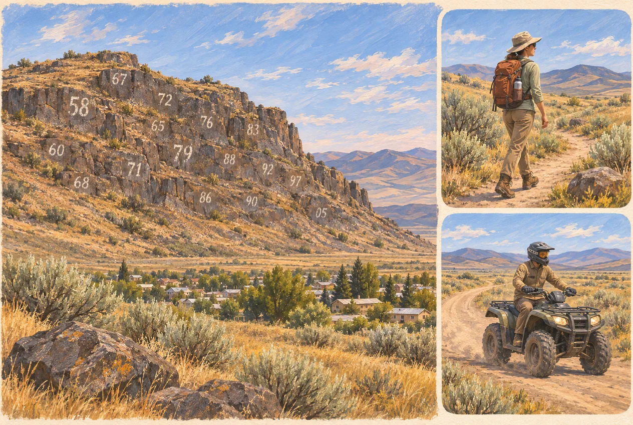
Number Hill is the landmark that makes people slow down and ask a question they cannot quite phrase: why are there enormous white numbers on the rock above Arco? They are graduation years. Since the Butte County High School class of 1920, each class has put its year on the cliff, and the accumulated dates have turned an ordinary hillside into a town yearbook you can read from the street. Three things are worth knowing before you go looking. The hill is a community tradition, not a developed attraction with a parking area and a sign. The best view is from town with a zoom, not from the base of the cliff. And the hiking and riding that people naturally want to add to the stop belong on routes whose ownership and permitted use you confirm first — the hillside itself is not one of them.
Jump to trip essentials- Region
- Downtown Arco
- Season
- Year-round; the view depends on light and weather
- Category
- Arco landmarks
Before you go
- Painted graduation years, a Butte County High School tradition dated to the class of 1920.
- View it from a lawful public place in town with a zoom; morning or late-afternoon light reads best.
- No verified trailhead, official hiking trail or designated ATV route on the hill itself.
- Never paint, retrace or add to the cliff — the tradition belongs to Arco, not to visitors.
- A 15 to 30 minute stop that works best inside a bigger Arco day.
- Check the BLM and NPS travel map, then the signs on the ground, before riding or hiking anywhere nearby.
Approximate landmark
Approximate hillside location above Arco in the Lost River Valley. This marks the landmark only — it is not a trailhead, a public parking area or an ATV staging point.
View on OpenStreetMapNumber Hill at a glance
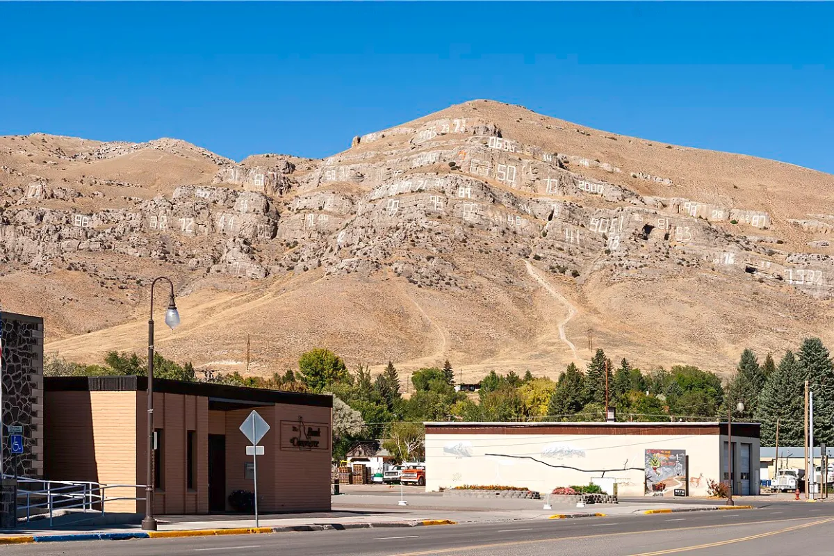
What it is: a rocky hillside above Arco in Butte County, covered with large painted numbers that are graduating class years. Who made it: generations of Butte County High School classes, a tradition commonly dated to the class of 1920. Best way to experience it: find a lawful public place in town with an unobstructed view, and use a camera or phone with optical zoom.
What it is not: a developed visitor site, a park, a hiking destination or an ATV area. No maintained trailhead, no formally designated hiking route and no designated motorized route on the hill has been verified in the authoritative sources available to us, and there are no verified visitor facilities on the slope. The primary hazards are ordinary for high-desert country and easy to underestimate: steep rock, unstable footing, falling stone, heat and exposure, fast weather, uncertain property lines and motorized traffic on routes you may be sharing.
As a stop it is brief — fifteen to thirty minutes is honest — and as a story it is unusually good value. It is the shortest way to understand that Arco is a town with a century of its own, not just a gas stop on the way to Craters of the Moon.
Why the hill above Arco is covered in numbers
Each number is a graduating class year. The practice is generally traced to the Butte County High School class of 1920; the classes that followed added their own years and kept the earlier ones legible, so the cliff became a running timeline instead of a single monument. Local reporting has kept the origin alive for decades, and the tradition has been renewed by each class since.
That detail is what separates Number Hill from an ordinary painted landmark. A monument is designed and installed in one go; this hill accumulated. Every date is one more class deciding to add a line to something already in progress, which is why the result reads as continuity rather than decoration. To a traveller the numbers look abstract. To a longtime Arco family they may mark a parent, a grandparent or the year somebody walked across that stage.
The useful way to think about it is as an outdoor community yearbook that records time by class year instead of by names and photographs. Once you see it that way, the hill stops being a curiosity and starts being a record.
A century of dates, readable in one look
Because the tradition started in 1920, the numbers have overlooked everything Arco has been through since. With a bit of imagination you can pick out stretches of the hillside that correspond to the Depression years, the classes that graduated during the Second World War, the arrival of the National Reactor Testing Station nearby, the nuclear experiments of the 1950s, and the growth of visitors coming for Craters of the Moon. Recent classes are adding years alongside great-great-grandparents’ dates on the same rock.
The dates do not explain what happened to any individual class, and we would not pretend they do. What they give you is a frame: a visible way to ask how different this valley looked when the number going up was 1934 rather than this year. That question is a good lead-in to the town itself, and to the EBR-I Atomic Museum an easy drive away.
One caution about the stories behind specific years. They belong to the people who lived them, and the hill is a community possession rather than an open surface. Treat it as a tradition you are allowed to look at.
The one thing not to do: add your own number
The painted years carry an established local meaning, and none of that meaning transfers to a visitor with a can of spray paint. It should not be read as permission to leave a mark. Do not paint a new number, trace or modify an existing year, add a name or a hometown, leave stickers, flags or memorial objects, use chalk, chip or move rock, or take anything off the hillside.
This is not fussiness. A local tradition that has survived a century is fragile in a specific way: it can be damaged as much by imitation as by vandalism, because copying the most visible feature of the tradition without any part of the community process behind it turns a record into a mess of noise. Plenty of landmark cliffs in the West have gone from meaningful to defaced exactly that way.
If a class year needs refreshing, that is a decision for the school, the community and whoever manages the land — not for a visitor with good intentions. Photograph the hill and leave it alone.
Where Number Hill is, and how to see it well
Number Hill rises above Arco in Butte County, and the painted face is visible from parts of town and from the roads around it. The map pin on this page marks the hillside only. We have deliberately not pinned a trailhead, a parking spot or an access point, because a digital pin creates a false sense of certainty: a dot dropped on a slope can send a driver up a private driveway, onto an undeveloped track, or into a shoulder with no room to stop.
For most visitors the best experience is to find a lawful public spot in Arco with a clear sightline and work the hill from there with binoculars, a camera, or a phone with optical zoom. A moderate zoom lens will produce a better photograph than standing at the base of the cliff, and the hill is large enough that distance is not a problem.
A good viewing spot meets all of these conditions before you get out of the car: parking is legal, the vehicle is fully out of the travel lane, no driveway, gate or emergency access is blocked, you are not standing on a highway shoulder, you do not need to cross anyone’s property, you have the view without climbing an embankment, and children and pets can be kept clear of traffic.
And do not stop the moment the numbers come into view. Keep driving to a place that is actually safe to stop, park, then look. Morning or late-afternoon light gives the most contrast between the white numerals and the darker rock, which matters if you want the dates to be readable in the photo rather than a bright smear.

Is there a trail up Number Hill?
We could not verify an officially maintained trailhead or a formally designated hiking route called the Number Hill Trail in the sources available to us. The accurate description is that primitive routes may exist in the wider area, but no track leading toward the hill should be assumed to be a public trail or to cross land that is open to recreation.
It is worth understanding why a visible route is not evidence. A worn line on the ground can be a private access road, a ranch or utility track, a motorized route, an administrative road, a path made by repeated unauthorised use, a route that crosses several different landowners, something under a seasonal restriction, or a route that simply ends at bad rock. Mapping applications are worse than useless here: they happily preserve obsolete tracks, private roads and informal shortcuts long after ownership or conditions changed.
Before walking anything in this area, get answers to a short list: who manages the land, whether public access is authorised, whether the route is open to foot travel, where legal parking actually is, whether seasonal closures are in effect, whether the route enters private land, and whether motorized vehicles share it. If those questions cannot be answered, enjoy Number Hill from town and pick a documented trail elsewhere around Arco, where there are plenty.
Hiking safety in the country around Arco
High-desert terrain around Arco looks open and uncomplicated from the road, and that appearance is the trap. Loose and unstable rock is the first hazard: slopes hold material that shifts underfoot, the person above you can send stone down, and a short slide on fractured volcanic rock is enough to cause serious cuts or a lower-leg injury. Do not climb directly below another person, and stay out of steep gullies and the base of cliffs where rockfall lands.
Exposure is the second. An exposed hillside offers almost no shade, so carry water even for a short walk, and turn around before you have used half of what you brought — particularly in summer, when the heat is the whole story. Weather is the third: open country exposes you to wind, lightning, cold rain and sharp temperature drops, and a clear view of the sky is not the same as no weather risk. If thunderstorms are building, get off exposed high ground, and do not shelter under an isolated tree or a rock overhang that looks unstable.
Wildlife is the fourth and the most avoidable. Watch where hands and feet go around warm rocks, brush and narrow gaps, do not reach into anywhere you cannot see, and give everything you meet space — never corner, handle or provoke a snake for a photograph.
Two habits tie the rest together. Do not rely on your phone for navigation or for calling for help: download maps before leaving town, tell someone where you are going and set a return time. And treat any quiet dirt track as shared: stay alert for engine noise, keep both ears free rather than plugged, step fully off the travel surface when a vehicle comes, avoid standing on the outside edge of a steep route, make yourself visible at blind corners, and keep children and animals under immediate control.
ATV riding near Arco: what is verified and what is not
Motorized recreation is a normal part of life on the public land around Arco, and Idaho has an enormous amount of it. That does not make every dirt track rideable, and it very much does not make Number Hill an ATV area — we could not verify any officially designated motorized route on or at the hill, so this page does not advertise Number Hill ATV trails, because doing so would imply that registration, public access and route designation had been confirmed when they have not.
The accurate way to put it: Arco sits in high-desert country where motorized use may be available on designated roads and routes, and you confirm the managing agency and the current route designation before you ride. The Number Hill pin on this page is a view of a landmark, not a staging area.
Being precise about this protects you as much as it protects the hill. Vague language is how riders end up on private land or on a route closed to motorized use, and it is also how a town ends up closing the routes that visitors keep abusing.
How to check a route before you unload
Start with the managing agency rather than with the track. Land around Arco can mix Bureau of Land Management property, state land, county roads, municipal property, private parcels, National Park Service land to the south, and areas with special management restrictions. Rules change at the boundary even where the terrain looks identical on both sides.
Then use official travel-management information rather than a general map. The BLM and National Park Service travel map for the Craters of the Moon region separates roads, primitive roads, nonmotorized trails, administrative routes and the various ownership categories, and its own legend is instructive: a primitive road is a route managed for four-wheel-drive or high-clearance vehicles that does not normally meet road standards, while the designated trails shown on that map are nonmotorized. A road open to motor vehicles is not a trail, and an administrative route is not public recreational access. Do not apply one general rule to everything near Arco.
Then believe the ground rather than the file. Map data goes stale; posted closures, gates and current agency notices control. If a route is unsigned and you cannot confirm its status, do not assume it is open. And a route that begins on public land can cross a private parcel further along — public ownership at the start of a ride guarantees nothing about the middle of it.
Turn around at private-property signs, closed gates, no-trespassing notices, administrative-use signs, seasonal closure notices, barriers protecting restoration areas, and any route visibly being reclaimed by the land. Do not create a bypass around a gate or a closure; that single act is the most reliable way to lose the access everyone else depends on.
Riding safety, and keeping vehicles off the painted rock
High-desert terrain produces high-consequence crashes at modest speeds, because dust, embedded rock, washouts and oncoming vehicles are all hidden by the land itself. Wear complete protection: a DOT-compliant helmet, eye protection or goggles, gloves, long sleeves, long trousers and over-the-ankle boots. BLM safety guidance recommends protective helmets and compliance with registration, equipment and route requirements, and treats spark arresters, compliant mufflers and tall visibility flags as requirements or best practices depending on the vehicle and the area — check the specific rules for where you are actually riding.
Slow down before anything you cannot see over or around: hill crests, blind curves, drainage crossings, narrow cuts, intersections, heavy brush, trailheads, parking areas, and anywhere the route is shared with hikers, horses or livestock. A rider approaching a crest cannot assume the far side is clear, and most of the collisions in country like this happen exactly there.
Do not ride impaired — alcohol, cannabis and impairing medication all blunt reaction time and terrain judgment at the same time. Finish the ride, load and secure the vehicle, get back to Arco and park before the first drink. Carry a real kit: water, first-aid supplies, offline maps, tire repair material, a compact air compressor, basic tools, a tow strap, a communication device, a light, weather-appropriate clothing, a fire extinguisher where appropriate, emergency food and vehicle-specific spares. Tell someone the route and the return time, because a route a few miles from town can become a long walk after one mechanical failure. Ride with a second vehicle if you can; if you cannot, choose a conservative documented route, carry satellite communication, and do not extend the plan you shared.
None of that makes the painted cliff a destination. Do not climb the painted face, hill-climb beneath the numbers, cut new bypasses or switchbacks, spin tires on vegetation, park against the painted rock, drive off-route for a photograph, disturb signs, fences or gates, or ride through residential property to reach the hill. Motorized access comes from the designation of a specific route, not from whether your vehicle is physically capable of getting there.
Number Hill and the other thing Arco is famous for
The hill records local history through class years. Arco’s other historical identity is nuclear energy, and the two are often compressed into one sentence with one of them wrong. Keep them apart and you will be more useful than most of what you read online. In December 1951, Experimental Breeder Reactor-I became the first power plant to produce usable electricity through nuclear fission — the first output lit four 200-watt lightbulbs, and the reactor soon produced enough to power its own facility. In 1955, the BORAX-III reactor generated enough electricity to power the town, which is why Arco calls itself the first town lit by atomic power.
EBR-I Atomic Museum is the place to stand in the building where the 1951 work happened, on US-20/26 between Arco and Idaho Falls. It is free and seasonal; Idaho National Laboratory’s published 2026 season opened May 22 with daily hours of 9 a.m. to 5 p.m. Check the current schedule before driving out, because opening dates and hours change year to year.
Craters of the Moon is the other natural addition, with the main visitor area about 18 miles southwest of Arco on US-20/26/93 and a seven-mile Loop Road of trails, caves and overlooks. Note what these three places are not to each other: Number Hill is a community landmark above town, shaped by graduating classes; Craters of the Moon is a federally managed volcanic landscape; EBR-I is a National Historic Landmark about nuclear-energy development. Number Hill is not part of Craters of the Moon, and describing it that way misleads people about both.
A half-day that makes the stop worth the detour
Late morning, see the hill. Start in downtown Arco, find a safe public vantage, and work the years with a zoom rather than trying to get to the rock. Allow twenty to thirty minutes.
Midday, take in the town. Walk Arco and look for the interpretation connected to the town’s development, the Lost River Valley and the nuclear legacy. Half an hour to an hour, depending on how long you linger and how many conversations you end up in.
Afternoon, choose one bigger thing rather than three rushed ones: EBR-I while it is open, a drive to Craters of the Moon, a hike on a verified public trail, or a ride on a motorized route confirmed open on public land. Do not improvise access onto Number Hill because a map app shows a line.
Evening, get all the driving and riding finished first. Park, unload and secure the ATV or the bikes, then walk. Number Hill is a short stop physically and a substantial one as a story; it works best as one part of a broader Arco day rather than the whole of it.
Finish the day where the locals can explain the years
A photograph of Number Hill tells you what the hill looks like. Somebody who graduated from Butte High tells you what it meant, which is the part worth collecting. Club Sawtooth is at 156 W Grand Avenue in Arco, open daily from 2 p.m. to 2 a.m., with four electronic dartboards with Remote Play, pool tables, foosball, an AMI jukebox, a Mortal Kombat 4 cabinet and occasional karaoke or live music. Ask which painted year means the most to whoever is next to you at the bar.
The order matters more than it sounds: ride or hike first, finish the drive, park, then have a drink. The hill is visible from town, so it fits just as easily before you head out as after you come back — and it is the kind of stop that survives a cancelled plan on the highway, which is worth something in this part of Idaho.
Frequently asked questions
What is Number Hill in Arco, Idaho?
It is a rocky hillside above Arco covered with large painted numbers, each one a graduating class year from Butte County High School. Together the dates form a visible record of the town’s school history, which is why locals treat the hill as a community landmark rather than a curiosity.
Why are graduation years painted on the hill?
The tradition is commonly traced to the Butte County High School class of 1920. Classes that followed added their own years and kept earlier ones visible, so the cliff accumulated into a timeline. It is best understood as an outdoor community yearbook that records years instead of names.
How old is the Number Hill tradition?
The documented starting point is 1920, so the tradition now runs past a century. The numbers have overlooked the Depression, the Second World War, the arrival of the nearby reactor site, the nuclear experiments of the 1950s and the growth of Craters of the Moon tourism.
Can you hike up Number Hill?
There is no verified maintained visitor trail or official trailhead in the sources available to us. Primitive tracks may exist in the area, but a visible route is not proof of public access — check land ownership, allowed uses, parking and any seasonal closures before walking in. The safest option is to view the landmark from a lawful public place in Arco and choose a documented trail elsewhere.
Can you ride an ATV on Number Hill?
Do not assume the hill is an ATV area. We could not verify any officially designated Number Hill ATV route, so keep motorized use to routes that an applicable agency, landowner and current on-site signage confirm are open. And even where riding is legal nearby, the painted cliff is not a riding destination: no climbing the face, no hill-climbing beneath the numbers, no new bypasses.
Are there ATV routes near Arco?
Arco sits in high-desert country with a lot of BLM-managed public land where motorized recreation is common, but routes carry different designations and restrictions. Use the official BLM and National Park Service travel map for the Craters of the Moon region, confirm the managing agency, observe posted signs and closures, follow Idaho’s requirements for your vehicle, and expect private parcels in the middle of otherwise public routes.
Is Number Hill part of Craters of the Moon?
No. Number Hill is a community landmark above Arco with its own history. Craters of the Moon National Monument and Preserve is a separately managed volcanic landscape southwest of town, with its main visitor area about 18 miles away on US-20/26/93. The two are neighbours, not the same attraction.
Can visitors paint their own number on the hill?
No. The years are an established graduating-class tradition maintained by the community. Visitors should not add, modify, retrace or repaint numbers, leave stickers or memorials, or remove rock. If a year needs maintenance, that is for the school, the community and whoever manages the land to decide.
Do I need a permit to visit Number Hill?
There is nothing to book in order to look at the hill from a public place in Arco, which is the recommended way to see it. Going onto the slope is a different matter — that turns on who owns and manages the land and whether access is allowed there, which is exactly the part we could not verify. Treat the hillside as someone’s land, not as a public park with a permit counter.
How long does the Number Hill stop take?
Fifteen to thirty minutes is enough to find a safe vantage, pick out the different years, take photographs and place the tradition in Arco’s history. Add time if you combine it with a walk through town or another attraction.
What is the difference between Arco’s 1955 milestone and EBR-I’s 1951 one?
In December 1951, EBR-I became the first power plant to produce usable electricity from nuclear fission, starting with four 200-watt bulbs. In 1955, the BORAX-III reactor generated enough electricity to power the town of Arco. Related, but separate events — and EBR-I Atomic Museum is about the 1951 one.
Sources and updates
Check current access, hours and conditions before setting out.