Grand Avenue Field Notes
Rockhounding near Arco: the Arco Hills, Big Lost River gravels and Mackay mining minerals
Arco sits on a geological seam. South and west of town, basalt lava and volcanic sediment of the Snake River Plain spread out toward the craters. North and northwest, the country changes character entirely: sedimentary formations, older volcanic units, mountain gravels and mineralised districts run up the Lost River Valley through Mackay toward Challis and the Salmon River. That is what makes this a rockhounding town rather than a town with one famous pit behind it. There is no single guaranteed collecting hole immediately outside Arco, and any guide that promises one is selling you somebody else’s rumour. What there is, is a set of genuinely different environments within a half-day drive, each with its own likely material and its own rules: chalcedony, banded agate, jasper and common marine fossils in the Arco Hills and Horsethief Canyon country; quartz and chalcedony in Big Lost River and Antelope Creek gravels; and the copper, lead, zinc, silver and skarn minerals of the White Knob Mining District above Mackay, which is the most interesting and the most legally complicated ground on this list. The work that separates a good day from a wasted one is not swinging a hammer, it is the half hour with a land-status map and the federal mineral-claims database before you leave. Most of the disappointment in this country comes from driving to a promising wash and finding a claim corner, a gate or a fence. This guide covers how to check, what the Bureau of Land Management actually permits and at what limits, which areas are absolutely closed, what you are likely to be holding when you pick a rock up, and how to plan trips that end with a bucket of questionable specimens and an argument about them under bar lights.
Jump to trip essentials- Region
- Arco and the Arco Hills, the Arco Desert, the Big Lost River corridor, Mackay and the White Knob Mining District, and the Challis country to the north
- Season
- April through early November; spring and fall are the practical windows, summer brings heat and fire risk, winter is a season for sorting and research
- Category
- Rockhounding
Before you go
- Treat Arco as a base for several different geological regions, not as one collecting pit: the Arco Hills and Horsethief Canyon, the Arco Desert, the Big Lost River corridor, Antelope Creek, Mackay and Challis are five separate outings.
- Check land status and mining claims before you go. BLM surface ownership does not mean the minerals are open: an active claim can sit on top of public land.
- Casual BLM collection is hand tools, minor disturbance, personal and noncommercial. The 25-pounds-plus-one-piece daily limit is for petrified wood, not for every rock you pick up.
- Common invertebrate fossils such as horn coral may be collected up to 25 pounds per person per day from eligible BLM land. Vertebrate fossils may not be collected at all without a research permit.
- Craters of the Moon is observation only: no lava, no cinders, no crystals, no fossils, no cave material. Developed campgrounds, picnic areas and interpretive sites are off limits for collection too.
- Never enter an abandoned mine. Bad air, open shafts, rotten timber, contaminated water and no rescue access. There is no specimen worth that risk.
No public destination pin
Searching starts from Arco: the Arco Hills and Horsethief Canyon country to the west and northwest, high desert to the north, the Big Lost River corridor and Mackay about 21 miles north on US-93, and Challis about 60 miles north.
Why Arco works: four geological neighbourhoods in one tank of fuel
Most rockhounding destinations in the Intermountain West are one thing. A single formation, a single mineral, a single wash that everyone works. Arco is a crossroads instead, which is either inconvenient or excellent depending on how you plan. South and west of town is Snake River Plain volcanism: basalt, cinder, volcaniclastic sediment and the lava field you can walk at Craters of the Moon, which is precisely where you may not collect anything. Immediately north, the Lost River Valley pulls mountain geology down to Arco’s elevation: limestone and other sedimentary units that carry the marine fossils, gravels that carry whatever their source hills contain, and mineralised intrusions around Mackay. Continue north over Willow Creek Summit and the Challis region adds Eocene volcanic rocks, intrusive bodies, hydrothermal systems and its own mining districts.
So the honest framing is that Arco is a base camp for four or five distinct collecting environments, each a separate trip: the Arco Hills and Horsethief Canyon country for chalcedony, agate and horn coral; the broad Arco Desert for volcanic material, gravels and float; the Big Lost River and Antelope Creek corridors for water-worn quartz and chalcedony; the White Knob Mining District above Mackay for copper carbonates, sulfides, garnet, fluorite and skarn minerals; and the Challis, Lime Creek and Willow Creek country for agate, jasper, silicified material and opalised wood. Distances are short by Idaho standards, which is exactly why people get sloppy about land status here: everything looks reachable, and much of it is somebody’s.
One more thing worth saying plainly. Regional collector reports, old field guides and decades of mine records tell you what has been found. They do not tell you whether you may take it, and they are not a map of permission. A specimen being geologically plausible in an area and a specimen being legally collectible there are two separate research questions, and this guide tries to keep them apart in every section that follows.
Start with the map: land status, claims and a six-step check
Rockhounding in this country begins with three questions asked in this order. Who owns the surface? Who owns the minerals? Is anything closed, claimed or restricted? A public dirt road means the road exists; it does not mean the ground beside it is open. Some of the ground around Arco is Bureau of Land Management, some is state land, a great deal is private ranch, some is National Park Service, some is controlled Idaho National Laboratory property, some is Forest Service as you climb into the Lost River and Boulder ranges, and BLM ground can still be blanketed by active mineral claims.
A repeatable workflow beats remembering a name from a forum. Step one, identify the parcel on an official surface-ownership or township-and-range map rather than a recreational app: the county parcel layer and a commercial map such as OnX or Gaia are useful secondary layers, and the relevant BLM field office publishes the ownership map you actually want. Step two, search the federal Mineral and Land Records System for active lode claims, placer claims and mill sites at that location, and read the claim boundaries rather than just the count. Step three, overlay claims against your access route, because a legal route can dead-end inside a claim and an inviting parcel can be entirely claimed even where the surface is public. Step four, read the ground when you arrive: claim monuments, posted notices, fresh monuments at a corner, fences, gates, active equipment, fresh workings and closure signs all outrank anything you read at home. Step five, if the answer is not clear, call the field office before you dig: for this area that is likely the BLM Upper Snake Field Office for Arco-side ground and the Challis or Salmon offices to the north, and BLM’s Idaho guidance explicitly recommends using agency ownership maps before collecting. Step six, save everything offline before you leave cell coverage: the ownership map, the claim search results, your route, and a note of turnaround times.
[!WARNING] Do not publish or share exact coordinates for a productive spot that sits on or beside a claim, inside a sensitive area, or on ground whose status you have not personally verified. Posting a coordinate is how a good area gets destroyed, fenced, posted or closed to everyone.
Road status is a fourth question that trips people up. A road that appears on a map may be a private agricultural access road, a route with a seasonal gate, an irrigation-district road, or a route closed for wildlife or cultural-resource protection. High clearance is often what the road wants; it is not what makes the road legal.
What BLM actually allows, and the limits people get wrong
BLM treats personal collection of ordinary rocks, mineral specimens, gemstones, petrified wood and common invertebrate fossils as casual use when it is lawful, noncommercial, done with hand tools and causes only minor disturbance. In practice that means surface collecting, a rock hammer, a cold chisel, a hand shovel, a hand pick, and a metal detector where detectors are otherwise lawful. It does not mean a trench.
What falls outside casual use: commercial collection, selling or bartering what you collect, heavy or earthmoving equipment, explosives, motorised excavation or screening, major excavation, collecting on an active claim without the claimholder’s permission, collecting in a developed recreation site, collecting restricted fossils, and removing anything cultural or archaeological.
The weight limits are the part most collectors misquote, so it is worth being exact. Ordinary rocks, mineral specimens and semiprecious gemstones are limited to reasonable amounts for personal use; the Idaho guidance does not apply the petrified-wood limit to every rock you pick up. Petrified wood has its own specific allowance: up to 25 pounds plus one additional piece per person per day, with an annual ceiling of 250 pounds, unless a more restrictive local rule applies. Common nonvertebrate fossils may be collected up to 25 pounds per person per day from eligible land for personal use. Vertebrate fossils have no casual allowance whatsoever, and neither do uncommon fossils or fossil trackways: leave them in place, photograph them, record the location and report the find to BLM instead. If you are carrying a scale in the truck, it is for petrified wood, not for a bucket of agate.
Two habits keep this easy. Photograph and label in the field so that your material has locality data, which is the difference between a specimen and a rock. And when the ground rules turn out to be unclear, treat the answer as no and move to your backup parcel rather than testing it with a hammer.
Where you cannot collect: the six no-go categories
Craters of the Moon National Monument and Preserve is the big one, and it is absolute. No lava, no cinders, no pumice, no crystals, no cave material, no fossils, no plants, no historical objects, no archaeological material. The monument is for looking and photography, and the park’s own rules emphasise staying on designated routes, particularly the paved paths at Spatter Cones and Big Craters, and not dropping rocks or other objects into the spatter cones. See the Craters of the Moon guide for the current conditions, fees and cave-permit programme.
Developed recreation sites come next. BLM and Forest Service rules differ in detail, but a campground, a picnic area, a developed trailhead or an interpretive site is not a collecting area unless the agency specifically says otherwise. Iron Bog Campground and the other developed sites in this country should never be marked as dig spots, and the archaeological resources around them are protected.
Active mining claims are a category of their own, and they are where the most well-meaning damage happens. BLM prohibits recreational collecting on an active claim without the claimholder’s permission, and mineral rights can be privately held under public surface. Private land needs the owner’s permission, and an unfenced parcel is not automatically public. Cultural and historical sites are off limits entirely: bottles, cans, nails, tools, ceramics, cabin material, mining hardware, railroad iron, ammunition and anything Indigenous are protected, and objects over 100 years old may qualify as archaeological resources. BLM’s Idaho guidance is to report discoveries rather than remove them.
Finally, controlled Idaho National Laboratory property. Stay out of it, and note that museum access at EBR-I does not authorise collecting anywhere else on the reservation. If you want the geology, there is plenty of legal ground outside the boundary.
The Arco Hills and Horsethief Canyon: chalcedony, agate and horn coral
The hills west and northwest of Arco are where regional collectors point first, and the reports are consistent about the target material: chalcedony, banded agate, jasper-like material, quartz, and horn coral and other common invertebrate fossils, often concentrated in washes and on weathered slopes where the finer material has blown or washed away. Treat the whole area as a research zone rather than a single public pit. Ownership in the Arco Hills is a patchwork of BLM parcels, state land, private ranches with gated access, mining claims, roads of varying legal status and seasonal livestock use, and the transitions between them are frequently unmarked.
Before you drive anywhere in the hills, put four documents in front of you: a BLM surface-ownership map, a mineral-claims search, the Idaho Geological Survey Arco 30-by-60-minute quadrangle, and a current road map. That quadrangle matters more than it sounds. It maps the basalt, volcanic, sedimentary, gravel and mountain units across this exact region, and it is the reason material changes so dramatically across a couple of miles here. Once you know which unit you are standing in, the question of what float should exist on the surface stops being guesswork.
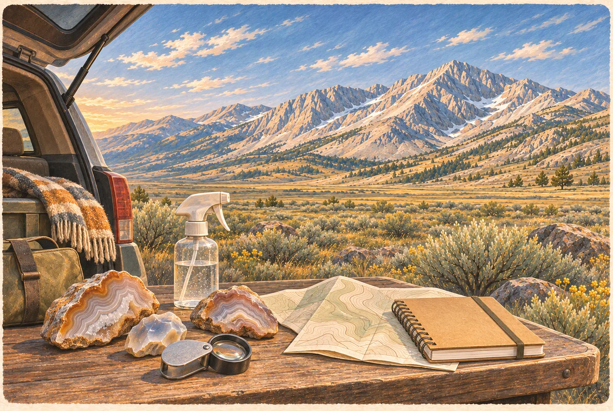
When collecting is legal, look where gravity and water do the digging for you: dry washes, eroded hillsides, gravel fans, natural float below an outcrop, previously disturbed ground, road cuts outside restricted rights-of-way where stopping and working are lawful, and exposed sediment after seasonal runoff. Follow float upslope rather than excavating: it can lead you back to the source with far less disturbance, and it is the difference between finding a productive zone and destroying a small one. Spray candidates with water from a bottle before you bucket anything; banding, translucency and pattern show up wet and disappear when dry.
[!NOTE] Horn coral is a common invertebrate fossil and may be casually collected in reasonable quantities from eligible BLM ground where no local restriction applies. A fossil in historic masonry, a documented scientific locality or a protected area is not fair game merely because the same fossil type is collectible elsewhere.
The Arco Desert: cover ground, do not dig a hole
The broad high-desert country around Arco is extensive volcanic terrain, old gravel deposits, sedimentary float and isolated exposures, with possible agate, chalcedony, jasper, quartz, calcite, weathered nodules and fossil-bearing sedimentary float in eligible areas. It is also the landscape most likely to mislead a visitor, because open-looking desert here is a mosaic: BLM parcels, state land, private ranchland, National Park Service land, Idaho National Laboratory property, other controlled federal land, active claims, wilderness and wilderness-study restrictions, and seasonal road closures, all interleaved without fences at every boundary.
The desert rewards a specific style of day, and it is the classic cooler-and-bucket outing. Meet in Arco, check the ownership map one more time, mark two or three backup areas, fill the fuel tank, carry more water than you think a walking day needs, follow only legal routes, and walk likely gravel and wash ground rather than excavating one random hole. Spray everything promising. Bucket the best material and leave the rest, because the desert is large and the next mile is different.
This is also the environment where the recovery kit earns its space: full-size spare in good condition, tyre plug and pump, shovel, tow strap, extra water, and offline maps. Cell coverage should not be assumed anywhere west or north of town, and a busted tyre two rough roads in is a long walk in summer heat. If you want to combine hobbies, many of these routes support a geocache or a cache series on the same legal track, and the geocaching guide covers the desert multi-caches and the vehicle requirements.
Big Lost River and Antelope Creek: gravels, and the geode question
The Big Lost River carries material off several ranges and tributary systems, and its river and terrace gravels can hold quartz, chalcedony, agate, jasper, calcite, volcanic material, sedimentary fragments and occasional mineralised float transported from upstream. Antelope Creek and the Antelope Canyon country east and northeast of the Arco Hills provide a similar transition between high-desert gravels and the Lost River mountain front, and collector reports associate the broader area with chalcedony, quartz, agate, geode-like nodules, calcite, sedimentary fossils and volcanic float.
Be careful with the word geode, in this corridor and anywhere else. A geode is a hollow rock with mineral growth on the inside, and not every rounded nodule is one: it may be solid agate, solid chalcedony, a host-rock fragment, or a nodule with a calcite seam and nothing else. Rounded is not the same as hollow, and crystal-lined is not the same as silica-rich. The useful field observations are naturally broken nodules that expose an interior, a chalcedony rind, quartz crystal lining, conchoidal fracture, repeated nodule shapes within one particular unit, and material concentrated in downstream gravel. Smashing every rounded rock on the bank tells the next visitor nothing and leaves the site looking worse; take a limited sample home and cut or break it with proper eye protection.
Access is the real difficulty along a river. The Big Lost crosses private ranchland, agricultural ground, road rights-of-way, BLM parcels, Forest Service land, state land, fishing-access sites and irrigation infrastructure, and a public fishing-access site is not automatically open to mineral collection. Do not enter cultivated ground, do not cross fences without permission, do not disturb streambanks, do not dig below the ordinary high-water line without confirming legality, do not redirect water, do not undermine vegetation, do not block agricultural access, and do not collect from a developed recreation site. The fishing guide works through the river reach by reach and documents the public-access picture, and it is the better place to decide where you may legally park and walk.
Mackay and the White Knob Mining District: the best minerals and the hardest rules
Mackay is the strongest mining-mineral component of an Arco-based rockhounding trip, and it is where you should keep your expectations highest and your permissions tightest. The White Knob Mining District above Mackay historically produced copper, lead, zinc, silver and gold-bearing ore, in ground associated with hydrothermal veins, skarn deposits, carbonate replacement, oxidised copper zones, sulfide mineralisation and contact metamorphism. Specimens reported or expected from the broader district include azurite, malachite, chrysocolla, chalcopyrite, pyrite, garnet, calcite, quartz, fluorite, other skarn minerals and iron oxides. The Empire Mine and related White Knob localities are the names collectors mention for copper and skarn material: malachite, azurite, chalcopyrite, pyrite, garnet, calcite, quartz, chrysocolla and fluorite.
None of that is permission. Colour is not permission, and neither is a waste pile. A bright green crust on an old dump is visually compelling and legally surrounded: surface ownership, mineral ownership, current claim status, private mining operations, historic-site rules, active closures, whether the dump is itself an archaeological feature, and whether the material is contaminated all have to be answered. That ground can include active or historical claims, private mineral rights, closed workings, historic structures, industrial contamination, active operations and genuine physical mine hazards. Treat the Empire Mine and White Knob district as places that illustrate what kinds of copper, sulfide and skarn minerals occur around Mackay, and study them rather than harvest them, unless your own current land-status and claim research explicitly establishes that personal collecting is permitted.
Mackay Mine Hill is a historical tour first, and the dedicated Mackay Mine Hill guide is the authority on its route, closures and etiquette. Mine Hill contains mine entrances, smelter sites, tramway remnants, rail grades, ore-bin locations, cabins, former townsites and active mining boundaries. Do not strip minerals, hardware, slag, bottles or artefacts from interpretive locations: the historical material belongs in its context, and a loose mineral specimen on verified claim-free BLM ground is a legally different object from a piece of colourful ore sitting inside a documented historical ore bin.
[!WARNING] Never enter a mine opening. Not an adit, not a shallow prospect hole, not the one that looks obviously worked out. Abandoned workings hold bad air, unstable rock, rotten timber, open shafts, explosives, contaminated water, wildlife, vertical drops, complete darkness and no reliable rescue access. Idaho Geological Survey maintains records of inactive and abandoned mines precisely because the state takes this seriously.
Mine dumps, and the one place crawling is encouraged
Old mine dumps tempt collectors for an obvious reason: they expose material that would otherwise require excavation, and weathering has already done some of the work. But a dump is not automatically abandoned and not automatically open. Before you touch material on one, answer these in order: who owns the surface, who owns the minerals, is there an active claim, is the dump part of a historic site, is the area closed, is mining active, are hazardous materials present, and does the land manager permit collection. If you cannot answer them, you have a study site, not a collecting site.
This is also where the local attitude is worth stating directly, because the honest version is more fun than a warning label. We want to see you crawling over legal surface float, turning over every ugly nodule with your boot, and coming back to town with dusty knees and a bucket full of rocks nobody can identify. We do not want to hear that you climbed a fence, crossed a claim, took a slag block home from an interpretive site, or walked into an old adit.
Handling matters once the material is yours. Wash your hands after handling malachite, azurite, chalcopyrite, arsenic- or lead-bearing minerals and any mine tailings, and do not eat while handling unwashed mine specimens. Bag soft minerals away from quartz: fluorite, calcite, copper coatings, delicate crystals, fossils and pyrite-bearing material each scratch easily and are worth wrapping separately in newspaper. Do not store sulfide minerals wet, since damp sulfides oxidise; dry material before long-term storage. And when you get to cutting, use a wet lapidary saw with eye protection, real respiratory control, hearing protection and secure work holding. Never dry-grind unknown mine material indoors, which is how amateur collections turn into a health problem.
Challis, Lime Creek and Willow Creek: research corridors, not pins
North of Mackay the geology changes again, and the Challis region brings in Eocene volcanic rocks, intrusive bodies, hydrothermal systems, mining districts, Salmon River gravels, fault-controlled mineralisation and extensively silicified and altered rock. Materials reported from the broader region include agate, red agate, jasper, quartz, iron-stained or citrine-coloured quartz, fluorite, calcite, chalcedony, opalised or petrified wood, pyrite and various mining-district minerals. The area is far too large and too mixed for one Challis rockhounding location, so the useful way to hold it is as research corridors: Challis-area BLM ground, Salmon River gravel where collection is lawful, the Willow Creek corridor, the Lime Creek area, historic mining districts and public geologic viewpoints.
Lime Creek is the name collectors mention for agate, jasper, quartz, silicified material, opalised wood and volcanic float, and it is a good example of how to talk about an area responsibly: Lime Creek is a Custer County research area associated with volcanic and silicified material, and before collecting you confirm the exact parcel, road status, mining claims, private holdings and any resource-specific restrictions. That protects the site and it protects you. Willow Creek Summit and the drainages between Mackay and Challis cross varied geology where road cuts where stopping is lawful, natural float below volcanic units, washes, creek gravels and old disturbed ground outside active claims are all worth a look.
Two cautions specific to this corridor. River access and mineral collection are separate permissions: a public boat ramp or fishing site may prohibit digging or collection, and the managing agency is the only authority on which. And on US-93, do not stop in a travel lane or on a blind curve to look at a road cut, and do not hammer into a road cut without permission; highway rights-of-way are not open quarries, and the sight lines on the summit stretches are poor enough that this is a safety problem before it is a legal one. The Peaks to Craters Scenic Byway guide covers the drive framework between Mackay and Challis, including where stopping is reasonable.
Reading what you found: a field identification workflow
Photograph before you collect: the specimen in place, the host rock, the wider landscape and the nearby float. Record the location properly, with a GPS point, the parcel, the date, the land manager, a specimen number and your name, and do not publicly post a sensitive or claim-adjacent coordinate. A specimen without locality data has lost most of its geological value, whatever it is made of.
Then work the specimen in a fixed order. Wet the surface, which reveals banding, translucency, pattern, fracture and colour that dust hides. Use a 10× hand lens for crystal shape, cleavage, grain size, fibres, bubbles, fossil structure and metallic luster. Test hardness conservatively and only on an inconspicuous area, using rough references: fingernail about 2.5, copper coin about 3, knife blade 5 to 5.5, glass about 5.5, steel file about 6.5, quartz 7. Use streak selectively, since it helps with hematite, magnetite, malachite, azurite and pyrite but destroys surface. Do not test cleavage on a specimen you hope to keep, and do not destroy a good piece merely to settle an argument at the bar. Label immediately.
For the material actually likely in this region: chalcedony is microcrystalline quartz, waxy, tough, and white, grey, blue-grey, tan or orange with translucent edges and conchoidal fracture and no obvious cleavage. Agate is banded chalcedony, with parallel bands, curved fortification patterns, moss-like inclusions, colour changes, translucent layers and a chalcedony rind, and it reads far better wet. Jasper is opaque microcrystalline silica coloured by impurities, here in red, brown, yellow, green, multicoloured and brecciated patterns. Quartz appears as massive white, vein, clear, smoky, iron-stained or druzy. Fluorite comes purple, green, clear or yellow, with cubic cleavage, a glassy luster and a hardness below quartz. Malachite is the green copper carbonate, as crust, staining, botryoidal coating or fibrous masses; azurite is its blue companion, as crust, small crystals, dark-blue masses or staining.
The two confusions worth settling. Chalcopyrite is a brass-yellow copper iron sulfide frequently mistaken for pyrite, but it is generally more yellow, softer, less sharply cubic and sometimes iridescently tarnished; pyrite forms cubes, granular masses and brassy crystals and is not gold. Skarn-associated garnets around Mackay may be brown, red-brown, orange or dark red, massive or crystalline. And horn coral is a tapered horn-shaped solitary coral, sometimes showing radial internal structure or a starburst cross-section, often calcite-replaced. None of these identifications change the legal answer: they only tell you what you are holding and whether it is worth the drive back with it.
The kit, and what to leave at home
A basic kit is small and cheap: a 10× hand lens, a small spray bottle, a rock hammer, safety glasses, gloves, a small hand shovel, a field notebook, a permanent marker, paper specimen bags, a bucket, newspaper or padding, offline maps, a GPS, drinking water and sun protection. Useful upgrades if you are serious: a magnet, a streak plate, hardness picks, a UV flashlight, a compact scale, a cold chisel, a small sledge, knee pads, an LED loupe, sample labels, a dropper bottle, and a satellite communicator for the desert.
Do not bring power tools on the theory that casual use covers them. BLM casual collection is built on hand tools and negligible or minor surface disturbance, so a power excavator, jackhammer, backhoe, explosives, a motorised screening plant or anything creating more than minor disturbance is outside the permission entirely, whatever the parcel.
Add the desert-and-mountain reality to the kit rather than treating it as separate: full-size spare tyre, plug and pump, shovel, tow strap, more water than seems necessary, sun protection, a hat, and a printed or downloaded map set. In summer add fire-restriction awareness and a smoke check before you leave town. In fall add blaze-orange thinking for hunting pressure and a headlamp for the short daylight.
Best seasons, and five trips worth planning
Spring is the best all-round season: cooler weather, freshly exposed material after runoff, and good walking at lower elevations, offset by mud, soft roads, lingering snow at height and closed mountain access. Summer gives the broadest access, the longest daylight and the easiest travel to Mackay and Challis, and charges you for it in heat, wildfire smoke, afternoon thunderstorms, snakes and a total absence of shade. Fall is the other good window, cooler with fewer insects, clearer light and less traffic, complicated by hunting activity, short daylight, early snow and seasonal closures. Winter is genuinely poor for broad searching because snow hides float, roads close and the ground freezes; use it for sorting, cutting, polishing, researching claims, reviewing maps and showing off what you already found.
Five plans that fit real distances. The Arco half-day: meet in town, compare land and claim maps, pick one verified BLM parcel, carry hand tools and water, work surface float and washes, label finds and return before dark. The Arco Hills day: verify Horsethief or Arco Hills access and claim status, stay on legal roads, work for chalcedony, agate and fossil-bearing float, avoid private ranch roads, and finish with enough daylight to handle a road problem. The Big Lost corridor day: choose a lawful collection parcel rather than a fishing access, check flow and ownership, work terrace and wash gravels without damaging banks, and continue to Mackay if daylight allows.
The Mackay mineral day: review White Knob geology, open current claim and land maps, tour Mackay Mine Hill for context, collect nothing from interpretive sites or active claims, work only ground you have independently verified, and keep mine minerals bagged separately. The Challis weekend: day one Arco to Mackay with the White Knob historical tour and legal ground, overnight in the region; day two the Challis and Salmon River corridor and a Lime Creek or Willow Creek research area on a verified BLM parcel, then south again. Do not turn a two-day trip into a race between unverified online coordinates, which is how people end up at a locked gate at 6 p.m. with no cell signal.
Frequently asked questions
Is Arco actually good for rockhounding?
Arco is good as a base, which is a different claim and the honest one. It sits where Snake River Plain volcanism meets the sedimentary and mineralised country of the Lost River Valley, so within a short drive you can reach chalcedony and agate ground in the Arco Hills, stream gravels on the Big Lost River and Antelope Creek, mining minerals above Mackay, and agate, jasper and silicified material toward Challis and Lime Creek. There is no single famous collecting pit immediately behind town, and any specific spot needs its own land-status and claim verification.
What rocks and minerals can you find near Arco?
Regional reports, historical mining records and collector accounts describe chalcedony, banded agate, jasper, quartz, geode-like nodules, calcite, fluorite, garnet, pyrite, chalcopyrite, malachite, azurite, chrysocolla, opalised or petrified wood and common invertebrate fossils including horn coral. Occurrence is never uniform: the material changes with the underlying unit across very short distances, which is why the Idaho Geological Survey Arco quadrangle is worth reading before you go.
Can you find geodes near Arco?
Nodule and geode reports exist for the broader Butte County region, including the Big Lost River and Antelope Creek areas, but a broad river corridor is not one uniform deposit and not every rounded rock is hollow or crystal lined. Plan on nodule-hunting as an interesting activity rather than a guaranteed geode, and confirm the geology and the parcel before building a trip around a single claim.
What minerals occur around Mackay?
The White Knob Mining District is associated with copper, lead, zinc, silver and gold mineralisation, with skarn and hydrothermal vein environments. Potential specimens include malachite, azurite, chrysocolla, chalcopyrite, pyrite, garnet, calcite, quartz and fluorite. The catch is that most of the interesting ground is claimed, privately held, closed, contaminated or historic, so the minerals are easy to discuss and hard to legally collect.
Can I collect at Mackay Mine Hill?
Do not assume so. Mine Hill contains active claims, private holdings, historical resources and active-mining closures, and its interpretive locations should be treated as observation only. Taking minerals, slag, hardware, bottles or artefacts from a documented historical site removes context that cannot be put back, and it can be an offence. Verify with the land manager and current claim research before collecting anywhere near Mackay.
What are the BLM collection limits?
Ordinary rocks, mineral specimens and semiprecious gemstones are limited to reasonable amounts for personal, noncommercial use collected with hand tools and only minor disturbance. The familiar 25-pounds-plus-one-piece daily limit applies to petrified wood, with an annual ceiling of 250 pounds, not to all rocks. Common nonvertebrate fossils are allowed up to 25 pounds per person per day from eligible land. Vertebrate fossils and uncommon fossils require a research permit, so leave them in place and report them.
Can I collect rocks at Craters of the Moon?
No. Nothing leaves the monument: no lava, cinders, pumice, crystals, cave material, fossils, plants, historical objects or archaeological material. The park protects those resources under federal law and its own site-specific rules, and it also asks visitors to stay on designated routes around fragile formations. Photograph it and leave every rock exactly where it is.
Can I enter an abandoned mine to look?
No. Abandoned workings can contain bad air, unstable rock, rotten timber, open and unmarked shafts, old explosives, contaminated water, wildlife and total darkness, with no reliable rescue access. There is no specimen worth the risk, and gates and closures exist to keep people alive rather than to keep them off good rocks. Use the Idaho Geological Survey inactive and abandoned mines records for research and stay on the surface.
Where do I check whether an area is claimed?
Use the federal Mineral and Land Records System for active lode claims, placer claims and mill sites, and cross-check against an official BLM surface-ownership map rather than a recreational mapping app alone. Then call the relevant field office for location-specific questions, likely the Upper Snake office for Arco-area ground and the Challis or Salmon offices to the north. Save the results offline, and treat on-site monuments, notices and gates as the final answer.
Can I sell what I collect, or use power tools?
Neither. Casual recreational collection is for personal, noncommercial use, so selling or bartering collected material is outside the permission. And casual use is built on hand tools with negligible or minor surface disturbance, which excludes motorised excavation, heavy equipment and explosives regardless of whose land it is.
Can I bring my finds into Club Sawtooth?
Reasonable hand specimens are fine, kept off the walkways and out of the game areas. Do not bring mine waste, contaminated tailings, sharp material, oversized boulders or anything collected illegally. The unofficial specimen judging under bar lights is the point of the evening, and the one rule is that everyone agrees how the rock was legally obtained.
Sources and updates
Check current access, hours and conditions before setting out.
- BLM recreational rockhounding guidance
- BLM Idaho home page and field office contacts
- Idaho Geological Survey publications and products
- Idaho Geological Survey interactive map search
- Idaho Geological Survey mines and minerals
- Idaho Geological Survey inactive and abandoned mines
- Idaho Geological Survey online geologic map
- NPS Craters of the Moon laws and policies
- NPS Craters of the Moon current conditions