Grand Avenue Field Notes
The 1983 Borah Peak earthquake and the Lost River fault scarp
At 8:06 a.m. on October 28, 1983, the western base of the Lost River Range moved. The magnitude 6.9 Borah Peak earthquake is the largest recorded earthquake in Idaho by magnitude and property damage: it broke the surface for about 22 miles, threw rock off the mountains, changed where the groundwater runs, badly damaged Mackay and Challis, and killed two people. What it left behind is uncommon in the Intermountain West: a fresh earthquake rupture that is still visible, and a free Forest Service interpretive site where you can stand next to it. This is not an amusement attraction. It is a quiet, undeveloped piece of mountain sagebrush that happens to record a day that broke a valley, and it is best visited with that in mind.
Jump to trip essentials- Region
- Lost River Valley, Doublespring Pass north of Mackay
- Season
- Listed May 1 through September 30, decided by road conditions
- Category
- Natural hazards
Before you go
- Magnitude 6.9 at about 10 kilometres depth, 14:06:06 UTC on October 28, 1983, which was about 8:06 a.m. local time. Some historical catalogs carry a 7.0 solution; 6.9 is the current primary USGS value.
- Free day-use site with interpretive signs, three picnic tables and one vault toilet. No entrance fee, no reservations, no potable water, no drinking fountain.
- The Forest Service lists the season as roughly May 1 through September 30, and lists it as open 24 hours a day within that season. Road conditions, not the calendar, decide access.
- Directions from Mackay: about 22 miles north on US-93, then about 2.5 miles on Doublespring Pass Road to the signed site.
- Allow 30 to 60 minutes for the site itself, and treat the whole trip from Arco as a half-day or full-day outing, not a stop.
Approximate landmark
Earthquake Interpretive Site, off Doublespring Pass Road, about 22 miles north of Mackay on US-93.
View on OpenStreetMapWhat you are actually looking at
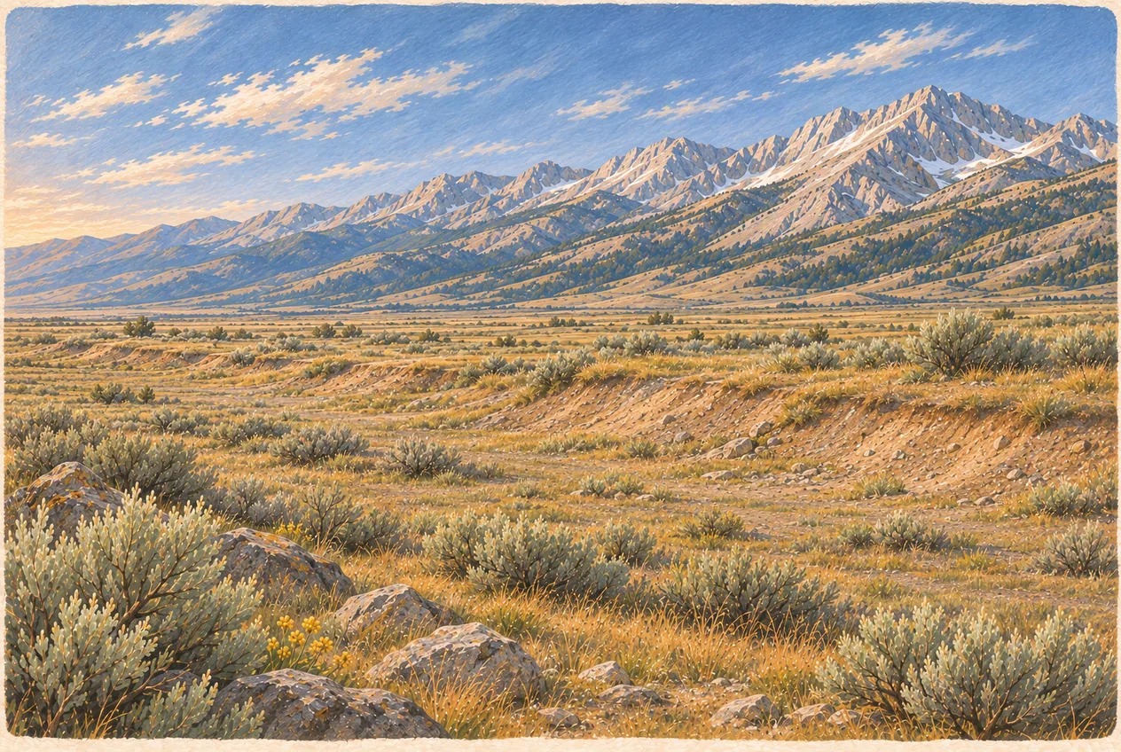
Most people drive up expecting a canyon. There is no canyon. The 1983 rupture is mostly a fault scarp: a step in the ground, a place where one side of the Lost River fault came down relative to the other and left a steep earthen face where the soil used to slope evenly. In the first weeks after the earthquake the step was dramatic and sharp. Four decades of wind, rain, snow, freeze-thaw, plant roots, animals and moving sediment have softened it, and parts of the trace are now a gentle slope with a change in vegetation rather than a wall.
So look for the geometry instead of the drama: a linear step running across the terrain, an abrupt change in ground elevation, several low scarps in parallel, sloping or eroded faces, offset ground surfaces on either side of the line, and an alignment that follows the mountain front. The interpretive signs at the site point out the rupture features so you are not guessing at a sag in the sagebrush. Ground cracking is genuinely there, but it is distributed across a zone rather than concentrated in one clean cut, and a bright afternoon straight-on light hides all of it.
Two things follow from that. Photograph the scarp obliquely, with low morning or afternoon light and the Lost River Range in the frame for scale, rather than facing it head-on at noon. And do not climb onto the steep faces to make the feature look better on camera or to walk the rupture line: the edges are unstable, the terrain is fragile, and the trace runs onto private land in places.
The morning of October 28, 1983
The earthquake ruptured part of the Lost River fault along the southwest side of the range, at USGS’s plotted epicentre near 44.058° N, 113.857° W, at a depth of about 10 kilometres. The measured magnitude is 6.9. You will still see 7.0 quoted: USGS preserves alternate catalog solutions for the event, including that historical estimate, but its reviewed page reports 6.9, and that is the number to use.
USGS describes a northwest-trending zone of fresh scarps and ground breakage roughly 35 kilometres, about 22 miles, long along the southwest slope of the range. The breakage was not one line. The most extensive section ran about eight kilometres between West Spring and Cedar Creek, where the surface broke into randomly tilted blocks several metres across. In places the zone of ground breakage reached about 100 metres wide and contained four to eight overlapping scarps between one and two metres high, along with tilted blocks and deformation zones.
The largest field-observed vertical displacement was about 2.7 metres, roughly 8.9 feet, at a location south of Rock Creek near the western base of Borah Peak. Maximum intensity reached Modified Mercalli IX on the strength of the surface faulting. Along with the ground failure came rockfall, landslides on the steep slopes of the range, and structural damage in the two towns at the valley’s centre.
Normal faulting: why a valley drops
The Lost River fault is a normal fault, which means the crust here is being pulled apart rather than squeezed. In a normal-fault earthquake one block of crust moves downward relative to its neighbour. That single mechanism is what produced the steep front of the Lost River Range, the subsiding valley floor, and the alluvial apron of gravel between them. It is the same extension that underlies the Basin and Range country to the south and the volcanic fissures of the Great Rift at Craters of the Moon, which is why the two landscapes look related and are not the same process.
You will hear the shorthand that the mountains went up about six inches while part of the valley floor dropped about six feet. That is a fair interpretive summary of the relative movement, and it is how the story is often told to visitors. The precise version is that displacement varied all along the rupture, deformation was spread across multiple scarps, and some places recorded far larger offsets than others.
One thing the earthquake did not do: build Mount Borah in one event. The range was raised by repeated fault movement across a much longer span of geologic time; the 1983 scarp is one modern episode in a continuing process. The Lost River fault remains geologically active and capable of another large earthquake. Nobody can give you a date or a decade for it, and a scarp walk is not a prediction instrument. Anyone selling a forecast off this fault is guessing.
Why the numbers disagree
Visitors and older brochures quote different figures for how far the ground moved and how long the rupture was, and the disagreements are usually about method rather than about facts. Field crews measured the biggest offset they could find on the ground: about 2.7 metres of vertical separation south of Rock Creek. A 2025 USGS-supported study that differenced historical aerial imagery against modern lidar reported a maximum measured vertical separation of about 2.02 ± 0.46 metres at Doublespring Pass. Different places, different instruments, and one of the two methods cannot see the part of the offset that was later eroded or that is spread across several smaller scarps.
The same goes for length. The historical impact summary describes about 35 kilometres of fresh surface faulting. The newer mapping, built on a high-resolution digital terrain model derived from 2019 lidar with roughly half-metre resolution, examined about 40 kilometres and mapped more than 800 individual traces at a scale of 1:500, including distributed cracking and older, more eroded scarps from prehistoric earthquakes.
That work is the reason the site is worth visiting at all, and the reason to be careful about what you say you are seeing. Modern mapping lets scientists separate 1983 deformation from prehistoric scarps, primary fault movement from distributed ground cracking, and real rupture from erosion. It also means a determined walker can find surface breaks well away from the interpretive area, including on land that is not public.
Mackay and Challis took the damage
The earthquake was not only a geologic event. USGS reports the most severe property damage in Challis and Mackay: eleven commercial buildings and thirty-nine private houses with major damage, and roughly 200 more homes with minor to moderate damage. Estimated damage in the Challis to Mackay area reached about $12.5 million, with total damage near $15 million.
Mackay took the worst of it. Most commercial structures on Main Street showed some damage, eight buildings were condemned, masonry was hit hardest, exterior and interior walls cracked and partly collapsed, and ceilings separated from walls. About 90 percent of residential chimneys were cracked, twisted or collapsed, which is the classic rural-Idaho earthquake injury: brick on a wooden house. Challis saw less general damage but two structures were extensively damaged, Challis High School and a roughly hundred-year-old vacant concrete-block building on Main Street.
Two people died and two were injured, and the deaths occurred in Challis. Keep that alongside the geology. The interpretive site is a record of an event that killed people and cost a small community most of its commercial core, and the tone that fits the place is a quiet one. Photograph the scarp, read the signs, let the memorial side of it sit in the same frame.
The water moved too
An earthquake this size rearranges groundwater, and 1983 is still cited as a textbook example. USGS documents water fountains erupting at the surface, sand boils near the Chilly Buttes and Mackay Reservoir, springs that ran harder or went quiet, well levels that fluctuated, and a temporary lake that formed south of Dickey where the water table rose. The valley’s wells and springs are the same reservoir that irrigates the hay and fills the troughs, so a fault slip is also a plumbing event for the people living on it.
That is worth a thought when you drive the valley: the reason the Lost River Valley looks the way it does, steep rock wall on one side and flat gravel on the other, is the same reason a rupture could change what came out of a tap. The earthquake should be read as both a structural event on the fault line and a landscape-wide hydrologic one.
Visiting the Earthquake Interpretive Site
The Forest Service runs the site as free day-use parking, interpretive signs, three picnic tables, scenic viewing and one vault toilet. There is no potable water, no reservations, no fee, no food, no gift shop, no staff, no guided tours, no seismic simulator and no paved interpretive loop. Plan to bring all the drinking water the group will need, plus a trash bag, because the vault toilet is not a restroom with services behind it.
The site is generally listed for use from about May 1 through September 30, with the actual opening and closing decided by the road. During that season the Forest Service lists it as open 24 hours a day, which is a legal description, not advice. Daylight is what gives you road visibility, safe footing, readable interpretation and reliable navigation. Meet in Arco to review the route and designate a sober driver; save drinks for after the site visit and return drive.
From Mackay, the Forest Service directions are about 22 miles north on US-93, then a turn onto Doublespring Pass Road and about 2.5 miles to the signed site. The listed coordinates are 44.16849 latitude, -113.862138 longitude. From Arco, take US-93 north through Moore and Mackay and continue about 22 miles beyond the town; the turnoff is the last decision point, so have the route downloaded offline before you leave town. A passenger car is often fine in good, dry conditions, but current road condition matters more than a general vehicle recommendation: confirm the access road is open, check for snow and mud, avoid it after heavy rain, carry a full-size spare, keep enough fuel to get back, and do not create bypasses around soft spots or rutted sections.
How long to stay, and what to carry
The site does not need a day. Give it 20 to 30 minutes to read the core signs and find the scarp, 45 to 60 minutes to finish the interpretation, take photographs and use the picnic area, or 90 minutes if someone in the group is sketching, photographing seriously or working through the geology with the kids. It earns its keep as one stop in a valley circuit with Mackay Reservoir, the Mackay Mine Hill tour, the Mount Borah trailhead and the towns.
Pack as if the nearest services are what they are: drinking water, sun protection, a hat, sturdy closed-toe shoes, a wind layer and a warm layer even in July, first aid, an offline map, a camera or binoculars, food, hand sanitizer and basic vehicle recovery gear.
Out on the ground, stay on established surfaces. The hazards are ordinary but real: loose gravel, eroded soil, animal holes, hidden rocks, mud, lingering snow patches, ice, sharp vegetation and uneven footing in sagebrush. The site offers almost no shelter, so the weather list runs from high wind and intense sun to thunderstorms, sudden cold, smoke and dust, and you should leave the open ground when lightning builds up over the range. Cattle, pronghorn, deer, snakes, raptors and small mammals are all possible: keep your distance, control dogs, and leave any gate as you found it.
Where the fault scarp fits in a trip
The interpretive site is one of the strongest geology stops on the Peaks to Craters Scenic Byway, the route that links Carey, Craters of the Moon, Arco, Mackay, Mount Borah country, Willow Creek Summit and Challis. Going northbound from Arco, it makes sense to stop at Mackay Reservoir, look at Borah’s north face, take Doublespring Pass Road out to the scarp and then continue over Willow Creek Summit toward Challis. Going the other way, cross the summit first and end in Mackay.
Do not treat the fault scarp and Mount Borah as the same outing. The Forest Service manages the interpretive site, the Mount Borah climbing trail and the Leatherman Pass trail as separate resources, and the interpretive site is not the trailhead. The standard route up the 12,662-foot summit is roughly seven miles round trip with more than 5,000 feet of gain, exposed scrambling and Chicken Out Ridge. Deciding to climb the high point of Idaho because you liked the look of the scarp from a picnic table is how people end up in trouble.
A science-themed day from Arco can pair this with EBR-I: reactor engineering in the morning, crustal mechanics in the afternoon, with the drives booked as part of the plan. What does not work is EBR-I, the interpretive site and a full Craters of the Moon visit in one day, or a full Mine Hill ATV day with this detour bolted on unless there is real daylight left. And for the record: the Lost River scarp is not volcanic. It is faulting, not a lava crack, and the earthquake has nothing to do with the eruptions that built the lava fields south of Arco.
Season by season, late spring brings cool temperatures, green valley and snow on the mountains, with mud and a closed access road as the price. Summer is the most reliable window for road access, long daylight and a picnic, at the cost of heat, thunderstorms, smoke, fire restrictions and no shade. Fall cools down, clears the light and brings valley colour, with hunting season added: wear visible clothing and expect shorter days and early snow. Winter is outside the listed season, and Doublespring Pass Road may be snow-covered, closed, icy or unmaintained. A map pin is not proof of winter access.
What 1983 is still teaching
The damage pattern in Mackay is a home-readiness checklist written by an earthquake. Secure masonry chimneys. Brace the water heater. Anchor tall furniture. Strengthen unreinforced masonry. Store emergency water. Keep shoes beside the bed. Know how to shut off gas, water and power. Keep battery lighting findable in the dark. Agree how the family will reach each other.
For travellers the lesson is about roads. After a large earthquake in this country, expect rockfall, damaged bridges, landslides, closed roads, broken utility lines, limited fuel, failed communications and a slow emergency response. Carry water, food, first aid, a flashlight, warm clothing, a paper map, tools, a fuel reserve and battery power. If shaking starts while you are driving, slow down gradually, pull completely out of traffic where it is safe, keep clear of cliffs, power lines and bridges, stay in the vehicle until the strong shaking stops, then expect damaged pavement and rockfall and do not drive around a closure.
One etiquette note for people who cache: the scarp makes an excellent educational stop, and virtual or EarthCache-style activities are fine where they already exist and are active. Placing a physical container needs the land manager’s permission first. Do not publish coordinates for unauthorised containers, routes across private land, or anything that points at sensitive archaeological sites.
Frequently asked questions
When did the earthquake happen and how strong was it?
October 28, 1983, at 14:06:06 UTC, about 8:06 a.m. local time, at magnitude 6.9 and roughly 10 kilometres depth. Some historical catalogs list a 7.0 solution; 6.9 is the current primary USGS value. USGS calls it the largest recorded earthquake in Idaho by magnitude and property damage.
Is the fault scarp a giant crack in the ground?
No. The feature is primarily a step or break in ground elevation, with multiple overlapping scarps and deformation spread across a zone. Erosion and vegetation have softened much of it since 1983.
How much did the ground actually move?
Field observations recorded up to about 2.7 metres, roughly 8.9 feet, of vertical displacement at one location south of Rock Creek. A 2025 topographic-differencing study calculated a maximum vertical separation of about 2.02 ± 0.46 metres at Doublespring Pass. Both are correct; they measured different places by different methods.
Where is the Earthquake Interpretive Site and does it cost anything?
About 22 miles north of Mackay on US-93, then about 2.5 miles on Doublespring Pass Road, at approximately 44.16849, -113.862138. There is no fee and no reservation system. It has interpretive signs, three picnic tables and one vault toilet, and no drinking water.
When is it open?
The Forest Service lists an approximate season of May 1 through September 30, dependent on road conditions, and lists it as open 24 hours a day within that season. Check current Salmon-Challis National Forest information, and in winter assume the access road may be closed or unmaintained.
Can I climb Mount Borah from the earthquake site?
No. The interpretive site and the Mount Borah trailhead are separate locations, and the climbing trail is its own resource with exposed scrambling on Chicken Out Ridge. Use the official trailhead and study the full route plan before considering a summit.
Is the Lost River fault still active?
Yes, it is a geologically active fault system capable of future earthquakes. The timing of any future event cannot be predicted. The area also carries older, more eroded scarps from prehistoric earthquakes.
Is this the same geology as Craters of the Moon?
Related, not the same. The Borah Peak event came from fault movement and crustal extension. Craters of the Moon was built by eruptions along the Great Rift. The scarp is not volcanic and is not a lava crack.
Sources and updates
Check current access, hours and conditions before setting out.