Grand Avenue Field Notes
Peaks to Craters Scenic Byway: Idaho road trip through Arco, Mackay and Challis
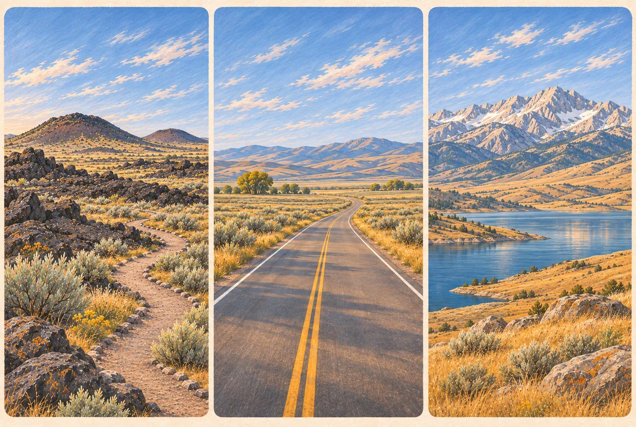
Two landscapes that look like they belong in different parts of the West are joined by one paved highway. At the southern end, black lava flows and cinder cones spread across the Snake River Plain at Craters of the Moon. At the northern end, the Lost River Range rises out of a broad irrigated valley and tops out at Mount Borah, 12,662 feet, the highest point in Idaho. In between are Carey, Arco, Moore, Mackay, Willow Creek Summit, Grand View Canyon and Challis. That is the Peaks to Craters Scenic Byway: about 143 miles of US-20/26/93 and US-93, with an uninterrupted driving time the byway’s own materials put at roughly 2 hours and 27 minutes. Treat that number as the time it takes to move a vehicle, not to see anything. It excludes the Loop Road, every hike, every cave, Number Hill, the USS Hawkbill sail, the EBR-I detour, Mackay Reservoir, Mine Hill, the earthquake fault scarp, Willow Creek Summit and all three of the communities where you will stop to eat. The published advice is to allow a long weekend, and that is honest. This page is the geographic spine of everything else here: it puts the Arco-area destinations in the order you actually meet them along the corridor, and it separates the paved official route from the dirt side roads that need their own permission checks, their own vehicle and their own margin of time.
Jump to trip essentials- Region
- Carey, Craters of the Moon, Arco, Moore, Mackay, Willow Creek Summit, Grand View Canyon and Challis, on US-20/26/93 and US-93
- Season
- The route itself is a year-round designation; Willow Creek Summit is weather-dependent and most side roads, campgrounds, caves and museums are seasonal
- Category
- Scenic drives
Before you go
- About 143 miles end to end, roughly 2 hours 27 minutes of nonstop driving. Plan one full day for an overview, two days for the major stops, three days for the road trip the route actually wants.
- The endpoints are the Idaho 75 and US 20 junction near Carey and the US 93 and Idaho 75 junction near Challis. The main route is paved and officially a year-round corridor.
- Full services are in four communities only: Carey, Arco, Mackay and Challis. Full services does not mean fuel at midnight, diesel everywhere, EV charging or a mechanic on call.
- Highest point on the route is Willow Creek Summit at about 7,161 feet. Carry warm layers in every season and check conditions before you cross it.
- Most of the best stops sit on unpaved side roads with no potable water and no cell service: the fault scarp, Mine Hill, Copper Basin, the Natural Arch trailhead, the Mount Borah trailhead.
- Check Idaho 511 for the paved highway and the relevant land manager for everything else, the day you leave and the morning you cross the summit.
No public destination pin
The southern end is the junction of Idaho 75 and US 20 near Carey; the northern end is the junction of US 93 and Idaho 75 near Challis. Arco sits roughly in the middle, about 18 miles northeast of the Craters of the Moon visitor entrance and about 21 miles south of Mackay.
What the route is, and what the 143 miles include
The official byway follows the corridor from the junction of Idaho 75 and US 20 near Carey, east past Craters of the Moon, through Arco, then north on US 93 through Moore and Mackay, over Willow Creek Summit, through Grand View Canyon and down to Challis and the junction of US 93 and Idaho 75. The highways are US 20/26/93 for the southern section, where the three numbers share one road, then US 93 alone for the valley and the mountains. The main route is paved. Full services sit in four places only: Carey, Arco, Mackay and Challis.
The numbers worth carrying: about 143 miles; roughly 2 hours 27 minutes of nonstop driving; recommended trip length two to three days; southern terminus at Carey; northern terminus near Challis; highest major landmark Mount Borah at 12,662 feet; highest point you actually drive over Willow Creek Summit at about 7,161 feet; primary national monument Craters of the Moon; primary historic community Arco; primary valley the Big Lost River Valley; primary water stop Mackay Reservoir; primary geology stop north of Mackay the 1983 Lost River fault scarp. The official designation is year-round, which describes the highway, not the experience. Everything you would want to get out of on a February afternoon is closed, snowed under or both.
What the driving estimate does not count is the useful part. It excludes the Craters Loop Road, hiking, cave permits, Number Hill, the USS Hawkbill sail, the EBR-I detour, meals, fuel, King Mountain, Mackay Reservoir, Mackay Mine Hill, the Mount Borah trailhead, the earthquake interpretive site, camping, fishing, photography, wildlife stops and the Challis-area museums. Each of those is a decision about an hour or more, plus a walk, plus a return to the road. Add them up and the difference between a scenic overview and a road trip is obvious.
There is no Wikipedia article for this byway and there is no single official mobile app for it. The route’s published description comes through the state tourism program, and the practical authority on the day you drive is Idaho 511 for the pavement and the relevant land manager for every gravel road that branches off it.
Which direction to drive, and where the overnight stop belongs
Either direction works, and the choice is about where you arrive from and what you want as the finale rather than about traffic. South to north suits travellers coming from Sun Valley, Bellevue, Twin Falls or anywhere in southern Idaho, and it suits anyone continuing north toward Salmon or Montana. You start in farmland and lava and the mountains get gradually larger in the windshield for two days, which is a good way to build a trip.
North to south is the direction the state tourism materials recommend when you want the literal peaks-to-craters progression: you start in Salmon River and mining country, cross the summit, drop into the Lost River Valley past Mount Borah and Mackay, and finish in the lava fields. Craters of the Moon becomes the last big visual event instead of the first, and it is the better finale. Coming from Salmon, Montana or north-central Idaho, this is also simply the direction you are already going.
For a trip built around an evening in Arco, both directions can be made to work, and the rule is the same either way: make Arco the end of the driving, not a point in the middle of it. Northbound, do Craters and Arco, park for the night, then continue to Mackay and Challis in the morning. Southbound, do Mackay and the mountains, arrive in Arco, park, and finish the day in town. Do not put a bar stop at the midpoint of a plan that has you driving the summit or the canyon after drinking. Park for the evening or hand the keys to someone who has not been drinking, and if that means sleeping in the car at a legal campground instead of driving 21 miles to Mackay, that is the correct trade.
Southern end: Carey, Wild Rose and the lava fields
Carey is the southern gateway, sitting where Idaho 75 and US 20 meet, and it is one of the four full-service communities. Treat it as the last easy place to prepare. Filling the tank here costs one stop; running short east of Craters costs an afternoon. Fill up, take on drinking water for every occupant, check the current Craters of the Moon conditions, confirm how much daylight you actually have left, look at weather and smoke, download offline maps for the whole corridor, and decide before you leave whether Wild Rose is part of the day.
Wild Rose Hot Springs lies east of Carey along the stretch toward Craters, and it also goes by Milford Sweat, Milford Hot Springs and Carey Hot Springs. Visitors have historically used the spring without a formal check-in, but access is not guaranteed. Obey current signs, gates and property-owner requests; turn back if access is closed or unclear. It is primitive in the full sense of that word: no developed facilities, no attendant, no changing area, no water spigot you can count on, uneven and sometimes sharp footing around the pools. Test the water before you get in rather than assuming a comfortable temperature, keep soap and glass out of the spring, pack out everything you carried in, park only where parking is lawful, and obey the signs you find there. Conditions on the approach road change with weather and grading, so check before you commit to the turnoff, and never combine soaking, drinking and driving on the same afternoon.
Craters of the Moon National Monument and Preserve is the defining southern attraction and the reason the byway has its name. The developed entrance is about 18 miles southwest of Arco on US 20/26/93. Start at the Robert Limbert Visitor Center rather than letting navigation take you toward remote preserve roads, which is a different trip requiring different preparation. The developed experience is the seven-mile Loop Road and its stops: North Crater Flow, Devils Orchard, Inferno Cone, Spatter Cones, Big Craters, Broken Top, Tree Molds, the Wilderness Trail trailhead and the Caves Area. The monument protects a volcanic landscape built along the Great Rift, and it holds some of the darkest night sky in the state, which is why so many people sleep here rather than drive on.
Realistic time budgets inside the monument run like this. Forty-five to ninety minutes for the visitor centre and one short walk. Two to three hours for the Loop Road and several short trails. Half a day for Inferno Cone, Spatter Cones and one moderate hike. A full day for longer trails, caves or a sunset. Overnight for camping and stargazing. Two things scale badly with a tight schedule: caves and elevation. Cave access depends on snow, ice, rockfall, bat protection, visitor centre hours and seasonal road access, and when caves are open, permits come out in person at the visitor centre. Do not build a one-day byway itinerary with a cave inside it until you have confirmed current conditions. Trails at Craters look short from the parking area and Inferno Cone in particular is a steep climb on loose cinder at elevation. The full trail, cave and dark-sky detail is on the Craters of the Moon guide.
Arco: the byway’s central stop
Arco is what keeps this route from being a two-day drive between two parks. It is the strongest central stop and the practical link between the lava country and the Lost River Valley, and it has fuel, food, lodging, camping access, public landmarks and a specific piece of atomic history. It is also where the driving should stop for the night in either direction.
Two landmarks are worth the ten minutes. Number Hill is the white class years on the hillside above town, a tradition generally traced to 1920 and still maintained by graduating classes. View it from a lawful public place; the map marker on the hill is a location, not a trailhead, a climbing route or an ATV staging point, and the hillside is not an invitation to walk up it. The preserved sail of the USS Hawkbill is the other one, an unlikely naval object in high-desert sagebrush: the submarine carried hull number 666 and was known as the Devil Boat. Treat it as a public landmark and memorial, which means parking legally, not climbing the structure, keeping children close, and leaving commemorative features alone.
The atomic history needs one distinction that gets muddled constantly, and muddling it is the fastest way to lose credibility with a local. On December 20, 1951, Experimental Breeder Reactor No. 1, southeast of town, generated the first usable electricity from nuclear fission and lit four 200-watt lightbulbs; the reactor-generator system reached full-power operation the next day. In 1955, the BORAX-III reactor powered Arco itself, which is why the town is described as the first community lit by nuclear-generated electricity. Those are different events four years apart, and the town’s claim is the second one.
EBR-I is a detour, not a byway stop. It sits southeast of Arco on US 20/26 toward Idaho Falls, away from the northbound corridor, and any itinerary that treats it as a passing glance is wrong about the geography. If you go, allow 60 to 90 minutes at the museum plus round-trip driving from Arco, and more if you want the guided explanation rather than reading placards. What is there is worth the detour for anyone interested in the engineering: historic reactor equipment, the original control room, analog instrumentation, remote-handling systems, radiation-detection gear, aircraft nuclear-propulsion prototypes and exhibits tracing how later reactors grew out of this building. Two practical limits: the museum is seasonal, so confirm the current visitor dates and hours before you plan around it, and a museum visit does not authorise entry into the rest of the Idaho National Laboratory reservation. The broader set of Arco stops is on the things to do page, and the reactor itself has its own guide.
Then stop for the night. Club Sawtooth is at 156 W Grand Ave, phone (208) 527-3003, open daily from 2 p.m. to 2 a.m., with four electronic dartboards and Remote Play, pool tables, foosball, an AMI jukebox you can run from your phone, the Mortal Kombat 4 cabinet, karaoke when someone signs up and occasional live music. It fits after a day at Craters, after the mountains, after EBR-I, after Atomic Days, because the sequence works: finish the driving, park the vehicle, put the outdoor gear somewhere it is not in the way, and then order a drink. The bar is not a byway visitor centre, guide service, campground, shuttle or public-land office, and it does not sell you a map of the route.
The Lost River Valley: Moore, King Mountain and open-range country
North of Arco, US 93 leaves the volcanic plain and enters the broad Lost River Valley, and the scale changes: open agricultural and sagebrush country boxed in by major ranges, with the Lost River Range, King Mountain, the Pioneers and the White Knobs all visible at once. The road is straight, the traffic is light and this is where people start feeling relaxed. The hazards here are not dramatic, they are agricultural. Expect slow farm and ranch vehicles, livestock near or in the road, irrigation equipment set across access points, wildlife crossings, dust blowing off unsurfaced side roads and few legal passing opportunities. The byway’s own guidance for the northern section specifically says to watch for open-range cattle, and cattle do not move for a vehicle that has already committed to a pass.
King Mountain rises above the valley near Moore, and several genuinely different activities share that name. They should not be collapsed into one pin or one plan: advanced hang gliding and advanced paragliding from the mountain launch, sailplane soaring in the valley below, the King Mountain Natural Arch reached on a short uphill non-motorised Forest Service trail, scenic driving, hiking and designated motorised routes. The Natural Arch walk and the aviation launch are separate places with separate rules.
Two notes on the aviation side. The Forest Service mountain launch is rated for advanced pilots, so do not arrive expecting to take a lesson or even to reliably watch a flight happen; soaring depends on the thermals and the wind of the day. If you are watching, stand clear of launch paths, landing zones, wings and suspension lines, aircraft, gliderport runways and pilot preparation areas, and keep children and dogs clear of all of it. A glider on final has no brakes and no ability to change its landing spot. The hiking and flying details are on the hiking near Arco and King Mountain gliding guides.
Mackay: the mountain gateway, its reservoir and Mine Hill
Mackay is the principal mountain-valley community on the byway and the last place with full services before the summit. It is the jump-off for Mackay Reservoir, the Big Lost River, Mine Hill, the White Knob Mountains, the Lost River Range, Mount Borah, the earthquake interpretive site, Copper Basin and Wildhorse Canyon. Refuel here before you commit to any mountain side road or to Willow Creek Summit, and treat Mackay as a decision point rather than a stop on the way to somewhere better.
Mackay Reservoir is the best developed water stop on the whole route, sitting under the Lost River Range about six miles north of Mackay on the west side of US 93. The BLM-managed Joe T. Fallini Recreation Site has 26 campsites with RV hookups, a dump station, restrooms, drinking water, a boat ramp, an interpretive trail and direct reservoir access. Fees, what services are actually open, water availability and dock access all change with season and staffing, so check current BLM information rather than relying on a list of amenities. The reservoir is known for rainbow trout and kokanee, and the fishing options run from shore fishing and trolling from a boat to fly fishing on the margins and ice fishing in late winter, when the BLM itself lists ice fishing as an opportunity. That combination of mountain reflection, boat ramp, campground and high-country ice makes it the stop that pays off most reliably on a byway trip. The Big Lost River drainage and its access problems are covered on the fishing near Arco guide.
Mackay Mine Hill climbs west of town into the historic White Knob Mining District, and it is a genuine half-day to full-day destination rather than a lookout. It supports a self-guided historical tour, ATV and UTV travel, dirt bikes, mountain biking, hiking, horse travel, photography and mining-history interpretation. It is not one uniform road either: official mapping splits the routes by vehicle suitability and physical restriction, so a track that carries a pickup may be closed to a wider machine, and a route open to a motorcycle may be closed to everything with a motor. What you do not enter, regardless of how inviting the portal looks, is any shaft, adit, tunnel, unstable building, open pit, tram structure, fenced closure or active mining area. Abandoned mine entries in this district are short, steep, rotten-timbered and full of bad air, and no specimen or photograph is worth the descent. The self-guided tour is covered in its own Mackay Mine Hill guide.
Mount Borah at 12,662 feet dominates everything north of Mackay, and the single most important thing to say about it on a road-trip page is that seeing it and climbing it are unrelated activities. The standard route is an advanced objective: more than 5,000 feet of gain, roughly seven miles round trip, very steep climbing, altitude, exposed scrambling along Chicken Out Ridge, loose rock, fast weather and a descent that takes the last of your legs. Nobody should decide to summit Mount Borah because they saw a trailhead sign at mile 90 of a day that already included Craters of the Moon. Better ways to have the mountain: view the range from Mackay Reservoir, stop at a lawful roadside pullout, drive to the trailhead and stand there without starting, pair the area with the earthquake interpretive site, or photograph the range in early or late light when it has a face to it. The trailhead itself has limited camping and a vault toilet but no potable water, and seasonal road and trail conditions affect access. The full climb, with its honest difficulty, is on the Mount Borah guide.
North of Mackay: the 1983 fault scarp, Willow Creek Summit and Grand View Canyon
The most significant geological stop on the byway is also its shortest detour, and it is a place where a road-trip guide can be genuinely useful: most people drive past something that changed the map. On October 28, 1983, a magnitude 6.9 earthquake ruptured the Lost River fault at 8:06 in the morning. The surface rupture is mapped for roughly 22 miles along the western base of the Lost River Range, with vertical offset reaching about nine feet. The short version the state materials use is that the mountains rose about six inches while part of the valley floor dropped about six feet, and either way what is left on the ground is a fresh scarp you can stand beside, which is uncommon anywhere in the Intermountain West. It badly damaged Mackay and Challis and killed two people, and the interpretive site is a quiet, free, undeveloped piece of sagebrush that records it.
The scarp is visible from stretches of the highway, but the Forest Service interpretive site above Doublespring Pass gets you close enough to read it. From Mackay, go about 22 miles north on US 93 and then about 2.5 miles east on Doublespring Pass Road to the signed site, which has interpretive panels, picnic tables and a vault toilet. The detour leaves the pavement, the last stretch is gravel that snow and mud close for much of the year, there is no potable water and no cell service to count on, and the Forest Service lists the season as roughly May 1 through September 30 with road conditions making the real decision. Stay on the established road, do not climb unstable scarps, respect fencing and neighbouring land, and allow 30 to 60 minutes. It pairs with Mount Borah because the earthquake physically changed the base of that range. The earthquake itself has its own guide, which covers the geology and the human history in detail.
Willow Creek Summit is the high point of the northern interior at roughly 7,161 feet, and it is the section that bites people in months that feel like summer. At that elevation the summit can hold snow, ice, wind, fog and blowing snow, and it can drop temperature fast while Arco, Mackay and Challis are all pleasant. Winter driving restrictions on the pass are real and can be in force when the valley roads are dry. Check Idaho 511 before you leave, which gives you road-condition layers, closures, cameras, weather stations, mountain-pass information and route notifications, and pack the warm layers even in July. From the summit region you can look back at the Lost River Mountains and the country around Mount Borah, which is the view the summit is there for; use a designated pullout to look at it.
North of the summit the highway runs through Grand View Canyon on its way to Challis, and the corridor tightens as the mountains close in. Expect curves, shifting shadow, wildlife, rockfall potential, narrow shoulders, oncoming trucks and quick weather changes. Drive for the road rather than the view, keep the vehicle moving at a sensible speed and take your photographs from designated pullouts. Nothing on this route is worth slowing unexpectedly in a travel lane to look at, and a canyon curve is the worst possible place to stop for a picture.
Challis: the northern gateway and whether to turn around
Challis anchors the north end and is the fourth full-service community. It opens onto Salmon River recreation, historic mining country, Bayhorse and the Custer district, and Land of the Yankee Fork State Park, whose visitor centre the state materials recommend as a northern starting point: public interpretation of mining history, family-oriented exhibits, gold panning and information about regional historic sites. If you are travelling north to south, a morning at Yankee Fork before you cross the summit sets up the whole corridor better than starting cold.
From Challis you can continue toward Salmon, follow Idaho 75 toward Stanley, work the public mining-history sites, turn around and run the byway in the other direction, or build a larger central Idaho loop. What you should not do is attempt to get all the way back to Arco late at night after a full day of stops. Between Challis and Arco is the summit, a canyon, a valley with cattle in it and 60-plus miles of two-lane highway, and a fatigued driver on an unlit road at 10 p.m. is the way this route produces accidents. Stay the night in Challis or in Mackay, or sleep in Arco and start early.
Itineraries that fit the time you actually have
One day, northbound express. Start early in Carey and drive to Craters of the Moon: visitor centre, the North Crater Flow walk, then either Inferno Cone or Spatter Cones, not both. Leave with enough time to reach Arco by midday, where you view Number Hill, see the USS Hawkbill sail, refuel, eat and drink something. Skip EBR-I, because it is a separate southeast detour and it will eat the afternoon unless reactor history is the actual purpose of your trip. In the afternoon drive north through Moore, look at King Mountain, stop briefly at Mackay Reservoir and continue toward Mount Borah country, adding the earthquake interpretive site only if the time and the gravel road both allow it. Aim to reach Challis before dark.
What to leave out of a single day: the Wild Rose soak, Craters caves, any long Craters hike, EBR-I, the Natural Arch, Mackay Mine Hill, a Mount Borah climb, fishing, an ATV rental, sunset at Craters and a night drive back to Arco. A one-day pass is a scenic overview and it is worth doing as one, but it is not the trip.
Two days. Day one, Carey to Arco: start in Carey, consider Wild Rose only if the approach and the parking are straightforward, then Craters for the visitor centre and the North Crater Flow, then two or three of Devils Orchard, Inferno Cone, Spatter Cones and an open cave with a permit. Drive to Arco in the evening for Number Hill, the Hawkbill sail, food, parking and the bar. Day two, Arco to Challis: leave northbound, look at King Mountain, add the Natural Arch only if you have time to do it slowly, stop in Mackay, then choose exactly one of the reservoir, a short Mine Hill tour, the Big Lost River or a public historical stop. Afternoon for Mount Borah country, the interpretive site, Willow Creek Summit, Grand View Canyon and Challis. That shape covers the major landscapes without pretending you have time for EBR-I and a full Mine Hill day.
Three days is the minimum for understanding the route rather than crossing it. Day one stays as above. Day two splits by interest: the history plan is EBR-I in the morning, back to Arco for Number Hill and the Hawkbill sail, then late afternoon at Mackay Mine Hill or the reservoir; the outdoor plan is the King Mountain Natural Arch, on to Mackay and the reservoir, with the afternoon for Mine Hill, the Big Lost River or the campground. Day three is Mount Borah country: early light on the range, the trailhead without climbing, the interpretive site, the summit, the canyon and Challis, then either continue toward Stanley or Salmon or stay put.
Five days uses the byway as an outdoor recreation corridor instead of a drive. Day one, Craters and Arco. Day two, EBR-I, a geocaching or letterboxing hunt, Number Hill and downtown Arco. Day three, choose one of the Natural Arch, fishing the Big Lost River, ATV riding near Mackay, Mine Hill, or Copper Basin. Day four, Mackay Reservoir, Mount Borah country, the interpretive site, and camping or stargazing on purpose. Day five, Willow Creek Summit, Challis and the Yankee Fork sites, then continue toward Stanley or Salmon.
Hiking, fishing and motorised detours along the corridor
The route offers hikes at every level, and the difficulty runs by effort rather than by distance. Easy: North Crater Flow, Devils Orchard, Spatter Cones, the earthquake interpretive site and the Mackay Reservoir interpretive trail. Short but strenuous: Inferno Cone, the King Mountain Natural Arch and Big Craters, all of which look gentle from a parking lot and are not. Moderate: Broken Top, Tree Molds, the North Crater Trail, lower mountain trails near Mackay and Forest Service trailheads in the Lost River region. Advanced: the Craters Wilderness Trail, Leatherman Pass, remote Lost River Range routes and Mount Borah. Trail-by-trail planning belongs on the hiking near Arco guide; what matters here is not putting a strenuous climb at elevation into the middle of a driving day.
Fishing follows the Big Lost River drainage, the corridor’s principal system. The possibilities are fly fishing on the river itself, its mountain tributaries, shore fishing and boat fishing at Mackay Reservoir, kokanee and rainbow trout, and ice fishing in late winter. Access is the hard part rather than the fish: the lower Big Lost can run intermittently dewatered, and the river corridor alternates between public and private ground, so walk from legal access and do not assume a bank is open because a road reaches it. Mackay Reservoir has the most developed access on the route, with the boat ramp and the recreation site. Water levels and access change year to year, which is a conversation for Idaho Fish and Game and the reservoir area rather than a blog comment.
Motorised side trips can add a full day or more, and they are where the byway stops being a drive and becomes an activity with its own paperwork. Mackay Mine Hill suits mining history, scenery, ATV and UTV riding, high-clearance travel and photography. Copper Basin suits longer mountain-road trips, camping, remote recreation and mixed trail networks. Arco Pass suits designated Forest Service routes in the King Mountain region and scenic travel. The one rule that matters more than any of those names: a visible track is not necessarily an open route. Use the current Forest Service motor vehicle use map for the forest ground, the relevant BLM travel map for BLM ground, Idaho Trails for the network view, current closure notices and the signs standing on the ground, in that order. A route open to a 50-inch ATV may be closed to a wider side-by-side, and a route that carried your neighbour’s truck in 2019 may be closed to everyone now. The OHV detail is on the ATV trails near Arco guide.
Camping along the route, so you do not have to drive at night
Camping is what turns a two-day scramble into a normal trip: you get sunset, the stars and an empty road at 7 a.m., and you skip the fatigued night drive. Lava Flow Campground sits near the Craters visitor centre and the Loop Road entrance, which makes it the best base for the southern section; services and vehicle access are seasonal, and the Loop Road closes to vehicles in winter while the monument itself stays open for winter use. It is first come, first served, so have a backup campground when timing matters.
In the middle section, use legal public or private campgrounds around Arco and do not assume a business lot or a roadside pullout permits overnight parking. Joe T. Fallini at Mackay Reservoir is the developed mountain option, with hookups, restrooms, drinking water, a dump station, boat access and an interpretive trail, about six miles north of Mackay. The Mount Borah trailhead offers limited primitive camping with no potable water, which suits a climb the next morning and nobody else.
Forest Service campgrounds and trailhead sites in the Lost River region around Iron Bog, Broad Canyon, Star Hope, Wildhorse, Lake Creek and Copper Basin are the quiet end of the list, with seasonal roads and seasonal services. Public camping possibilities extend north of Challis into the Salmon River and mining-history country. In every case confirm the exact campground and its land manager rather than driving to an approximate map dot, and check whether it is reservable, first-come or simply a signed spot on a road. Broader options in the area are on the camping and RV parks guide.
Photography and wildlife, from a car
The route is unusually good for photography because the subjects are so different and the light is high-desert clear. At Craters, the basalt textures, cinder cones, lava against sagebrush, sunrise, sunset and the night sky all work, and a night shot from a lawful spot near the campground beats any daytime frame. Number Hill wants a zoom from town rather than a hike up an uncertain property boundary. King Mountain and the Lost River Valley give you valley scale, agricultural patterns, mountain light and, when the thermals are up, soaring aircraft, always observed from a safe distance. Mackay Reservoir is the reliable one: mountain reflections, sunrise, shoreline texture, the Lost River Range and winter ice. Mount Borah is best from public pullouts and trailhead areas. The fault scarp is a geology and interpretive-landscape subject and works well with the range behind it. Willow Creek Summit and Grand View Canyon are fine subjects and bad places to stop, so use designated stopping areas only.
Wildlife is part of the driving and part of the hazard. Expect pronghorn, mule deer, elk, bighorn sheep, coyotes, raptors, sagebrush birds, waterfowl and cattle. Pronghorn in particular move along the roadsides and cross unexpectedly at dawn and dusk, when the light is best and the animals are moving. Use binoculars and a telephoto lens instead of your feet, keep a sensible following distance, slow where it is lawful and safe, and never brake hard or stop in the road for an animal. Do not feed wildlife, block traffic, approach animals, fly a drone at an animal, publish exact locations of sensitive species or separate a young animal from adults. Open-range cattle are a regular feature of the northern sections, and a herd occupying the shoulder is not a photo opportunity from the travel lane.
Fuel, water, food and what full services really means
The byway identifies Carey, Arco, Mackay and Challis as the full-service communities, meaning fuel, food and lodging are generally available in the place. It does not promise 24-hour fuel, late-night food, EV charging, diesel at every station, immediate mechanical help, every type of lodging or public transport. Any one of those can be absent in any one of the four, and the distance between them is 20 to 60 miles of two-lane highway.
A working fuel strategy is boring and it prevents the only common breakdown on this route. Start with a full tank. Refill in Arco before remote side trips, including the fault-scarp road and anything toward Copper Basin. Refill in Mackay before Mine Hill, Copper Basin or the summit in bad weather. Do not stake the whole trip on one late-night fuel stop existing. Know what your vehicle’s real range is with passengers, cargo and air conditioning, check EV charging separately as its own question, and keep legal reserve fuel for backcountry travel.
Water and food need the same treatment. Carry enough drinking water for every occupant for the whole day plus a margin, because public drinking water may be unavailable at Craters Loop Road stops, King Mountain, the Natural Arch trail, Mine Hill, the Mount Borah trailhead, the earthquake site and Forest Service trailheads generally; Mackay Reservoir’s recreation site is one of the few public taps out there. Carry snacks and a simple meal even when you plan to eat in town, because community hours are limited and some are seasonal, and a closed cafe in a small mountain town in the off-season is not a rumour.
Season by season, and what to carry
Spring brings snow at elevation, mud on side roads, closed campgrounds, flooded river areas, snowmelt and unstable weather. The paved highway can be perfectly open while Mine Hill, Copper Basin, the Mount Borah road and the fault-scarp approach are unsuitable, which is the single most common reason a spring itinerary fails. Summer brings heat at Craters, afternoon thunderstorms, wildfire and smoke, road construction, heavy recreation traffic, livestock and a lot of motorcycles and bicycles on the shoulders. Fall brings cold mornings, hunting activity, early snow, short daylight, seasonal facility closures and moving wildlife; wear something visible during rifle seasons and park where a hunter would expect a road, not in a thicket. Winter brings snow and ice at Willow Creek Summit, the Craters Loop Road closed to vehicles, EBR-I closed, minimal campground service, difficult side-road access and large temperature differences between valley and pass. The monument remains open in winter for snow-based travel, which is a different trip described in the winter activities guide.
For the paved byway itself, carry a full-size spare, jack and lug wrench, a first-aid kit, drinking water, food, warm layers, a flashlight, a phone charger, a blanket, a paper or offline map, a basic tool kit and seasonal traction equipment when winter is possible. For side roads, add a high-clearance vehicle where appropriate, a tire plug kit, an air compressor, a tow strap, a shovel, a fire extinguisher, a satellite communicator, extra water and extra fuel, plus recovery points rated for the vehicle. Cell coverage is intermittent in the valley and unreliable on the forest roads, so the offline map you downloaded in town is the one that will work at the turnoff.
A road shown in a navigation application may be private, seasonal, closed, unmaintained, restricted by vehicle class, impassable when wet or simply unsafe for a passenger car. That is not pessimism, it is how a county access road on a BLM parcel behaves after spring runoff. Check the land manager’s current notice for the specific route and treat the drive down it as reversible: turn around rather than see how it gets.
Cyclists and tourers, a word for the drivers. The long open pavement and big views attract touring cyclists and motorcycles in groups all summer. Expect bicycles near narrow shoulders, groups that will not single-file on command, wind exposure on the valley straightaways, debris, fast weather changes at the summit and few places to pass legally. Do not force a pass on a curve or over a summit and give at least the legal clearance. Riders themselves: carry warm and waterproof layers even in July, because Willow Creek Summit can be twenty degrees colder and wet than the valley you left.
Before you leave, and where the bar sits in the plan
Five checks take ten minutes and decide whether the day works. Idaho 511 for the paved highway, winter status, construction, closures, cameras and weather. The current Craters of the Moon conditions page for the Loop Road, entrance, cave access and visitor centre hours. Museum hours for EBR-I, which is seasonal and off the main route. Campground status for whatever you intend to sleep at, including whether it is reservable. And fire restrictions for the county you are riding in, because a fire ban changes what a campsite means. Then check the land-manager road notices for any gravel route you plan to drive. All of that changes without notice, and nothing on this page is a substitute for it on the morning you go.
Club Sawtooth works best on this route as the place where the driving stops rather than an attraction to squeeze between stops. Northbound: Craters, then Arco, then park for the evening, then the bar, then Mackay and Challis in the morning. Southbound: leave Challis, run the fault scarp, Mount Borah country, the reservoir and King Mountain, arrive in Arco, park, and finish the day there, with Craters the following morning. If the trip falls in the third full weekend of July, Arco is running Atomic Days: parade activity, the wet parade, rodeo traffic, park events, bands and late nights, with road closures that change how you move through town that weekend. Check the current schedule and arrange a sober driver before, not at.
The practical version is simple. Make Arco the overnight base for the middle of the route, since it is the only community roughly central to the whole corridor and the only one with the services, the lodging and the evening to make that comfortable. Fill the tank there, put the gear away, and bring the day’s lava-field and mountain stories to 156 W Grand Ave. See what is at the bar before you plan the morning.
Frequently asked questions
How long is the Peaks to Craters Scenic Byway, and how long should I allow?
About 143 miles end to end, with roughly 2 hours 27 minutes of nonstop driving. That figure is only the driving. Allow one full day for a scenic overview, two days for the major destinations, or three days for a comfortable road trip covering Craters, Arco, Mackay, Mount Borah country and Challis. The published recommendation is a long weekend, and five days if you want to use it as an outdoor corridor.
Where does the byway begin and end, and is it paved?
It connects the junction of Idaho 75 and US 20 near Carey with the junction of US 93 and Idaho 75 near Challis, passing Craters of the Moon, Arco, Moore, Mackay and the Lost River Valley. The official main route is paved highway. Most optional attractions are not: the fault-scarp interpretive area, Mine Hill routes, Copper Basin and several trailheads all require unpaved side roads.
Which direction is better?
Both. North to south gives the literal peaks-to-craters progression, starting in Salmon River and mining country and finishing in the lava fields, and it is the direction the state materials recommend for that specific transition. South to north suits travellers arriving from Sun Valley, Twin Falls or southern Idaho, and the mountains grow for two days. Whichever you pick, put the overnight stop in Arco and make it the end of the day’s driving.
Is the byway open year-round, and where do I check conditions?
The route itself is designated year-round, but weather rules the northern half. Willow Creek Summit sits around 7,161 feet and can hold snow, ice and wind while the valleys are dry, and the Craters Loop Road closes to vehicles in winter. Side roads, museums, campgrounds, caves and trailheads are seasonal. Use Idaho 511 for the paved highway and the relevant land manager for gravel routes, on the day you travel.
Where are full services available, and can I count on fuel late at night?
Carey, Arco, Mackay and Challis are the full-service communities, meaning fuel, food and lodging are generally present. Full services does not guarantee 24-hour fuel, late-night food, EV charging, diesel everywhere or immediate mechanical help. Start with a full tank, refill in Arco before side trips and in Mackay before the mountain roads, and never depend on one late-night stop.
Is EBR-I on the byway, and is it worth the detour?
No, it is a detour southeast of Arco on US 20/26 toward Idaho Falls, off the northbound corridor. It is worth the detour if nuclear history interests you: allow 60 to 90 minutes plus round-trip driving, and more for a guided visit. It is seasonal, so confirm current visitor dates and hours, and understand that a museum visit does not authorise entry into the wider Idaho National Laboratory reservation.
Can I add the Wild Rose Hot Springs to the drive?
It lies near the Carey-to-Craters section. Visitors have historically used the spring without a formal check-in, but access is not guaranteed. Obey posted signs, gates and property-owner requests, and turn back if access is closed or unclear. The site is primitive, with no developed facilities and uneven footing around the pools. Park only where lawful, test the water before entering, carry water, keep soap and glass out of the spring and pack out your trash. Never combine soaking, drinking and driving.
Can I climb Mount Borah as part of a one-day byway trip?
No. Mount Borah is an advanced objective with more than 5,000 feet of gain, about seven miles round trip, very steep ground, altitude, exposed scrambling on Chicken Out Ridge, loose rock and fast weather. Pairing a summit attempt with a full day of driving is how people end up on a mountain at dark. Viewing it from Mackay Reservoir or a lawful pullout, or driving to the trailhead without starting, is a complete experience.
Where can I camp along the route?
Lava Flow Campground near the Craters visitor centre, Joe T. Fallini Recreation Site at Mackay Reservoir with hookups, dump station, drinking water and a boat ramp, limited primitive camping at the Mount Borah trailhead with no water, and Forest Service campgrounds and trailhead sites in the Lost River region around Iron Bog, Broad Canyon, Star Hope, Wildhorse, Lake Creek and Copper Basin. Public options continue into the Challis area. Facilities and access are seasonal in every case.
Is Mackay Reservoir worth stopping at, and what happened at the fault scarp?
Yes. It is the best developed water stop on the route, with Lost River Range views, a boat ramp, an interpretive trail, fishing for rainbow trout and kokanee, ice fishing in late winter and camping. The fault scarp north of Mackay is where the magnitude 6.9 earthquake of October 28, 1983 broke the surface along the Lost River fault, mapping to roughly 22 miles of rupture with offset up to about nine feet; the free Forest Service interpretive site, about 2.5 miles up Doublespring Pass Road, puts you beside it.
Can I take an ATV or side-by-side down the byway side roads?
Only on routes officially open to your vehicle class. Use the current Forest Service motor vehicle use map, the BLM travel map for BLM ground, Idaho Trails and posted closure signs, and read the boundaries rather than the count. A route open to a 50-inch ATV may be closed to a wider side-by-side, and a visible track is not evidence that anything is legal to drive.
Sources and updates
Check current access, hours and conditions before setting out.
- Peaks to Craters Scenic Byway overview, Town of Carey
- Idaho 511 current road conditions, closures and cameras
- NPS Craters of the Moon current conditions
- NPS Craters of the Moon directions and entrance information
- NPS Craters of the Moon caves and permit access
- NPS Craters of the Moon: the loop road closes to vehicles in winter
- NPS camping at and near Craters of the Moon
- NPS geologic activity in the Craters of the Moon region
- USGS event page for the 1983 Borah Peak earthquake
- Salmon-Challis National Forest recreation information
- Bureau of Land Management Idaho home page and field office contacts
- Idaho Fish and Game fishing opportunities
- Recreation.gov camping search for the corridor
- Nine facts about EBR-I, the first nuclear power plant