Grand Avenue Field Notes
Geocaching and letterboxing near Arco: EarthCaches, the Arco Desert and one local letterbox
Arco is an unusually good place to cache. The lava fields to the southwest, the high-desert roads to the west and north, the mining country around Mackay and the historic landmarks inside town give a GPS search something to be about beyond the container itself, and the finds run the full range from a one-minute roadside grab to an all-day desert route that wants a high-clearance vehicle, offline maps and a recovery kit. Most visitors cache without ever thinking about it: the Craters of the Moon EarthCaches are walked by thousands of people who never open the geocaching app, and the paved Caves Trail is the most-visited learning exercise in the monument. Letterboxing, the older cousin that trades coordinates for written clues and hand-carved rubber stamps, is thinner here by a wide margin, though one verified letterbox hybrid sits in the Arco Hills and it is the best single find for understanding both hobbies at once. What ties the whole activity together in this country is that the ground underneath it is closely managed. Craters of the Moon is National Park Service land with fragile lava and a cave-permit programme, the desert roads are BLM ground where a wet rut is a permanent scar, the mountains are Forest Service, and the laboratory boundary is a fence you do not approach for any reason. So this guide is as much about where a listing does not give you the right to walk as it is about what to look for. Before you drive anywhere, open the live map: caches are archived, roads close and listings go stale faster than any other attraction on this site.
Jump to trip essentials- Region
- Arco, Craters of the Moon, the Arco Desert and the Lost River Valley
- Season
- April through October is the practical window; desert routes depend on dry roads and Craters EarthCaches depend on the Loop Road
- Category
- Geocaching
Before you go
- Verified local finds worth planning around: the Arco Hills letterbox hybrid GCB4152, the Craters EarthCaches Lava Tubes GC4NX9B, Spatter Cones GC7EAC5 and Inferno Cone GC4FZKB, and the two-stage Arco Desert multi GC5EQKX.
- Craters of the Moon EarthCaches have no physical container. You observe the geology and log your answers through the listing, which is why they can be completed on a normal park visit.
- Stay on designated trails in the monument, move no lava, collect nothing, and enter no cave without the free permit issued at the Robert Limbert Visitor Center when the caves are open.
- Do not post spoilers: no final coordinates, no decrypted hints, no EarthCache answers, no clear photographs of a hiding place.
- A rubber stamp inside a letterbox hybrid belongs to the box and must go back inside it. It is not a trade item and not a souvenir.
- Traditional letterboxing near Arco is thin and hard to keep current. Search Atlas Quest and Letterboxing North America separately, read the recent find logs, and confirm land-manager permission before you set out for a box.
No public destination pin
Searches start from Arco: downtown and the Arco Hills, Craters of the Moon about 18 miles southwest on US-20/26/93, Arco Desert roads, and Mackay about 21 miles north on US-93.
Three hobbies that share one set of ground rules
Geocaching is a treasure hunt run on coordinates: a listing publishes a set of numbers and some hints, and you use a GPS receiver to find the container or to complete a location-based task. Around Arco you will run into most of the standard types. Traditional caches put the coordinates on the container itself. Multi-caches give you a first location whose information leads to a second stage and then a final. Mystery or puzzle caches publish coordinates that are not the answer, and you solve something first. EarthCaches have no container at all: you study a geological feature and answer questions in your log. Virtual caches ask you to complete tasks at a location rather than find anything. Wherigos run an interactive digital cartridge on a phone or dedicated player. Event caches are gatherings. And a cache series or power trail strings a group of finds into a route, which is the type that quietly eats an entire day.
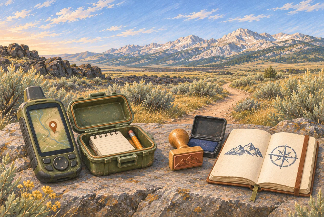
Letterboxing is older and deliberately less digital. You follow a written clue, sometimes with a compass, to a weatherproof box that holds a unique rubber stamp and a logbook. You carry your own personal signature stamp and your own logbook: you stamp the box’s logbook with your stamp, then stamp your own book with the box’s stamp, and the box’s stamp goes back inside. Atlas Quest describes it as an artistic treasure hunt in parks and forests, with the stamps often hand-carved by their owners, and it hosts tutorials on carving, stamping, logbook making, compass work and clue writing. What you collect is impressions in your own book, not objects.
A letterbox hybrid is the bridge, and it is what you will actually find on a geocaching map near Arco: a geocache that also holds a rubber stamp and letterboxing instructions alongside the log. The stamp is part of the cache and has to stay inside it. The one strong local example is Arco Hills MOLE’s Final Redux, GCB4152, a letterbox hybrid in the hills above town placed in November 2024, rated difficulty 2 and terrain 2, which logs the same way whether you treat it as a letterbox, as a geocache or as both at once.
Three platforms carry the inventory, and you need to know which one you are looking at. Geocaching.com holds the traditional, multi, mystery, EarthCache, virtual, Wherigo and letterbox-hybrid listings and is where nearly all Arco-area activity lives. Atlas Quest is the main letterboxing site, and it now requires a free account to view many clues and message-board material: registration takes a trail name and a password and no email address. Letterboxing North America is the second letterboxing database. Both letterboxing sites are account-gated or clue-interpreted enough that you cannot treat a search-result page as a live status report.
Start in town: downtown Arco and the Arco Hills
Arco itself is the right place to start if you have not cached in this country before, because it needs no high-clearance vehicle, no long drive and no park itinerary. Town finds sit near paved roads, fuel, food and short walks, the searches are quick, and there is local history in the reason most of them are hidden. The verified anchor is Arco Hills MOLE’s Final Redux, GCB4152: a letterbox hybrid, difficulty 2 and terrain 2, with a stamp inside that must go back inside. Pair it with a walk on Grand Avenue and a lawful view of Number Hill and you have a one-hour outing that touches both hobbies.
Urban and roadside caches carry risks that wilderness caches do not, mostly because other people are watching. Do not block a business entrance. Do not dismantle, open or lean on utility equipment. Do not step into a private yard. Be conspicuously uninteresting near government buildings, schools, laboratories and infrastructure, because crouching at a fence line with a phone in your hand reads badly on any camera. Use discretion around anyone who is not playing: the honest answer to a passing question is that you are looking for a small container with a log in it, which is funnier and less alarming than looking like you are checking a window latch. Put the container back exactly as you found it, closed, camouflaged and in the same orientation, and never describe the hiding place in public.
[!WARNING] Number Hill is a landmark, not a trailhead. A cache listing near it is not a reason to climb it or to cross uncertain property. Treat access to Number Hill exactly as the dedicated guide describes it, and view it from a lawful public location.
For town work, carry a phone with the app, a pen, a small flashlight, tweezers for a log that has swollen shut, gloves, water, sun protection and a reflective vest if any of the finds sit on a roadside. Screenshots of the listings are fine within the platform’s rules and cost nothing to carry.
Craters of the Moon: EarthCaches instead of containers
The monument is the most distinctive caching near Arco, and it works differently from anywhere else on this list. EarthCaches here hold no box: the task is to read the volcanic landscape at published stops and log your observations through the listing. Nothing gets hidden, buried or attached to anything, which is exactly why the National Park Service tolerates the activity at all. Do not look for a physical container in the monument, do not hide one and do not search for an unapproved one.
Lava Tubes, GC4NX9B, is the one to plan on. It runs along the paved Caves Trail, roughly 0.8 miles each way, with several observation stops on how lava tubes form and what the volcanic geology shows. Its listing states that entering a cave is not required to finish the EarthCache, and that is the sensible reading: cave entry means a free permit collected at the visitor center and only when the caves are open. Treat the hours, seasonal wording and fee figures printed inside the listing as out of date, which they usually are, and drive on current park conditions and current park fees instead.
Spatter Cones, GC7EAC5, asks you to compare volcanic formations and observe the size, shape and structure of the cinder. Its listing warns about summer heat, keeps bikes and pets off the trail and asks for Leave No Trace practice. Inferno Cone, GC4FZKB, is a short but steep climb of roughly half a mile round trip, with the geological observations made from the summit and a firm instruction to stay on the established trail. It also quotes an old entrance fee; do not repeat that number to anyone, use the park’s fee page. NPS – Craters of the Moon, GC9MK4P, is a Wherigo marked for Premium members: public search information shows difficulty 1 and terrain 1.5, and the cartridge content belongs to the paying members, so it is not reproduced anywhere here. Idaho Spud Art #2 – Craters of the Moon, GC9WYGD, is a small mystery cache tied to a 40-cache Idaho Spud Art power trail; read it as part of a regional route rather than as a box sitting in the developed monument trail system, and its own note that winter snow can make area roads impassable is the same warning the winter activities guide gives for the whole valley. Craters of the Moon National Monument, GCH0QX, is a multi-stage virtual cache with observation locations spread across the monument, and like the EarthCaches it carries obsolete fee and visitor-center detail. The one listing to leave alone is Craters of the Moon National Monument, GC10F0Y: it has been archived for lack of owner maintenance and is not an available find.
The monument rules apply to every one of these and they are not suggestions. Begin at the Robert Limbert Visitor Center. Stay on designated trails, which in the Spatter Cones and Big Craters area is a regulation rather than advice. Move no lava: the rope pahoehoe and squeeze-up features are fragile and a bootprint lasts for centuries. Enter no closed cave. Get the permit when a cave is open and you intend to go in. Keep EarthCache answers out of your public log. Check the Loop Road and visitor-center access before driving, download the NPS app for offline use, and never plan park operations off a cache page.
The Arco Desert: multi-caches, cache art and mud
West and north of town, BLM desert ground holds the route-based caching: multi-caches, mysteries, cache art and series that group a dozen finds into one drive. 3 Multi Road, GC5EQKX is the representative one, a two-stage multi inside a larger Arco Desert collection. Its listing strongly recommends four-wheel drive or high clearance, tells you not to leave the road with a vehicle, and warns against going out when the ground is wet because vehicles damage the road and end up stuck. Nothing about that is unusual for desert caching anywhere; it is just that here the ground is volcanic ash and sagebrush flats that turn to grease.
The practical rule for all of it is short: if the road is wet enough to rut, turn around. Do not drive around mud holes, do not drive around snowdrifts, do not drive around gates, and do not drive around washouts or closures. Another vehicle’s tracks are not evidence that access is legal or responsible, only evidence that someone else took the same gamble. A cache sitting close to a road does not authorise leaving the road for it, and cross-country driving is not permitted by any listing on any platform.
A desert cache day is a vehicle-support trip with a hobby attached. Bring a high-clearance vehicle where the listing attributes justify it, a full tank, a full-size spare, a plug kit, an air compressor, a shovel and a recovery strap. Carry a dedicated GPS or a phone with the map already downloaded, plus the current BLM travel map for the area. Carry water beyond what you think you need, food, warm layers even in summer, sun protection, a first-aid kit, a headlamp and a satellite communicator if you have one, because large parts of this country have no cell coverage at all. A big cache series consumes far more daylight and fuel than the count of caches suggests: plan a turnaround time before you leave town and hold it.
Mackay, the Lost River Valley and the highway corridor
Mackay and the valley to the north suit anyone combining caching with the Mackay Mine Hill tour, the reservoir, the Big Lost River or the mining history. Another Mackay Multi-Cache UV, GC9AW0G, is a Premium-member multi whose public information shows difficulty 1.5, terrain 1.5 and a small container; the stages sit behind the paywall and are not repeated here. Farther north, Maria’s Chilly Slough, GC3CQ40, is an easy park-and-grab on US-93 between Mackay and Challis whose listing ties the spot to the former settlement of Chilly and an old freight-stage stop. It is well outside the Arco area but it is a good corridor find for anyone running the valley toward the Salmon River.
Caching around Mine Hill means respecting the same constraints the mining guide sets out: BLM travel designations, closed mines, unstable structures, open shafts, private property, vehicle classification and seasonal road condition. A listing is never authority to enter a mine, a tunnel, a timber structure, a tramway or anything behind a fence, and the ground around old workings fails without warning.
The highway network supports a lot of casual caching: US-20/26/93 through Arco and out to the monument, US-93 north to Mackay and Challis, the Carey–Craters–Arco corridor, the roads toward EBR-I and Idaho Falls, and public backcountry roads where your vehicle class is legal. Roadside caching is where people get killed, so treat it as the dangerous category it is. Pull completely out of the travel lane. Never stop on a blind curve or a hill crest. Do not stop on a shoulder unless it is lawful and genuinely safe. Never cross high-speed traffic for a container. Keep children in the vehicle until you have looked at the area. Wear something reflective in low light. Do not open gates, do not enter restricted federal property, and do not park across a ranch or emergency access.
[!WARNING] EBR-I is a public visitor site; the Idaho National Laboratory around it is controlled federal property. A cache application is not a route planner through that landscape. Do not use one to enter INL roads, approach a security boundary, take an apparent shortcut, search near restricted infrastructure, fly a drone or retrieve anything from controlled land.
Traditional letterboxing near Arco, and why the list is thin
Honest answer: traditional letterboxing around Arco is much thinner than geocaching, and the honest way to use it is as a search you run yourself rather than a list we hand you. The three places to look are Atlas Quest, Letterboxing North America and the letterbox-hybrid category on Geocaching.com. Atlas Quest needs the free account before it will show many clues. Letterboxing North America does return Idaho results in searches, but public result pages in this region have not carried enough destination, status and maintenance information to identify any of them reliably as a current Arco-area box, so naming one here would be guessing at something that may have been stolen from a trailside in 2019.
That is the structural problem with letterboxing inventories. A box can stay listed long after it is gone: the container is lost or waterlogged, the stamp is stolen, the trail is rerouted or closed, the owner goes inactive, the host site changes hands, or the land manager removes it. On a geocaching map you get one query and a status field; letterboxing clues live across several platforms and often need interpretation rather than a coordinate, so the gap between listing and reality is wider.
The workable approach for a visitor is to search Atlas Quest for Arco, then widen the radius to Moore, Mackay, Carey and Craters of the Moon, then search Letterboxing North America separately rather than assuming one site covers the other, then read the most recent find logs on anything you intend to drive to. Check that the clue is active, confirm the land manager allows it, and include letterbox hybrids in the Geocaching.com search, since in this region the hybrids are where the stamp tradition actually survives. Do not plant anything anywhere without authorisation.
Could Arco support a letterboxing trail of its own?
Local letterboxing has an obvious thematic foundation here, and four of them. An atomic-history trail could run the four lightbulbs, EBR-I, the BORAX-III reactor and Atomic City with stamps built on historic energy symbols. A graduation trail could use Number Hill typography, the Butte County school history, the hill’s silhouette and a community timeline. A lava trail could stamp rope pahoehoe, block ‘a‘ā, cinder cone, lava tube and sagebrush. A Lost River Valley trail could stamp Mount Borah, Mackay mining, the Big Lost River, pronghorn, the gliders on King Mountain and Natural Arch. Each of those ideas, though, runs into a permission problem before it reaches a carving knife: nothing goes on Idaho National Laboratory or EBR-I property without written authorisation, nothing goes on Number Hill without confirmed ownership and permission, and nothing goes inside Craters of the Moon without National Park Service approval.
The version that actually works in a town this size does not bury anything in wilderness at all. Clue-based stamps hosted by participating local businesses, a printed passport card, and a completion stamp kept at the bar give visitors a trail with a story, and they remove every hard problem at once: no remote container to maintain, no private-property ambiguity, no conflict with park policy, no vehicle-recovery call because someone followed a clue into a mud flat. Before anyone builds it, the non-negotiables are written permission from every host, weatherproof containers wherever a box sits outdoors, no placement at infrastructure or utility locations, published host hours, one named person responsible for maintenance, a completion stamp available to daytime participants without any purchase required, and a route that does not put children into a bar during adult operating hours.
Etiquette: signing, trading, trackables and spoilers
Sign the log with your geocaching name and the date unless the listing asks for something different. At a letterbox hybrid, stamp the hidden logbook with your personal stamp if you want to, stamp your own book with the box’s stamp, put the box’s stamp back inside, then sign the standard log. That is the whole ritual and it takes under a minute.
Trade only where the container is built for trade, and trade equal or greater value. Leave no food, no alcohol, no ammunition, no knives, no medication, nothing dangerous and nothing adult. Never treat a letterbox stamp as swag. A trackable is not a souvenir either: it is an object with a goal attached, and you should take one only if you intend to log it, follow its stated goal, move it on within a reasonable time and place it in a suitable cache. When you finish with a physical cache it goes back to the same exact spot, lid closed, camouflage restored, not moved somewhere you think is better and not re-hidden so cleverly that the next finder gives up.
Spoilers are the part of etiquette that gets people banned. Keep final coordinates, decrypted hints, descriptions of the hiding structure, puzzle solutions, EarthCache answers, photographs that show a hiding place and Premium-only instructions out of your logs and out of any article, including this one. If access does not match the listing, say so through the platform with a needs-maintenance or needs-archived log instead of forcing the find.
Kit by terrain, because the difference between a town find and a desert find is mostly what is in the pack. Town and roadside: phone with the app, pen, small flashlight, tweezers, gloves, water, sun protection, reflective vest, downloaded listings. Desert: all of that plus dedicated GPS, offline BLM map, high clearance when the attributes call for it, full-size spare, plug kit, air compressor, shovel, recovery strap, extra water, food, headlamp, warm layers and a satellite communicator. Craters EarthCaches: park map, water, proper footwear, sun protection, a current cave permit only if you intend to enter an open cave, and answers written down privately rather than posted. Letterboxing: personal stamp, personal logbook, ink pad, pen, compass, printed or offline clue, and a small towel for drying a damp container. The hidden stamp never comes home with you.
Permission: who actually says you can be there
Geocaching.com itself requires the landowner’s permission before a cache is placed, and that requirement is the reason most listings around here sit where they do. On National Park Service land the caution is greater: Craters of the Moon is managed under the same authority as a national park, and the practical rules are to use approved published listings only, place nothing yourself, bury nothing, hide nothing in a cave, create no new route, move no lava and collect no natural material. Atlas Quest’s own guidance on land managers says the same thing from the letterboxing side: boxes do not get planted on managed land without approval, and national monuments count as managed land.
Forest Service and BLM ground is looser but not unrestricted. Placing a cache there can still require notice or permission from the district, compliance with local rules, avoidance of archaeological sites, avoidance of mines, avoidance of designated wilderness, compliance with the route designation for your vehicle, and a commitment to maintain the container and remove it when you stop caring about it. A cache that has gone to pieces in a remote area is litter with a logbook in it.
Private property beats a public listing every time, and there is no version of this where that changes. Do not cross a fence, enter a field, walk around a locked gate, search a yard, open a utility cabinet, enter a mine, move equipment or ignore a no-trespassing sign. Ranch country in the Lost River Valley is working land, and the Big Lost and the roads along it are frequently either private or claimed.
One housekeeping note about how we handle this on the Club Sawtooth Explore Map. Individual caches are not mapped as permanent pins, because availability changes faster than we can maintain it and a stale pin sends people to an empty tree. The map shows activity areas instead: the Arco search area, the Arco Hills hybrid area, the Craters EarthCache area, the Arco Desert series, the Idaho Spud Art region, the Mackay area and the Big Lost River corridor, each carrying the terrain, road, seasonal and land-manager warnings and a link to the live platform search. The live map is the authority on any given container, always.
Safety in this country, and four outings that fit a day
The hazards are the ordinary high-desert ones and they are all avoidable. Heat is first: black lava and sagebrush flats run dangerously hot in July and August, so carry more water than feels necessary and do not commit to a long power trail in midday sun. Mud and snow are second, and they close desert roads for months at a time on no schedule. Caves are third: archived cache pages still describe cave approaches and old access routes, as the retired Minidoka/Arco Road and Clay Caves listings do, and no archived page is an access guide. Any cave entry needs verified legal access, a land-manager check, a helmet, several independent light sources per person, proper footwear, a group, a turnaround plan and white-nose-syndrome decontamination compliance where it applies. Mines are fourth and the rule is absolute: never enter one because a cache sits near it. Hunting season is fifth: wear visible colour in the fall and check what is open in the units you are standing in. Wildlife is sixth: rattlesnakes, livestock, deer, elk, pronghorn, insects and, in mountain country, larger animals with fewer options about moving. Cell coverage is seventh and it is the reason to download listings, maps, route information, land ownership, weather and emergency contacts before leaving town. A phone with no signal is a camera.
One hour in Arco: search the live Arco map, pick one or two town-accessible caches, add the letterbox hybrid if it shows active, take a lawful look at Number Hill, walk downtown, and finish at the bar later in the evening if it suits.
A half day at Craters: start at the visitor center, check current road and cave access, complete one or two active EarthCaches on marked trails, write your answers down privately rather than in the public log, and drive back to Arco.
A day in the Arco Desert: check weather and road moisture first, take the high-clearance vehicle the listings call for, download everything, set a turnaround time, stay on the roads, leave the moment rain threatens and be back before dark.
A Mackay run: search active listings around town, do the easy town or highway find, walk the BLM-approved Mine Hill route if conditions allow, keep clear of every opening and structure, and head south before you are committed to a night drive.
Frequently asked questions
Is there actually geocaching near Arco, Idaho?
Yes, and in four distinct settings: town and Arco Hills finds, Craters of the Moon EarthCaches and virtual listings, route-based multi-caches and cache art in the Arco Desert, and scattered finds around Mackay and up US-93 toward Challis. Cache status changes constantly, so the live Geocaching.com map is the only authority on a specific container. Verified local listings worth building a plan around include the letterbox hybrid GCB4152 above Arco, the EarthCaches GC4NX9B, GC7EAC5 and GC4FZKB in the monument, and the two-stage desert multi GC5EQKX.
Can you geocache at Craters of the Moon?
Through approved published listings: EarthCaches such as Lava Tubes, Spatter Cones and Inferno Cone, a multi-stage virtual cache, and a Premium Wherigo. EarthCaches there hold no physical container, which is why they are permitted. Placing your own container, burying anything, hiding anything in a cave, moving lava, collecting natural material or searching off-trail are all out of the question on National Park Service land. See the Craters of the Moon visitor guide for the park rules and current conditions.
Do I need a cave permit to finish the Lava Tubes EarthCache?
No. The Lava Tubes EarthCache listing makes clear that entering a cave is not required to complete it; the observations are made along the paved Caves Trail and at its stops. If you decide to go into a cave that is open, the National Park Service requires a free permit collected in person at the Robert Limbert Visitor Center under its cave-management programme, and caves that are closed to protect bats or for safety stay closed regardless of what an old cache page describes.
Is there a letterbox near Arco, and can I take its stamp?
There is one verified letterbox hybrid on Geocaching.com, Arco Hills MOLE’s Final Redux, GCB4152, placed in November 2024 at difficulty 2 and terrain 2. Traditional Atlas Quest and Letterboxing North America inventory in this region is thin and hard to verify from public pages, so search both platforms yourself, widen the radius to Moore, Mackay, Carey and the monument, and read the latest find logs before driving anywhere. And no: the rubber stamp inside belongs to the box, must be used in your own logbook and must go back inside. It is not trade item and not a souvenir.
Do I need four-wheel drive, and can I drive off road to reach a cache?
Not for every cache, but the Arco Desert listings that sit on remote dirt roads often recommend high clearance or four-wheel drive, and 3 Multi Road, GC5EQKX explicitly recommends it and forbids leaving the road. Read each listing’s attributes and recent logs rather than assuming. And a cache never authorises cross-country driving: stay on roads open to your vehicle class, and if the ground is wet enough to rut, turn around. Rutting volcanic ash and ash flats leaves damage that lasts decades and it is the fastest way to get a route closed to everyone.
Can I hide a geocache or place a letterbox near Arco?
Only with the landowner’s or land manager’s permission, and Geocaching.com requires that permission before placement. Forest Service and BLM ground may also require notice to the district, avoidance of archaeological sites, mines and designated wilderness, and compliance with travel designations, plus ongoing maintenance and removal when you stop maintaining it. Inside Craters of the Moon nothing is placed without National Park Service approval, and that includes a hand-carved letterbox stamp in a jar. On private land, nothing at all without the owner.
Sources and updates
Check current access, hours and conditions before setting out.