Grand Avenue Field Notes
Craters of the Moon from Arco: trails, caves, camping and stargazing
Craters of the Moon National Monument & Preserve is the unmistakable day trip from Arco: cinder cones, lava flows and a paved scenic loop through a landscape unlike the rest of Idaho. Rather than following a map pin into the backcountry, start at the Robert Limbert Visitor Center on the main highway and build your visit around what is actually open.
Jump to trip essentials- Region
- Southwest of Arco
- Season
- Year-round; seasonal access
- Category
- Craters and lava

Before you go
- Entrance is about 18 miles southwest of Arco on US-20/26/93.
- Check Loop Road and cave status; cave permits are in person when caves are open.
- Carry water, save maps offline and stay on designated routes.
Official visitor entrance
Robert Limbert Visitor Center, 1266 Craters Loop Road, Arco, ID 83213.
View on OpenStreetMapStart at the visitor center, not a back road
The National Park Service places the park entrance about 18 miles southwest of Arco on US-20/26/93. Set navigation to the Robert Limbert Visitor Center, because some map apps suggest unpaved approaches into remote parts of the preserve. Staff and current-condition notices can tell you whether the seven-mile Loop Road, trails and caves are accessible that day.
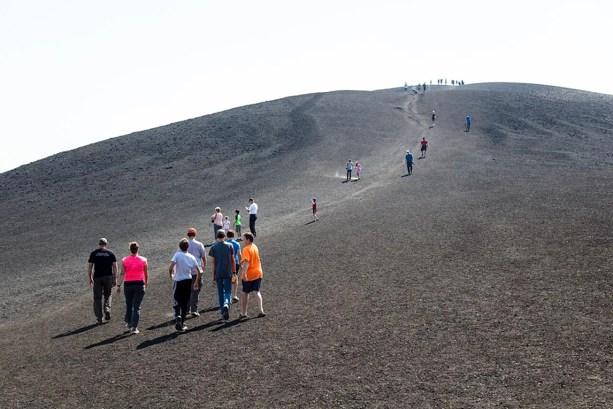
When the loop is open, stop for the North Crater Flow, the short but steep climb up Inferno Cone and the contrasting shapes along Devil’s Orchard. You do not have to do everything to have a good visit. Bring water and sun protection; NPS says drinking water is available at the visitor center, not along the loop.
A landscape made by the Great Rift
This is not one volcano with one crater. Eruptions along the Great Rift over thousands of years built the cinder cones, spatter cones, lava tubes and flows you can see from the road. The most recent eruptive period ended roughly 2,000 years ago. That is young in geological terms, but it does not mean you are driving through an active eruption.
Look at the ground along North Crater Flow: smoother, sometimes ropy pāhoehoe sits near jagged, broken ‘a‘ā. Both tell you something about how the lava moved and cooled. Even apparently solid black crust can be hollow and easily broken. Stay on the marked surface rather than climbing over it for a photo; the landscape keeps the footprints and damage long after the visitor has gone.
Make the seven-mile Loop Road fit your schedule
The paved Loop Road connects the developed viewpoints and trailheads when vehicle access is open. A drive with a couple of short walks can fill one or two hours; add Inferno Cone and a longer trail and you have a half-day; caves, photography and several hikes can turn it into a full day. The road’s length is not a measure of how long a visit takes. Ask at the visitor center what is accessible and whether you need a turnaround time before sunset.
For a first visit, try North Crater Flow and Devils Orchard, then decide whether the steep cinder climb at Inferno Cone suits the weather and the group. Spatter Cones and Big Craters make a good next stop. Caves need their own permit and extra time, so do not count them as a guaranteed roadside add-on. In winter the loop may be closed to vehicles even when the park entrance is open; check current conditions instead of using last year’s opening dates.
Do not count on caves being open
The park requires a free in-person permit at the visitor center for lava tube caves when they are open. Cave openings and seasonal road access change; some caves are permanently closed to protect bats. Check the NPS current-conditions page before you leave, not an old itinerary or a social-media photo. A cave closure still leaves plenty of aboveground lava scenery.
Cell coverage inside the park is limited. Save the NPS map offline, take the marked trails and plan enough time to be back on the paved road before your next stop. Look at road and weather conditions, especially outside summer.
Pick a walk that fits the day
North Crater Flow is a good introduction to the lava without committing to a long hike. Devils Orchard is another short stop with a different look at the same volcanic country. For a climb, Inferno Cone trades a steep cinder slope for a wide view across the flows. Spatter Cones and Big Craters put you close to the features that gave this landscape its shape. Trail surfaces, grades and exposure vary: choose from the current park map and ask at the visitor center what is open.
If you have more time, look at Broken Top, Tree Molds or the Wilderness Trail rather than trying to squeeze every pullout into one rushed loop. The black ground absorbs sun, shade is scarce and water is not available at the trailheads. Carry your own supply, take breaks and stay on signed routes; a tempting shortcut over fractured lava can be harder and more damaging than it looks.
Which trail is right for you?
Short walks and a steep little summit
North Crater Flow is roughly a quarter mile of paved, exposed trail and a fine first look at the lava. Devils Orchard is a roughly half-mile interpretive walk the park describes as wheelchair accessible; Spatter Cones has a short accessible route to look into the vents. Inferno Cone is only about half a mile round trip but climbs steeply through loose cinders without shade. Skip the summit when wind, heat or thunder make the climb a bad trade.
When you have a few hours
Broken Top Loop is roughly 1.8 miles around a cinder cone, while the Tree Molds route is about two miles round trip to impressions left where lava surrounded trees. The longer North Crater Trail is about 3.5 miles between trailheads, so confirm whether your party needs a shuttle or must retrace the route. The Big Craters spur is short but steeper than it looks. Distances and accessibility can change with trail work or closures; confirm the current park map before setting out.
When the backcountry is the destination
The Wilderness Trail leads away from the developed loop toward the Lava Trees; it is roughly four miles to that feature, not a quick paved stroll. Shade, water, cell service and obvious route markers fall away fast. Overnight wilderness travel requires a free permit, and the park has additional rules for its North End. Ask staff about current permits and route conditions, then treat this as a separate hike rather than one last stop before driving home.
Lava tubes are a separate trip plan
Indian Tunnel and Dewdrop Cave are among the caves visitors ask about, but never assume either will be accessible when you arrive. A free cave permit must be obtained in person at the visitor center when caves are open. Bat-protection closures, weather and staffing can change which caves are available. Ask about the rules before you head down the loop.
Cave travel is not like a paved museum corridor. Bring a reliable light for each person, wear shoes that grip uneven rock and dress for a cooler interior. Leave the formations and everything else where you found them. If the caves are closed or your group is not comfortable underground, the surface trails still make a full visit.
The cave permit is also a bat-protection check
Indian Tunnel has sections where daylight enters through openings in the roof, but it still requires scrambling over rough rock; Dewdrop Cave is smaller and can feel tighter. Being listed as open means a cave can be entered with a permit, not that every visitor will be comfortable inside. Take a helmet, boots with traction, a headlamp and a backup light. A phone flashlight is not enough. Turn around if ice, lighting, footing or anyone in the group makes the visit unsafe.
The visitor-center screening protects bats from white-nose syndrome. Under the park’s current cave policy, clothing and equipment that have been in another cave, mine or underground space cannot be brought into these caves even if cleaned. That includes items you might not think about, such as a camera, shoes or a flashlight. Ask staff about the current rule before packing, and do not enter a closed opening even if you can see a way in.
Camp among the lava, not on an assumption
Lava Flow Campground is the developed option inside the park, near the visitor center and loop entrance. Its vehicle season, registration procedure, fee, water and restroom availability can change. Check the National Park Service camping information alongside current conditions before relying on a site, and bring your own drinking water rather than betting the evening on a seasonal tap.
Wood fires are not permitted in the campground; charcoal in provided grills depends on current fire restrictions. Winter camping and wilderness overnights have different access and permit requirements, and a site reachable on foot is not necessarily serviced or cleared of snow. If a campground with different facilities is a better fit, compare the camping and RV options around Arco before leaving town.
Stay for the stars if you can get home safely
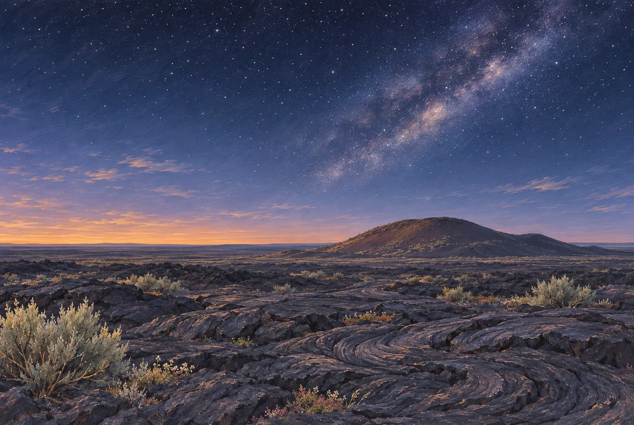
Craters of the Moon has been an International Dark Sky Park since 2017. A moonless night brings out faint stars, while a brighter moon picks out the shapes of cinder cones and lava for photographs. Decide which experience you want, check the forecast and confirm where you may legally park after dark. A red-light headlamp, warm layers, an offline map and a little patience beat stumbling across broken lava to chase a photograph.
The best stargazing plan starts while it is still light: learn the route back to your car, stay on a developed viewing surface and confirm road access before the visitor center closes. If you are not camping, allow for the dark drive back to Arco with an alert driver. See our stargazing near Arco guide for more ideas beyond the monument.
Winter is a different kind of Craters trip
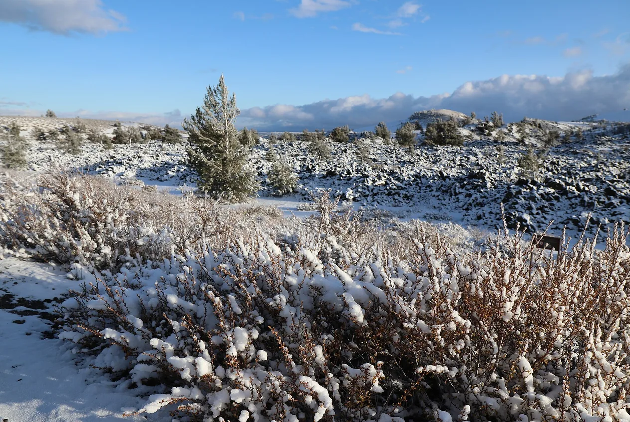
A snowy Loop Road may suit snowshoeing or cross-country skiing, but a road closed to vehicles stays closed to vehicles. The entrance and the developed loop do not share one guaranteed year-round schedule. Snow can hide the edges of sharp lava, and cave openings are not a winter shortcut around a closed road. Ask the National Park Service about current routes, permits and services before making the drive.
Bring layers, water and equipment for the actual weather, not the forecast in downtown Arco. For other cold-season outings, see the winter activities near Arco guide. If road or weather conditions say no, Number Hill and town are still here tomorrow.

Accessibility and simple rules worth remembering
Devils Orchard is listed by the park as a wheelchair-accessible trail, and Spatter Cones has a short accessible route. North Crater Flow is paved but narrow and exposed in places. Facilities, surfaces and parking can change with weather or maintenance; ask the visitor center about your specific access needs rather than relying on a generic “easy” rating.
Pets are not permitted on park trails or in the backcountry. Keep all lava, rocks and plants where they are; use designated routes, and do not drive around a closure gate. The real way to see more of this park is to leave it intact for the next person. For another landscape on the same trip, look at Number Hill in Arco or Wild Rose Hot Springs near Carey only if its uncertain access has been confirmed.
Let the lava day end in Arco
Drive the same highway back into town and stop at Number Hill or the historic EBR-I museum if your timing allows. Once the sightseeing and driving are over, Club Sawtooth at 156 W Grand Ave is a natural place to cool off, compare photos and pick the next song. Four electronic dartboards offer Remote Play and compatible tournaments; there is pool, foosball, an AMI jukebox and Mortal Kombat 4 too. Park before ordering a drink and let a sober driver handle the trip home.
Frequently asked questions
How far is Craters of the Moon from Arco?
The Robert Limbert Visitor Center and developed park entrance are approximately 18 miles southwest of Arco on US-20/26/93. Navigate to the visitor center, not a remote backcountry pin.
How long should I spend at Craters of the Moon?
Allow one or two hours for a few short walks and the Loop Road when open. Add a half-day for a longer trail; a cave visit requires extra time and a free in-person permit when caves are open.
Can I enter the caves?
Only if the cave is currently listed as open and you obtain a free in-person permit at the visitor center. The park also screens equipment used in other caves or mines to protect bats. Check current conditions before making caves the point of your trip.
Can I camp and stargaze inside the park?
Lava Flow Campground operates according to road and weather conditions. The monument is an International Dark Sky Park, but access after dark, campground registration and services should be checked with the National Park Service before arrival.
Is the Loop Road open in winter?
The park entrance may be accessible while the seven-mile Loop Road is closed to vehicles by snow. Conditions can permit skiing or snowshoeing, but do not drive past a closure and verify current access before leaving Arco.
Can I bring my dog on the trails?
No. Pets are not permitted on the park trails or in the backcountry. Check the National Park Service pet rules before arriving and do not assume that a trail is an exception.
Sources and updates
Check current access, hours and conditions before setting out.