Grand Avenue Field Notes
Winter activities near Arco: snowshoeing, skiing, ice fishing and snowmobiling
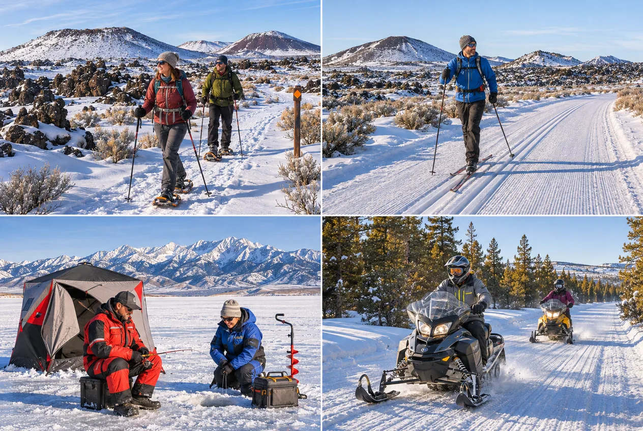
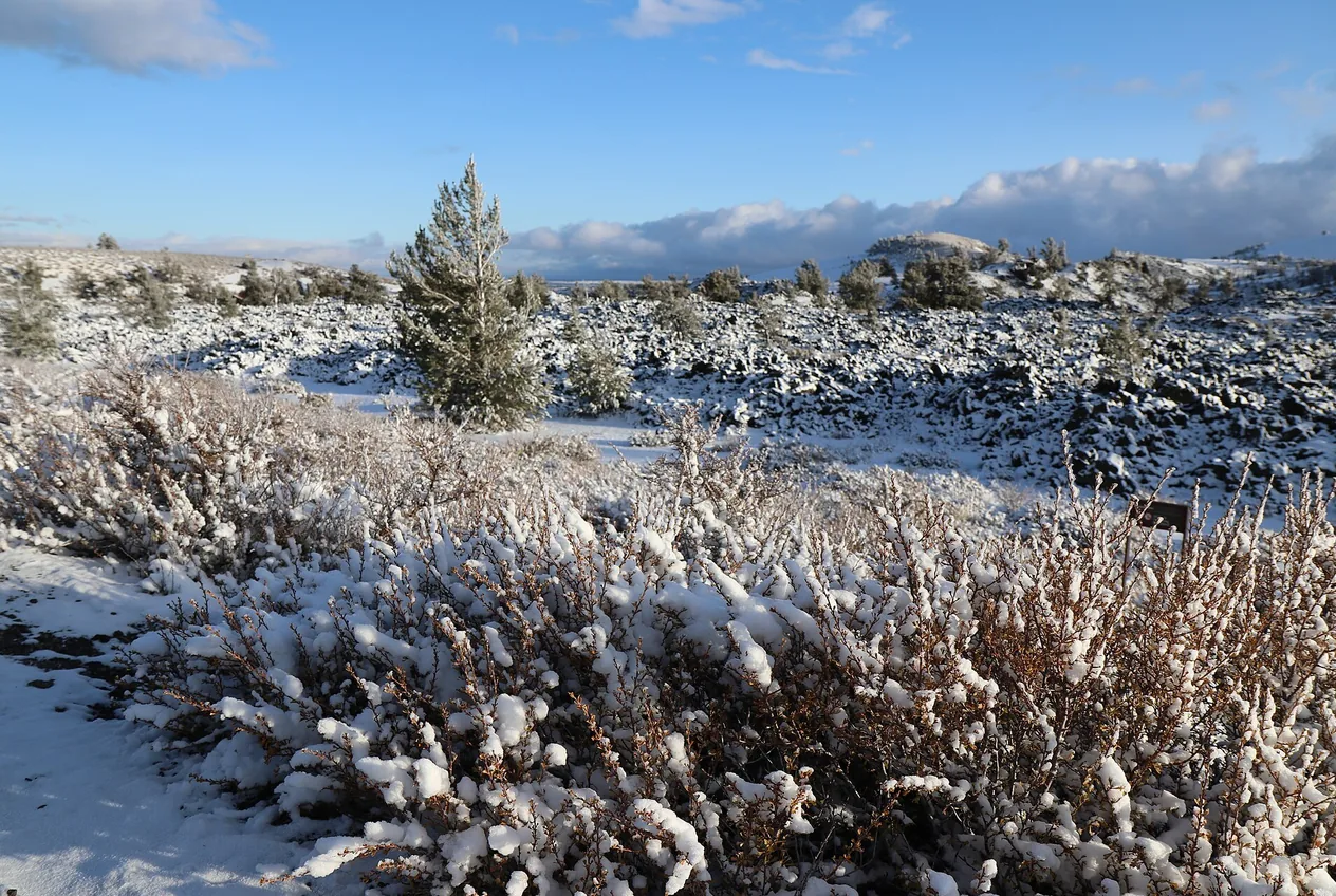
Winter rewrites the country around Arco. Snow fills the open sagebrush, outlines the black lava flows and turns the Lost River Range into a wall of white above the valley. Craters of the Moon becomes less accessible by vehicle, and the Loop Road offers a ski route when snow and winter grooming allow. Mackay Reservoir becomes an ice-fishing destination when the ice supports travel, and the forest roads around Arco Pass, Copper Basin, Pass Creek and the North Fork of the Big Lost become snowmobile corridors. The same cold that gives clear skies and firm snow also produces frostbite, dead batteries, whiteouts, thin reservoir ice and delayed emergency response, so a winter trip here starts with conditions, not with an itinerary.
Jump to trip essentials- Region
- Craters of the Moon, Mackay Reservoir and the Lost River Region
- Season
- December through March, decided by snow, ice and road conditions rather than by calendar
- Category
- Winter
Before you go
- Craters of the Moon is open year-round, but the Loop Road closes to motor vehicles for the season and becomes a winter route for cross-country skiing and snowshoeing. The park marks a one-mile snowshoe-only trail near the visitor center and grooms the Loop Road when snow and operations allow.
- Idaho Fish and Game gives three to four inches of clear, solid ice as the minimum for one person on foot and 10 inches for an ATV or snowmobile, and says Idaho reservoirs generally do not develop ice thick enough for routine car or truck travel.
- Every snowmobile operated in Idaho generally needs an Idaho certificate of number, required from November 1 of each season. Idaho Parks and Recreation lists one-year fees of $45.50 for residents and $59.50 for nonresidents, with rental machines at $75.50; nonresidents are not exempt.
- Grooming does not happen on a schedule. Idaho Parks and Recreation grooms only when equipment and operator safety allow, when the parking lot holds at least 18 inches of snow, when avalanche conditions do not endanger the operator and when temperatures sit between -20°F and 40°F.
- Winter daylight is short and travel is slow. A route that takes two hours in summer can take far longer in deep snow, wind crust or drifted roads, so set a turnaround time before leaving town and carry a headlamp even for a morning outing.
- The main highways here climb: US-20/26/93 toward Craters and Carey over Tom Cat Summit, and US-93 north toward Mackay and Challis over Willow Creek Summit. Check Idaho 511 for closures, cameras and mountain-pass status, and do not rely on consumer navigation alone.
Official visitor entrance
Robert Limbert Visitor Center at Craters of the Moon, about 18 miles southwest of Arco on US-20/26/93.
View on OpenStreetMapConditions decide the trip, so check them in Arco first
Everything on this page is subordinate to a conditions check on the morning of the trip. Before leaving Arco, look at the Craters of the Moon current conditions page, Idaho 511 for closures, cameras and mountain-pass status, the Salmon–Challis winter sports page for route and grooming status, reservoir ice information for Mackay and the avalanche forecast for the Lost River, Pioneer and surrounding ranges. None of those can be checked reliably from the trail: much of this country has no cellular coverage, so save the pages and download the maps offline while you still have signal.
The reason for the fuss is that winter here does not fail gradually. The same cold that produces clear skies and firm, sculpted snow also produces frostbite in exposed skin, hypothermia in a group that stopped moving, dead vehicle batteries, frozen water bottles, whiteouts that erase the route, weak reservoir ice, avalanche exposure, road closures that appear overnight, ten hours of usable daylight instead of fifteen, and an emergency response time measured in hours rather than minutes once you are off a maintained road.
A fixed itinerary is the wrong tool for these months. Decide the destination after the conditions check, not before, and give the day two or three ranked options so that a closed road or a wind warning sends you to the next plan rather than into a gamble. A route that takes two hours in summer can take far longer in deep snow, wind crust, drifted roads or a mechanical delay, so build that margin into the turnaround time you set before leaving town, and carry a headlamp even for an outing planned entirely in daylight.
Snowshoeing and cross-country skiing at Craters of the Moon
The Robert Limbert Visitor Center sits about 18 miles southwest of Arco on US-20/26/93, and the monument stays open all year, but the Loop Road does not. The park runs the road to motor vehicles from roughly mid-April through late November as conditions allow, and once it closes for the season the pavement and cinder surface stay open to nonmotorised travel: it becomes the cross-country skiing and snowshoeing route, with the several possible turnaround points and lava-field and cinder-cone views that made it a scenic drive.
For a first outing, the park marks a one-mile snowshoe-only trail near the visitor center. It suits visitors who are new to snowshoeing, testing equipment, short on time, or who want a marked route close to the building rather than a full Loop Road traverse. A marked route is not a promise of easy travel: snow depth, wind, drifting and temperature change how hard that mile feels, and the same variety applies across the monument. The park reports that average February snow depth can run from about 26 inches at the north end down to around two inches at the south end, so a reading taken at the visitor center, at a highway camera or in Arco itself does not describe the whole monument.
Snowshoes are the one item the park can help with: when the visitor center is open and stock allows, they are available through the Craters of the Moon Natural History Association for a suggested donation. Skiers bring their own equipment. The reason the park pushes snowshoes rather than boots is postholing, where each step breaks through into the snow below. Postholing exhausts people, wrecks a set groomed ski track, leaves trip hazards for whoever follows, doubles the return trip and contributes to cold injury once wet clothing stops insulating. Walking directly in the parallel ski tracks does the same damage from the other direction, so snowshoers stay out of them.
The park grooms the Loop Road for classic cross-country skiing and snowshoeing when there is enough snow and operations allow, which is a conditions statement rather than a calendar date. The route itself is rolling, exposed, largely unsheltered and entirely free of vehicle traffic once the gate is closed, which makes it scenic and hard at once: the full outing is significantly more demanding than the visitor-center loop. Etiquette in a shared groomed track is small but load-bearing: skiers use the parallel tracks, snowshoers stay out of them, faster users announce a pass, downhill users need room to control speed, stops happen outside the track and a group does not stand across the full groomed width. Backcountry touring gear can be the better choice when the road is ungroomed or drifted, but no equipment substitutes for route and weather judgement.
Two park rules travel badly from summer to winter. Pets are not allowed on park trails, including when carried; they are permitted only where cars can go, such as roads, parking areas and Lava Flow Campground, subject to current winter access. And a closed Loop Road stays closed to a machine that could physically cross the snow: a four-wheel-drive truck, a tracked UTV or a snowmobile gains nothing from the closure gate, and driving around it puts the driver in a place the park has decided is not maintained or reachable.
Carry more than the walk suggests: snowshoes, waterproof winter boots, gaiters, poles with snow baskets, layers and a wind shell, a hat, insulated gloves plus a spare pair, sunglasses or goggles, water in an insulated container, food, a headlamp, an emergency bivy, a first-aid kit, an offline map and, for longer travel, a satellite communicator. Craters winters run cold, windy and exposed, with temperatures below 0°F, blowing snow, flat light, rapidly drifting routes, frozen equipment and whiteout possible in terrain that offers almost no windbreak.

Ice fishing at Mackay Reservoir
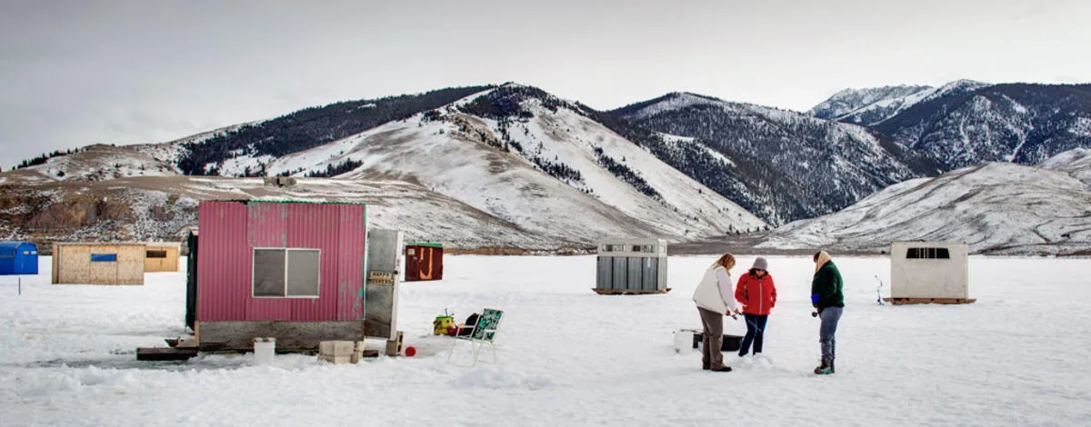
Mackay Reservoir is the region's principal winter fishing destination, a broad mountain water north of Arco where anglers work for rainbow trout and kokanee among other documented species, often near the Joe T. Fallini recreation site area when access is open; check road and parking conditions before leaving Arco. The setting is the appeal and the problem: the reservoir's size and exposure make it beautiful, and no frozen reservoir is automatically safe.
Idaho Fish and Game ice-safety guidance gives three to four inches of clear, solid ice as the minimum to support one person on foot, thicker ice for a group, and 10 inches for an ATV or snowmobile. An earlier IDFG article used greater than eight inches for ATVs, UTVs and snowmobiles while the current consolidated safety page says 10 inches; use the conservative 10. IDFG also states plainly that Idaho lakes and reservoirs generally do not develop ice thick enough for routine car or truck travel, so existing vehicle tracks on the ice are not evidence of anything except that someone else took the same risk.
Thickness is not uniform across a single water, and Mackay has its own mechanism for changing it quickly. Water releases through Mackay Dam lower the reservoir, which leaves ice unsupported at the edges so that shore ice cracks and fails first, and a falling level makes access deteriorate over days rather than weeks. Weak ice also collects near inlets, outlets, springs, docks and structures that absorb sunlight, pressure ridges, cracks, snow-covered sections and recently refrozen holes. That is why IDFG tells anglers to drill test holes as they move rather than trusting one measurement, and why a report from an earlier season proves nothing about this one.
The gear list is a rescue list. Carry a spud bar and an auger to test and to cut, ice picks worn on the body rather than packed in a sled, a throw rope, a flotation suit or life jacket, cleats, a whistle, waterproof communication, spare dry clothing, an emergency blanket, a headlamp, a first-aid kit and a hot non-alcoholic drink. Fish with another person but space the group out, because concentrating weight in one spot is how a sound ice field fails. Shelters go up with an exit route kept clear, and they come off the ice before conditions deteriorate rather than after.
Fishing holes are also limited in size: IDFG rules cap fishing holes at 10 inches in diameter on ice-covered water, but that size limit does not make a hole safe to step on or the surrounding ice safe to cross. And alcohol belongs in the cooler for the trip home rather than on the ice. IDFG tells winter boaters and anglers to leave alcohol at home because it increases heat loss and susceptibility to hypothermia, impairs swimming, disguises cold injury and slows the decisions that self-rescue depends on. Fish sober, get every person and machine back to shore, finish the highway drive, park in Arco, and drink there.
Snowmobiling in the Lost River Region
Snowmobiling is a serious winter activity in this part of Idaho, and legal access depends on route designation, snow depth, grooming, avalanche conditions and land-manager restrictions rather than on whether a machine can cross snow. The Salmon–Challis National Forest lists snowmobiling opportunities in the Lost River Region around Arco Pass, which includes the King Mountain area, Antelope Canyon, Copper Basin, the North Fork of the Big Lost and Pass Creek. The Forest Service describes Antelope Road, Forest Road 137, as a seven-mile snowmobile route running from the forest boundary to the Brockie Lake Trailhead. Copper Basin and the North Fork area also support cross-country skiing and snowshoeing, and neither has potable water. The North Fork is reached from North Fork Road off Trail Creek Road, and Pass Creek is accessed through Road 122 when winter conditions and route status permit.
Use current Forest Service winter mapping and the Idaho Trails application rather than assuming that a summer motorized road is a winter snowmobile corridor. Verify parking, grooming status, avalanche information and weather, download the maps before leaving signal, confirm your registration, set a return time and leave the itinerary with someone outside the group.
Registration is not optional. Idaho generally requires every snowmobile operated on public or private land to carry an Idaho certificate of number, required from November 1 of each season, and nonresidents are not exempt. Idaho Parks and Recreation’s published one-year fees are $45.50 for residents and $59.50 for nonresidents, two-year certificates at $89.50 and $117.50, and rental machines at $75.50. That money pays for grooming, plowing parking lots, signing, trail clearing, avalanche education, rider training and search and rescue, which is to say it pays for most of what makes a ride here possible. An emailed registration receipt serves as temporary proof for 60 days while stickers are processed.
A mapped groomed trail is not evidence that anyone groomed it this week. Grooming happens only when equipment and operator safety are acceptable, when the parking lot holds at least 18 inches of snow, when avalanche conditions do not put the operator at risk and when temperatures are between -20°F and 40°F. Early-season snowfall, a warm spell or an avalanche warning can each stop it. Check trail status on the morning of the ride.
- Impaired operation of a snowmobile, motorbike, UTV, specialty off-highway vehicle or ATV on a public roadway, highway or off-highway is a misdemeanor under Idaho Code § 67-7114, and the state’s general DUI law covers actual physical control of a motor vehicle as well. Alcohol costs balance, reaction time, route judgment, avalanche decision quality and the ability to notice hypothermia in yourself or a partner, and a passenger can become the person who has to move the machine if the operator is injured.
Avalanche terrain, cold injury and short daylight
The Lost River, Pioneer and surrounding ranges hold avalanche terrain, and a plowed parking lot or a packed snowmobile track says nothing about the slopes around it. Look for terrain traps in gullies, open bowls, wind-loaded ridges, cornice areas, creek channels below slopes, roads that cross avalanche paths and low-angle runout zones beneath steep ground; slopes around 30 to 45 degrees are where the problem usually sits. Every backcountry group should travel with a transceiver, a probe and a shovel, plus communication, first-aid kit, emergency shelter, spare layers, repair tools, a tow system and food and water. The equipment is worthless without the training: transceiver search, probing, strategic shoveling, spacing while travelling, slope recognition, terrain avoidance and how to call for help.
Do not lean on shortcuts. Existing tracks, another group’s highmark, a reassuring colour on the forecast without reading the problem description, one slope test, familiarity from summer, and the thought that it has never slid here before are each a way of delegating a decision to somebody else. Highmarking in particular stacks increasing slope angle, machine load and exposure on top of one another, and its failure modes include triggering an avalanche, losing momentum, side-hilling into a rollover, a machine coming down onto the rider, getting stuck in a terrain trap and separating from the group. Staying on lower-angle designated routes is usually the right answer, and nobody should ride or travel alone in remote winter terrain.
Craters winters are cold, windy and exposed, with temperatures below 0°F, blowing snow, rapidly drifting routes, flat light and the occasional whiteout. Wind strips heat from exposed skin whether or not the air temperature looks alarming, and a person who is injured, lost or delayed generates far less body heat than someone moving. Treat deteriorating coordination as an emergency: persistent shivering, poor coordination, slurred speech, confusion, unusual silence, stumbling, loss of fine motor control and drowsiness are all reasons to stop, warm up and get out. On frostbite, numbness is not improvement; fingers, toes, ears, nose and cheeks are the usual casualties, and carrying enough insulation to stand still matters more than insulation for moving.
Snow also records travel you never see in summer, and winter is an energy shortage for wildlife. Watching tracks from the route is fine; following an animal, approaching a bedding area, pressuring creatures in severe cold, feeding them, letting dogs chase a track or leaving the designated route for a photograph all cost an animal energy it needs to survive.
- Daylight is a hard limit rather than a suggestion. Plan around sunrise, sunset and civil twilight, then add travel time, setup time, a weather margin and an allowance for equipment failure. Deep snow, wind crust, poor visibility, drifted roads and group fatigue all turn a two-hour summer route into a much longer one.
Winter camping, warm water and what closes until spring
Craters of the Moon allows walk-in snow camping in authorized locations under a free permit, with the Lava Flow Campground, the Devils Orchard parking area and the Tree Molds parking area the usual winter choices. Vehicle camping at the visitor center is not permitted, snow can bury the toilets so a shovel is worth carrying, and waste has to be packed out. Before pitching anything, read the park’s current winter camping rules, because permitted locations and access change with conditions. The risks of a winter night on the lava are frozen water, wind damage, deep snow, dead batteries, hypothermia, road closure and a slower emergency response.
Carbon monoxide is the quiet one. Never heat an enclosed tent, shelter or vehicle with charcoal, an unvented propane heater, a camp stove or an open flame, and never run an engine in a snow-obstructed area. Keep exhaust systems clear of snow, and ventilate when running an engine to warm up.
A hot spring after cold travel is tempting, and in this corridor the relevant primitive option is Wild Rose near Carey. Visitors have historically used the spring without a formal check-in, but access is not guaranteed; obey current signs, gates and property-owner requests before entering. In winter, even when access is permitted, icy parking, a snow-covered approach, slippery pool edges, temperature shock, darkness and the walk back in cold, wet clothing all require care. Carry dry clothes, test the water, keep the soak short, dress fully before walking out to the vehicle and drive back sober. The pool itself is undeveloped, with uneven footing, so it rewards the same care in January as in July.
Some things simply are not available until the season turns. EBR-I is normally seasonal and closes outside its summer visitor period, so check Idaho National Laboratory’s current information before putting it on a winter plan. Craters’ caves are generally unavailable under snow and ice, the Loop Road is closed to vehicles, Forest Service campgrounds and mountain roads can be unreachable, and Mount Borah stops being a summer scramble and becomes a mountaineering objective. Arco itself keeps working as the region’s winter service base, with fuel, basic supplies, food, RV and lodging options, Number Hill and the USS Hawkbill sail for a short town walk when sidewalks and roads are safe.
Winter photography on snow and lava, and the winter night sky
Winter is the most photographic season here and the least forgiving. Snow and basalt give a contrast the same landscape does not have in August: black lava emerging through white, cinder-cone silhouettes against a low sun, wind-carved snow surfaces, frosted sagebrush, a ski track crossing an otherwise blank field, long blue shadows that run for most of the short day, and the Lost River Range standing white above the valley floor. Craters of the Moon is the obvious subject, the Mackay Reservoir shoreline and the shanties on the ice in midwinter give a different one, and on a clear cold night the monument is the region’s best star destination, provided the road conditions that got you there are still passable on the way back.
Cold is the equipment problem. Low temperatures reduce battery performance, so carry several charged spares rather than one, and keep the spares against your body in an inside pocket where your own heat keeps them usable. Bring a tripod, a lens cloth, gloves that still let you work the controls, insulation for the camera body, and a headlamp with a red mode for night work so you are not the reason the group cannot see the sky. Plan the light rather than hoping for it: at these latitudes in December the sun stays low, so the strong shadowed light is available across most of the usable day and the flat midday window is short.
Condensation is the failure that people bring on themselves. Moving a cold camera into a warm vehicle or a warm building turns moisture out of the air onto the body and lens, and inside a camera that moisture can freeze again or fog the sensor. Sealing the equipment in a plastic bag before it comes in from the cold lets the moisture form on the bag instead, and letting the gear warm gradually rather than immediately avoids the same problem. The same logic applies to spare batteries: warm them against your body, not on a heater.
The rule that matters most is not a photography rule. Do not leave the designated route to get a composition. Snow hides exactly what the lava fields are made of: cracks, holes, sharp rock, abrupt drops, buried vegetation and crusted surfaces that look like a smooth white plain and are not. A smooth snow surface is not evidence of safe footing anywhere in this monument, and a photograph taken on top of a flow that was invisible an hour ago is a bad trade. The same restraint applies to animals: winter is an energy shortage for wildlife, so following a track, approaching a bedding area, letting a dog chase one or stepping off the route for the shot costs an animal energy it needs to survive the season.
Getting there: mountain highways, chains and the winter vehicle kit
The roads that carry winter plans here climb. US-20/26/93 runs southwest toward Craters and Carey over Tom Cat Summit, while US-93 runs north toward Mackay and Challis over Willow Creek Summit. Both are maintained, and maintained does not mean clear: a plowed road can still be a frozen road, and a pass can be closed or restricted while the valley floor is dry. Idaho 511 is the source for road conditions, closures, cameras, construction, weather stations and mountain-pass status, and it is checked before departure and again at midday when the plan is long. Do not rely solely on consumer navigation, which routes around a closure that has already been posted and has no idea what the pass is doing today.
Carry tire chains appropriate to the vehicle, and know how to fit them before the day you need them, along with the rest of the traction kit: a shovel, traction material and a tow strap. Cellular coverage is thin or absent across much of this country, including the Craters backcountry and the Salmon–Challis winter routes, so conditions pages, park pages, route maps and the offline map are downloaded while you still have signal in Arco, and the route and return time are left with someone outside the group.
Every winter vehicle here should carry the full kit rather than a summer kit plus a blanket: full-size spare with jack and lug wrench, chains, shovel, traction material, tow strap, jumper cables or a battery pack, ice scraper, snow brush, flashlight and headlamp, reflective markers, first-aid kit, emergency blankets, a sleeping bag, warm clothing and spare gloves, water, high-calorie food, a power bank, a paper map and, for remote routes, a satellite communicator. Cold kills a battery that was fine yesterday, so a vehicle that has been sitting outdoors in single-digit weather is worth checking before it becomes the plan for a day at Mackay.
If the vehicle is stuck or you are stranded, the sequence is short and worth memorising. Stay with the vehicle unless there is a clearly safer occupied shelter nearby, since a vehicle is larger, warmer and easier to find than a person on foot. Call for assistance, make the vehicle visible, and clear snow away from the exhaust before the engine runs at all. Run the engine intermittently rather than continuously to conserve fuel, crack a window while it runs so carbon monoxide has somewhere to go, keep moving enough to stay warm without sweating into the cold, and do not drink alcohol for warmth. Alcohol feels like warmth, increases heat loss and dulls exactly the judgement a stranded night requires.
Suggested winter days, built around a conditions check
Half-day at Craters: check the monument’s current conditions in Arco, meet the group there rather than at the trailhead, carry full winter gear even though the plan is short, drive out to the Robert Limbert Visitor Center and use the marked one-mile snowshoe route, then turn around while the weather and the light are still comfortable rather than at the last moment. Back in Arco, park and finish the day at Club Sawtooth. This is the outing to choose with borrowed snowshoes, with cold-weary company or with an uncertain forecast.
Full ski day at Craters: confirm grooming status first, since an ungroomed Loop Road is a different and slower trip; carry skis, repair supplies and the emergency gear rather than only the ski clothing; start early, pick a turnaround point before entering, stay on the winter route, keep watching wind and visibility, and return before dusk. Nothing is opened until the highway drive is finished and the vehicle is parked.
Ice-fishing day at Mackay Reservoir: check reservoir and weather conditions, including whether water is being released through the dam, test the ice from the shore outward and keep testing as you move, wear flotation, carry ice picks and a throw rope, drill repeated test holes rather than one, keep the whole group sober, take shelters off the ice while conditions are still good rather than after they turn, and bring every person and machine back to shore before finishing the drive and parking in Arco. The beers come after all of that.
Snowmobile day: confirm the certificate of number is current, download the current designated routes and maps before leaving signal, check grooming status and the avalanche information for the range you intend to ride, carry transceiver, probe and shovel if the plan enters avalanche terrain and everyone is trained to use them, travel sober, choose conservative terrain over the tempting line, return before dark, then load and secure the machines and complete the highway drive before anyone drinks.
Bad-weather day, which is a real plan and not a consolation prize: when snow, ice, avalanche danger or wind makes the outdoor option inappropriate, do not force the original itinerary. Stay in town, look at Number Hill and the USS Hawkbill sail only while the sidewalks and roads are safe, and spend the rest of it indoors at Club Sawtooth with Remote Play darts, pool and the jukebox. If the weather or the drinking changes the return plan, ask staff where the vehicle can sit overnight and bring it back when the driver is sober.
A whiteout day is a Club Sawtooth day
High wind, a whiteout, unsafe reservoir ice or a bad avalanche number is not a reason to force the plan; it is a reason to change it. Club Sawtooth at 156 W Grand Ave is the legitimate indoor alternative in Arco, and it is also a reasonable place to start the day: meet the group there, check the weather and Idaho 511 together, confirm ice or grooming status and avalanche conditions, agree on who is driving sober and set the return time before anyone leaves town.
The main draw in winter is darts. Club Sawtooth runs four electronic dartboards with Remote Play, so you can play local matches, take on remote opponents, enter compatible tournaments or just practice while the wind does something unpleasant to the loop road. Pool tables, foosball, the jukebox and an arcade cabinet cover the rest of an afternoon, and karaoke or live music shows up now and then.
The practical details worth knowing in advance: Club Sawtooth is smoking friendly indoors, so visitors with smoke sensitivity, respiratory conditions or children should plan around that. Dogs are welcome inside under the current policy, kept leashed and controlled and kept clear of the throwing lanes. The bar sells sealed beer and wine to go under its license, which suits a legal campground or a private gathering, provided every container stays sealed in the vehicle during the drive and nothing is opened on the ice or at a trailhead. If weather, fatigue or drinking changes the return plan, ask staff where to leave the vehicle overnight; overnight parking is not RV hookups or campground service, and the car comes back when the driver is sober.
The order that keeps a good winter day good is simple: check conditions, recreate sober, secure the machines and equipment, finish the highway drive and park. Craters supplies the snow, Mackay Reservoir supplies the ice and the Lost River country supplies the routes. The warm finish is at Club Sawtooth, open daily 2 p.m. to 2 a.m., reachable at (208) 527-3003.
Frequently asked questions
Is Craters of the Moon open in winter?
Yes, the monument is open year-round, but the Loop Road and several facilities close to vehicles for the season. The closed Loop Road becomes a winter route for cross-country skiing and snowshoeing, and the park grooms it when snow and operational conditions allow. Caves are generally unavailable under snow and ice. Check the park’s current conditions page for visitor-center hours and road status before leaving Arco.
Can I rent snowshoes at Craters of the Moon, and is there an easy route?
When the visitor center is open and stock allows, snowshoes are available through the park’s partner natural history association for a suggested donation, and ski equipment is not provided, so bring your own. For an easy outing, the park marks a one-mile snowshoe-only trail near the visitor center. Snow depth, wind and temperature still change how hard that mile feels.
How thick does the ice have to be at Mackay Reservoir?
Idaho Fish and Game gives three to four inches of clear, solid ice as the minimum to support one person on foot, thicker ice for a group and 10 inches for an ATV or snowmobile, and warns that Idaho reservoirs generally do not get ice thick enough for routine car or truck travel. Thickness varies across the same reservoir, so drill test holes as you move. Water releases through Mackay Dam can drop the level and crack shore ice quickly, which is why a report from an earlier season proves nothing about today.
Do I need a permit to ride a snowmobile near Arco?
Yes. Idaho generally requires every snowmobile operated on public or private land to carry a certificate of number, required from November 1 each season, and nonresidents are not exempt. Idaho Parks and Recreation lists one-year fees of $45.50 for residents and $59.50 for nonresidents, two-year at $89.50 and $117.50, and rental machines at $75.50. An emailed receipt is temporary proof for 60 days. Riding itself is limited to designated routes, so verify the current Forest Service winter map and trail status before unloading.
Can I have a beer while ice fishing or snowmobiling?
Not while the machine is running or the boots are on the ice. Idaho Fish and Game advises winter anglers and boaters to leave alcohol at home because it increases heat loss and susceptibility to hypothermia, impairs swimming and slows decision-making during an accident, and Idaho Code § 67-7114 makes operating a snowmobile or other off-highway vehicle under the influence a misdemeanor. Club Sawtooth sells sealed beer and wine to go for a legal campground or for after the driving is finished and the vehicle is parked.
What is open in Arco on a bad winter day?
Arco stays the practical winter base: fuel, basic supplies, food, RV and lodging options, plus Number Hill and the USS Hawkbill sail for a short walk when sidewalks are clear. Club Sawtooth is the indoor plan, open daily from 2 p.m. to 2 a.m. with four Remote Play dartboards, pool and foosball, smoking allowed indoors, dogs welcome inside and sealed beer and wine to go. EBR-I is normally closed outside its summer season, so check before driving out there.
Is the Craters of the Moon Loop Road groomed in winter?
The National Park Service grooms the Loop Road for cross-country skiing and snowshoeing when sufficient snow and operational conditions allow it; it is not a groomed ski trail all winter. The road also closes to vehicles beyond the Winter Visitor Access point, so check current conditions and the closure point before you plan a route.
Can I drive a truck or SUV onto the ice at Mackay Reservoir?
No. Idaho Fish and Game states that Idaho lakes and reservoirs generally do not develop enough ice for routine car or truck travel, and vehicle tracks already on the ice are not proof that it is safe. Reservoir outflow and water-level changes can crack or weaken ice, especially near the edges, so walk out, check thickness yourself and keep weight spread.
Where can I actually ride a snowmobile near Arco?
Designated winter routes exist in the broader Lost River Region, including the Arco Pass, Antelope Canyon, Copper Basin, North Fork Big Lost and Pass Creek areas. Riding is limited to designated routes, and mapping changes by season, so use current Forest Service and Idaho Trails mapping rather than an old track file.
Can I winter camp at Craters of the Moon?
Yes, in authorized locations such as the Lava Flow, Devils Orchard and Tree Molds areas with a free winter camping permit; car and RV camping is not allowed at the visitor center itself. Rules and open areas can change, so confirm current winter camping requirements with the park before you load the camper.
Is EBR-I open in winter?
No, in practice. EBR-I is normally seasonal and generally closes outside its summer visitor period. Use Idaho National Laboratory current information before adding the EBR-I Atomic Museum to a winter itinerary, and plan Number Hill or the town instead on a winter day.
Are hot springs reachable in winter?
Some may be, but snow, unplowed access roads, private-property permission and pool safety all change in winter. For Wild Rose Hot Springs, verify current road conditions and water temperature before setting out; it is a primitive soak without managed winter access.
Can I leave a vehicle overnight at Club Sawtooth?
Yes, under the current Club Sawtooth policy. Ask staff where to park when you arrive and retrieve the vehicle when you are sober, which matters more in winter when a night drive over a summit in a storm is the worst option left.
Sources and updates
Check current access, hours and conditions before setting out.
- NPS: the loop road is closed, but we are open for winter
- NPS Craters of the Moon current conditions
- Salmon–Challis National Forest winter sports
- NPS camping near Craters of the Moon
- BLM Mackay Reservoir recreation site
- BLM Joe T. Fallini recreation site
- Idaho Fish and Game fishing and winter safety information
- Idaho 511 highway conditions