Club Sawtooth Explorer Map
104 places around Arco, Idaho, charted by the regulars of Club Sawtooth: hot springs, fishing, hikes, ATV routes, hunting units, geocaches and letterboxes.
We are a dive bar at 156 W Grand Ave, Arco, ID 83213, in the Lost River Valley an hour north of Sun Valley and twenty minutes from Craters of the Moon. This is the list people actually ask for at the bar: where to soak after a hot day on the lava, which water is holding trout, what to climb before the first pour. Tap a pin for details, or read the directory under the map.
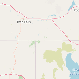
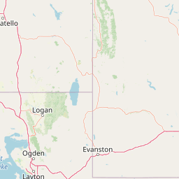

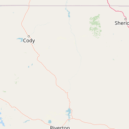
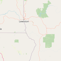


Hot Springs22
Every soak we send people to, from the lava-rock pool outside Carey to the Salmon River tubs above Stanley.
Wild Rose (Carey) Hot Springs
~100°F · 33 min from the bar
The closest natural soak to the club: a free lava-rock pool about 8 miles east of Carey on the road to Arco. Also called Milford Hot Springs.
43.365, -113.789
Kirkham Hot Springs
105°F · 2 hrs from the bar
Cliffside steamy waterfalls into the Payette.
44.069, -115.545
Goldbug Hot Springs
104°F · 3 hrs from the bar
Legendary mountain views, heart-pumping hike.
44.913, -113.845
Sunbeam Hot Springs
100°F · 1.5 hrs from the bar
Accessible roadside soak on the Salmon River.
44.264, -114.752
Worswick Hot Springs
104°F · 1.4 hrs from the bar
Dozens of small natural pools near Fairfield.
43.585, -114.887
Lava Hot Springs
Natural Pools · 2.5 hrs from the bar
Developed soaking pools and river tubing town.
42.605, -112.014
Ninemeyer Hot Springs
River Soak · 3 hrs from the bar
Remote river pools, primitive access.
43.755, -115.571
Bonneville Hot Springs
102°F · 2.8 hrs from the bar
Backcountry pools near Deadwood Reservoir.
44.212, -115.741
Trail Creek Hot Springs
103°F · 2 hrs from the bar
Natural soaking tubs near Sun Valley.
44.205, -114.897
Jerry Johnson Hot Springs
105°F · 10 hrs from the bar
Iconic Clearwater River soaking pools - 355 mi up the Salmon River canyon, an overnight trip, not a night out from the bar.
46.508, -115.297
Weir Creek Hot Springs
104°F · 10 hrs from the bar
Easily accessible river pools on the South Fork of the Clearwater, 355 mi away - plan to overnight.
46.474, -115.268
Sacajawea Hot Springs
101°F · 5.5 hrs from the bar
Historic soak on the Middle Fork of the Salmon, 203 mi and about 5 h 30 min out of Arco.
45.315, -114.779
Mountain Village Resort Springs
98-104°F · 3 hrs from the bar
Resort with multiple pools near Stanley.
44.35, -115.415
Elkhorn Hot Springs
103°F · 3.5 hrs from the bar
Historic resort in the Salmon-Challis NF.
44.892, -113.901
Skinny Dipper Hot Springs
104°F · 2.2 hrs from the bar
Remote cliffside pools near Kirkham.
44.109, -115.582
Frenchman's Bend Hot Springs
101°F · 2.1 hrs from the bar
Family-friendly pools along the river.
44.082, -115.547
Pine Flats Hot Springs
102°F · 2.1 hrs from the bar
Multiple riverfront pools with camping.
44.085, -115.56
Challis Hot Springs
105°F · 2.5 hrs from the bar
Commercial pools with RV park access.
44.486, -114.205
Vulcan Hot Springs
106°F · 1.8 hrs from the bar
Primitive pools in the Wood River Valley.
43.732, -114.659
Zims Hot Springs
103°F · 6 hrs from the bar
Family-owned resort in the Weiser headwaters, 294 mi and about 6 h from the bar.
44.875, -116.098
Miracle Hot Springs
Natural Pools · 2.3 hrs from the bar
Resort with private soaking tubs.
42.615, -114.021
Boat Box Hot Springs
107°F · 2 hrs from the bar
One galvanised tub on the Salmon River beside Highway 75, 3 miles north of Stanley — a pipe does the filling, river water cools it.
44.245, -114.886
Fishing Spots19
Tailwater, spring creek and lake. The best of it is within an afternoon of the bar; the panhandle water is a weekend, and we say how long each one takes. Rules change: check current IDFW regs.
Big Lost River
Blue Ribbon Fly Fishing · 8 min from the bar · Rainbow, Brook & Brown Trout
Technical tailwater right outside Arco, 3 mi down the road. Check flows!
43.6, -113.31
Little Lost River
Remote Stream · 1.5 hrs from the bar · Bull Trout (Catch/Release Only)
Native bull trout stronghold, 49 mi north up the Lost River Valley.
44.11, -113.25
Redfish Lake
Deep Lake Trolling · 3 hrs from the bar · Kokanee, Mackinaw
Iconic Sawtooth alpine lake, 140 mi over Stanley.
44.14, -114.92
Silver Creek Preserve
Spring Creek Fly Fishing · 1 hr 15 min from the bar · Large Brown Trout
World-famous technical spring creek, 57 mi south near Hagerman.
43.32, -114.15
Salmon River
Big River · 2.5 hrs from the bar · Steelhead, Chinook, Trout
Legendary river with multiple access points, 119 mi toward Stanley.
44.27, -114.73
Mackay Reservoir
Reservoir · 35 min from the bar · Perch, Trout
27 mi up the valley. Windy afternoons, great ice fishing.
43.91, -113.62
Birch Creek
Spring Creek · 35 min from the bar · Native Trout
24 mi to the east. Cold clear water with selective hatches.
43.79, -113.02
Little Wood River
Freestone · 1 hr 20 min from the bar · Rainbow & Brown Trout
56 mi south through Carey and Hill City.
43.35, -114.03
Warm Springs Creek
Mountain Stream · 3 hrs from the bar · Cutthroat Trout
Remote high-elevation water, 136 mi over the Sawtooths.
44, -114.89
Henrys Fork
World-Class Fly Fishing · 3 hrs from the bar · Rainbow Trout
158 mi east through Idaho Falls. Famous for large trout and hatches.
44.567, -111.356
South Fork Boise River
Tailwater Fishery · 4.5 hrs from the bar · Rainbow & Brown Trout
Below Anderson Ranch Dam, 156 mi west - excellent dry fly fishing, but an overnight.
43.564, -115.31
Henry's Lake
Stillwater Trophy Lake · 3 hrs from the bar · Hybrid Trout
159 mi east over Teton Pass. Large hybrid trout, big views.
44.598, -111.355
Priest Lake
Deep Lake · 11 hrs from the bar · Lake Trout, Kokanee
Far northern Idaho, 527 mi and about 11 hours - a vacation, not a day trip from the bar.
48.582, -116.913
Snake River (Hells Canyon)
Big River · 11 hrs from the bar · Smallmouth Bass, Sturgeon
Deepest river canyon in North America, 409 mi and roughly 10 h 40 min up the Clearwater.
45.35, -116.675
Anderson Ranch Reservoir
Reservoir · 3 hrs 45 min from the bar · Kokanee, Trout
142 mi west below the dam. Popular for trolling and scenic camping.
43.432, -115.426
Crane Creek
Spring Creek · 5.5 hrs from the bar · Rainbow Trout
Small Weiser River tributary in Washington County, 271 mi west; pin at the creek mouth near Weiser.
44.291, -116.782
Lochsa River
Wild River · 8.5 hrs from the bar · Steelhead, Cutthroat
Bitterroot steelhead water, 378 mi and about 8 h 20 min to the Selway–Lochsa confluence at Lowell.
46.141, -115.598
Magic Reservoir
Reservoir · 2 hrs 40 min from the bar · Rainbow Trout, Perch
96 mi south out of the Big Lost country. Good shoreline access.
43.185, -114.499
St. Joe River
Wild & Scenic River · 9 hrs from the bar · Cutthroat Trout
454 mi and about 9 h 20 min to the Panhandle - one of the highest navigable rivers in the world, and a trip of its own.
47.316, -116.567
Hikes18
Cinder cones and lava flows in Craters of the Moon, plus the Sawtooth and Lost River peaks worth the drive.
Grand Loop
72mi round trip · 14k ft gain · Hard
44, -114.9
Inferno Cone
0.4mi round trip · 164ft gain · Moderate
43.445, -113.555
Sawtooth Lake
10mi round trip · 1.7k ft gain · Hard
44.17, -115.06
Big Southern Butte
2.5mi round trip · 2k ft gain · Hard
43.425, -113.03
Fish Creek Rim
6mi round trip · 900ft gain · Moderate
44.05, -114.82
Borah Peak Route
7.5mi round trip · 5.3k ft gain · Extreme
44.137, -113.781
Mammoth Cave Trail
0.6mi round trip · Minimal gain · Easy
43.462, -113.565
Carey Canyon Walk
3mi round trip · 400ft gain · Easy
43.31, -113.94
Devils Orchard Loop
0.7mi round trip · 50ft gain · Easy
Interpretive trail through lava formations.
43.458, -113.571
North Crater Flow Trail
1.8mi round trip · 100ft gain · Easy
Walk across youngest lava flow in the monument.
43.472, -113.553
Broken Top Loop
2.2mi round trip · 250ft gain · Moderate
Circle a cinder cone with panoramic views.
43.455, -113.548
Tree Molds Trail
2.0mi round trip · 150ft gain · Moderate
See where lava encased ancient trees.
43.45, -113.54
Wilderness Trail
3.5mi round trip · 400ft gain · Moderate
Access to backcountry wilderness area.
43.465, -113.575
Echo Crater Route
5.5mi round trip · 800ft gain · Hard
Backcountry permit required, remote crater exploration.
43.448, -113.542
Buffalo Caves Trail
1.5mi round trip · 300ft gain · Moderate
Explore limestone caves near Lost River.
43.82, -113.41
White Knob Summit
6.0mi round trip · 2.5k ft gain · Hard
Challenging climb to White Knob peak.
43.78, -113.65
Cinder Cone Scramble
1.2mi round trip · 500ft gain · Moderate
Off-trail scramble up a volcanic cone.
43.48, -113.59
Lava Tube Connection
4.0mi round trip · 600ft gain · Moderate
Connect multiple lava tube caves.
43.47, -113.56
ATV & OHV Routes16
Lava fields, desert plains and mountain traverses. Pin is the route's first waypoint; sizes are rough.
Lost River Loop #1
Hard · 4 mapped waypoints
43.6, -113.2
Smiley Creek Pass
Moderate · 3 mapped waypoints
43.8, -114.8
Arco Desert Plains
Easy · 3 mapped waypoints
43.5, -113.2
Pioneer Mountain Traverse
Hard · 3 mapped waypoints
43.7, -114.3
Mackay Mine Roads
Moderate · 2 mapped waypoints
43.91, -113.62
Carey Lava Loop
Easy · 2 mapped waypoints
43.3, -113.94
Borah Peak Base Loop
Hard · 3 mapped waypoints
44.13, -113.78
Big Butte Challenge
Extreme · 3 mapped waypoints
43.42, -113.03
Craters Backcountry Route
Moderate · 3 mapped waypoints
43.46, -113.56
White Knob Mountain Trail
Hard · 3 mapped waypoints
43.78, -113.65
Little Lost River Valley Run
Easy · 3 mapped waypoints
44.1, -113.25
Lehman Creek Canyon Crawl
Moderate · 3 mapped waypoints
43.85, -113.45
Mackay Reservoir Shoreline
Easy · 3 mapped waypoints
43.91, -113.62
Antelope Valley Traverse
Moderate · 3 mapped waypoints
43.55, -113.35
Cinder Butte Circuit
Easy · 3 mapped waypoints
43.5, -113.58
Pahsimeroi High Route
Extreme · 3 mapped waypoints
44.3, -113.6
Hunting Units16
Idaho Fish and Game units our regulars draw. Pin is the middle of the unit boundary we hold on the map.
Unit 36
Sawtooth Wilderness – Elk, Deer, Goat
44.05, -114.85
Unit 50
Lost River Range – Antelope, Sheep
43.75, -113.25
Unit 49
Pioneer Mountains – Elk & Mule Deer
43.65, -114.25
Unit 20A
Boise Front – Mule Deer
43.65, -115.75
Unit 28
Salmon Zone – Elk, Bear
44.35, -113.7
Unit 51
Snake River Plains – Antelope
43.3, -112.95
Unit 33
Frank Church Wilderness – Elk, Mountain Lion
44.75, -114.75
Unit 39
Middle Fork Zone – Deer, Wolf
44.25, -115.25
Unit 45
Pahsimeroi Valley – Elk, Antelope
44.55, -113.55
Unit 52
Camas Prairie – Waterfowl, Pheasant
43.45, -114.75
Unit 30
Salmon River Breaks – Bear, Cougar
45.25, -114.55
Unit 10
Panhandle Zone – Moose, Grouse
48.75, -116.25
Unit 16
Clearwater Region – Elk, Turkey
46.25, -115.25
Unit 21
Weiser River Zone – Deer, Bear
44.75, -116.55
Unit 54
Southeast Desert – Pronghorn, Coyote
42.75, -112.75
Unit 73
Island Park – Elk, Bison
44.65, -111.15
Geocaches8
Caches we have hunted ourselves, mostly around Craters of the Moon and downtown Arco.
Inferno Cone Overlook Cache
Difficulty 2.5 · Terrain 3 · Small
Hidden near the Inferno Cone overlook with panoramic views.
43.445, -113.555
Devil's Orchard EarthCache
Difficulty 1.5 · Terrain 2 · Virtual
Educational earthcache about the unique geology and ecology.
43.458, -113.571
Big Southern Butte Summit Cache
Difficulty 3 · Terrain 4 · Regular
Challenging hike rewarded with 360° views of the desert.
43.425, -113.03
Arco's Atomic Power Puzzle Cache
Difficulty 2 · Terrain 1.5 · Micro
Multi-stage cache on West Grand Avenue in downtown Arco, near the civic block, playing on the town's atomic history. Confirm the current listing on geocaching.com before you go hunting.
43.635, -113.3
Mammoth Cave EarthCache
Difficulty 2 · Terrain 2.5 · Virtual
Learn about lava tube formation while exploring the cave.
43.462, -113.565
Echo Crater Rim Cache
Difficulty 3.5 · Terrain 4 · Small
Remote backcountry cache requiring backcountry permit.
43.448, -113.542
Lost River Sinks Cache
Difficulty 2 · Terrain 2 · Regular
Where the river disappears underground - unique hydrology.
43.81, -113.41
Craters Visitor Center Travel Bug Hotel
Difficulty 1 · Terrain 1 · Large
Popular exchange point for travel bugs and trackables.
43.461, -113.561
Letterboxes5
Stamp-and-logpad boxes, including the National Park Service letterbox at the Craters visitor centre.
Craters of the Moon Lunar Letterbox
Located near the visitor center. Ask at desk for stamp.
Official National Park Service letterbox, often at the information desk.
43.461, -113.561
Arco Atomic Letterbox
Start on West Grand Avenue in downtown Arco.
A downtown box on the old West Grand strip, in the first town lit by atomic power. Ask at the bar for the current stamp location.
43.635, -113.302
Number Hill Letterbox
Look near the base of the famous painted numbers.
Hidden near the iconic hill where graduating classes paint their year.
43.497, -113.583
Lost River Letterbox
At the mouth of the canyon where the river disappears.
Find near the geological phenomenon where the river goes underground.
43.82, -113.4
Borah Peak Summit Letterbox
Idaho's highest point - bring your stamina!
Located near the summit register. Challenging 12+ mile hike.
44.137, -113.781